Scheduled Maintenance
Please be advised that this website will undergo scheduled maintenance on the following dates: •
Tuesday 3rd December 11:00-15:00
During these times, some services may be temporarily unavailable. We apologise for any inconvenience this may cause.
Achabeg
Kerb Cairn (Prehistoric)
Site Name Achabeg
Classification Kerb Cairn (Prehistoric)
Alternative Name(s) Achnaha
Canmore ID 22444
Site Number NM64NW 5
NGR NM 6488 4532
Datum OSGB36 - NGR
Permalink http://canmore.org.uk/site/22444
- Council Highland
- Parish Morvern
- Former Region Highland
- Former District Lochaber
- Former County Argyll
NM64NW 5 6488 4532.
(NM 6488 4532) Cairn (NR)
OS 1:10,000 map, (1974)
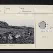
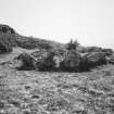
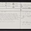
Situated on a terrace on the N side of the road from Lochaline to Drimnin, about 150m SE of Achabeg, is a mutilated, turf-covered cairn (noted as a stone circle - {Argyll County Council 1914}). It is about 0.5m high and its perimeter is marked by a kerb of sixteen close-set stones, up to 0.9m high, giving a diameter of 5.3m. In the S arc there is a break of 2.5m in the kerb. Two loose slabs within the cairn may have come from here.
Visited by OS (RL) 8 June 1970.
Argyll County Council 1914.
A well-preserved kerb-cairn, as described by OS (RL) 1970.
RCAHMS 1980, visited 1973.
Scheduled as 'Achnaha, kerb cairn'.
Information fron Historic Scotland, scheduling document dated 8 November 2000.


