Achabeg
Kerb Cairn (Prehistoric)
Site Name Achabeg
Classification Kerb Cairn (Prehistoric)
Alternative Name(s) Achnaha
Canmore ID 22444
Site Number NM64NW 5
NGR NM 6488 4532
Datum OSGB36 - NGR
Permalink http://canmore.org.uk/site/22444
- Council Highland
- Parish Morvern
- Former Region Highland
- Former District Lochaber
- Former County Argyll
NM64NW 5 6488 4532.
(NM 6488 4532) Cairn (NR)
OS 1:10,000 map, (1974)
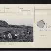
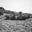
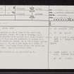
Situated on a terrace on the N side of the road from Lochaline to Drimnin, about 150m SE of Achabeg, is a mutilated, turf-covered cairn (noted as a stone circle - {Argyll County Council 1914}). It is about 0.5m high and its perimeter is marked by a kerb of sixteen close-set stones, up to 0.9m high, giving a diameter of 5.3m. In the S arc there is a break of 2.5m in the kerb. Two loose slabs within the cairn may have come from here.
Visited by OS (RL) 8 June 1970.
Argyll County Council 1914.
A well-preserved kerb-cairn, as described by OS (RL) 1970.
RCAHMS 1980, visited 1973.
Scheduled as 'Achnaha, kerb cairn'.
Information fron Historic Scotland, scheduling document dated 8 November 2000.


