
Fintray, St Meddan's Church And Burial-ground


Church (Medieval)
Site Name Fintray, St Meddan's Church And Burial-ground
Classification Church (Medieval)
Alternative Name(s) Fintray, Old Parish Church
Canmore ID 19445
Site Number NJ81NE 11
NGR NJ 87187 15564
Datum OSGB36 - NGR
Permalink http://canmore.org.uk/site/19445


- Council Aberdeenshire
- Parish Fintray
- Former Region Grampian
- Former District Gordon
- Former County Aberdeenshire
St Meddan's, medieval. Magical ruin, hidden in dark trees on terrace overlooking broad sweep of the Don, plain rebuilt rectangle with remains of sepulchre and several enigmatic medieval gravestones.
Taken from "Aberdeenshire: Donside and Strathbogie - An Illustrated Architectural Guide", by Ian Shepherd, 2006. Published by the Rutland Press http://www.rias.org.uk

NJ81NE 11 87187 15564
(NJ 8718 1557) Supposed St Meddan's Church (NR) (In Ruins)
OS 6" map (1928).
See also NJ82NE 25.
For successor church (NJ 8406 1652) and present parish church (NJ 8484 1664), see NJ81NW 26 and NJ81NW 58, respectively.
A church, dedicated to St Meddan, occupied this site, in 'early Christian times' and the present building now ivy-covered and roofless, was in use until 1703, when a new church was erected at Hatton of Fintray (NJ81NW 26). There are several old gravestones in the churchyard, of which four have unusual designs. They are placed 'not far from the walk in the south side of the churchyard between it and the ruined church, but much nearer to the walk than to the church'.
J Ritchie 1911.
The Church of Fintray was dedicated to St Medan and belonged to the Abbey of Lindores.
H Scott 1926.
Field Visit (20 October 1961)
The walls of the church, 20 x 7.8m, stand to roof level and appear to have been restored. Of the 4 old gravestones mentioned in Ritchie one stands erect in the graveyard , two lie buried in the graveyard, only their marked faces showing, while the fourth stone, the smallest of the group, is now inside the ruined church. There are several other small sculptured stones in the church.
Visited by OS (EGC), 20 October 1961.
Field Visit (22 November 1996)
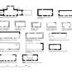
(Classification amended to: Church; Burial-Ground; Medieval Grave-Slabs). The remains of the former parish church of Fintray, which stand within a tree-grown burial-ground on a S-facing slope overlooking the River Don, have been incorporated into the burial-enclosure of the family of Forbes of Fintray, later Forbes-Sempill. This enclosure measures 19.8m from E to W by 7.8m transversely over a wall that is built of mortared granite blocks and surmounted by a coping, and it has opposed entrances fitted with railed gates midway along both sides. The remains of the church are incorporated in the E end of the structure, and comprise the E end and the adjacent portions of the N and S walls. These are only visible on the interior of the enclosure, as the exterior has been faced with granite, uniform with the remainder of the burial-enclosure.
The surviving portion of the N wall measures 6.9m in length, extending W as far as the chamfered E jamb of an opening. Towards its E end there is a sacrament house. The E gable has been reduced in height to conform with the side-walls of the burial-enclosure, but it measures 5.97m in internal length and has an offset at a height of 2.1m. The S wall only survives as a thickening of the base of the burial-enclosure over a distance of 1.85m in length.
The sacrament house comprises a stone plaque, 0.36m in width by 0.37m in height, above a lower panel containing the opening to the locker. The plaque bears a low relief depiction of Christ crucified, flanked by two figures, and is enclosed within a simple roll-moulded frame. The lower panel measures 0.48m in width by 0.63m in height and 0.19m in thickness, and the opening of the locker, which is 0.33m wide and 0.37m high, is framed with simple incised lines. An indeterminate object is carved in low relief on the lintel of the opening and was perhaps intended to represent a monstrance. The whole composition is badly worn, and possibly deliberately mutilated, as the heads of the figures are all damaged, and that of Christ has been obliterated.
The burial-ground is roughly rhomboidal on plan and enclosed by a dry-stone dyke. It is sparsely populated with monumental stones, mostly of 18th- and 19th-century date, but there are at least three medieval slabs, and three unshaped slabs stand upright in a row to the S of the S entrance to the burial-enclosure. None of the latter appears to bear any markings.
The first of the medieval stones stands upright to the SE of the burial-enclosure and is an irregularly shaped slab measuring 0.51m in breadth by 0.2m in thickness and 0.96m in height. It bears in its upper dexter corner, the carving in low relief of a stumpy sword with a circular pommel and straight cross-guard. Below this is the broadly incised figure of a cross-potent.
The second medieval stone lies close by and is an irregular recumbent slab, measuring 1.7m in length by 0.5m in width. Towards either end it bears a disc containing a cross, set saltire-wise. On the outer rim of each disc, in line with the arms of the crosses, are four thimble-shaped terminals. Beside one of the discs is a quadrilateral, its internal area divided into six squares. Adjacent to this is cut the outline of a pair of shears.
The third stone lies to the ESE of the burial enclosure, but it could not be located on the date of visit due to a covering of snow. This slab is again unshaped, bearing at either end an incised cross potent. Between them and towards one edge, is the crude, incised figure of a sword with rounded pommel and depressed cross-guard.
Another rough slab similar to these medieval stones lies in the SE corner of the burial enclosure and measures 1.47m in length by 0.8m in breadth. No carving is visible on its present upper surface, and it was not possible to inspect its underside.
A number of other carved fragments formerly lay along the S wall of the burial enclosure, but since a previous visit in 1991, these have been removed, and their present location is unknown.
Fintray was one of several Garioch churches granted to the abbey of Lindores by its founder, David, Earl of Huntingdon, between 1191 and 1195. In 1257 a perpetual vicarage was established to serve the church, but the parsonage revenues continued to be drawn by the abbey (Cowan 1967, 66). The church was ruinous by 1732 (Collections, 245), having fallen into disuse following the construction in 1703 of a new building by Sir William Forbes of Craigievar at Hatton of Fintray. The construction of the burial-enclosure probably predates James Logan's account (c.1818-20), which notes the 'site of the original building '. inclosed by high walls, being the place of interment for the family of Forbes of Fintray' (Cruickshank 1941, 5).
Visited by RCAHMS (IF, AW), 22 November 1996.

