Pricing Change
New pricing for orders of material from this site will come into place shortly. Charges for supply of digital images, digitisation on demand, prints and licensing will be altered.
Upcoming Maintenance
Please be advised that this website will undergo scheduled maintenance on the following dates:
Thursday, 9 January: 11:00 AM - 3:00 PM
Thursday, 23 January: 11:00 AM - 3:00 PM
Thursday, 30 January: 11:00 AM - 3:00 PM
During these times, some functionality such as image purchasing may be temporarily unavailable. We apologise for any inconvenience this may cause.
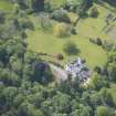
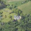
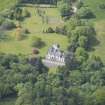
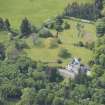
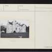
Kininvie House
Tower House (Medieval)
Site Name Kininvie House
Classification Tower House (Medieval)
Alternative Name(s) Kininvie Castle
Canmore ID 16866
Site Number NJ34SW 4
NGR NJ 31882 44048
Datum OSGB36 - NGR
Permalink http://canmore.org.uk/site/16866
- Council Moray
- Parish Mortlach
- Former Region Grampian
- Former District Moray
- Former County Banffshire
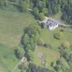
NJ34SW 4 31882 44048 - House; NJ 31971 44042 - Dovecot.
(NJ 3188 4405) Kininvie House (NR)
OS 6" map, (1959.)
Kininvie appears to have been reconstructed at the end of the 16th century, but the walls are probably of older date. The original structure is said to have been erected in 1480.
D MacGibbon and T Ross 1887-92.
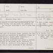
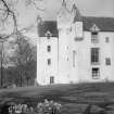
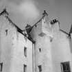
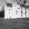
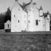
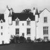
The oldest part of Kininvie House, probably the 16th century reconstruction mentioned by MacGibbon and Ross, is the W wing containing a square tower containing a staircase (see photo on illustration card). This wing has been modernised and harled to conform with the remainder of the house, which, according to Shaw (L Shaw 1882) was added by Archibald Young Leslie in 1840.
No trace, and no local knowledge of the original structure allegedly built in 1480.
Visited by OS (RL) 30 January 1967; L Shaw 1882.
(NJ 3197 4404) Dovecot (NAT)
OS 25" map, (1905).
The dovecot is circular, with two string courses, and has been harled. It has possibly been reroofed, and is late 16th or early 17th century. SDD building list (SDD 1960-)
Information from G Stell (RCAHMS) 27 April 1970.
Photographic Survey (1957)
Photographic survey by the Scottish National Buildings Record in 1957.


