Scheduled Maintenance
Please be advised that this website will undergo scheduled maintenance on the following dates: •
Tuesday 3rd December 11:00-15:00
During these times, some services may be temporarily unavailable. We apologise for any inconvenience this may cause.
Tulloch Wood
Enclosure (Iron Age), Field System (Iron Age), Hut Circle(S) (Iron Age)
Site Name Tulloch Wood
Classification Enclosure (Iron Age), Field System (Iron Age), Hut Circle(S) (Iron Age)
Canmore ID 15784
Site Number NJ05NE 9
NGR NJ 089 560
Datum OSGB36 - NGR
Permalink http://canmore.org.uk/site/15784
- Council Moray
- Parish Rafford
- Former Region Grampian
- Former District Moray
- Former County Morayshire
NJ05NE 9 089 560.
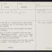
Centred at NJ 089 560 is a settlement of four stone-walled huts, a possible hut or enclosure, and a contemporary field system. Each hut is circular and the measurements are given between wall centres.
Hut 'A' measures c 11.0m in diameter with the wall spread to an indeterminate width. One or two outer facing stones are visible in the W and N arcs. The entrance in the WNW is ill-defined.
'B' measures c 15.5m in diameter with the wall spread to c 3.5m all round. The entrance in the WNW is mutilated.
'C' measures c 11.0m in diameter with the wall spread to c 2.0m. The W arc is obscured by whins. The interior of the hut is uneven, probably due to an accumulation of debris round a tree stump and a collection of water against the N arc creating a boggy hollow. The entrance is not evident. A stone clearance heap lies outside the hut, against the wall in the SE.
'D' measures c 12.0m in diameter with the wall spread to c 3.5m. The outer wall face is visible in the SE arc. The N arc is mutilated by modern cultivation. The entrance in the SE is flanked on its SW side by an earth-fast boulder and is partly blocked by modern field clearance. 'E' lies immediately outside the N wall of a rectilinear enclosure measuring about 110.0m ENE to WSW by c 90.0m transversely. It comprises a curving stony turf-covered bank spread to c 2.5m, measuring c 13.0m ENE to WSW between its centres, which terminates in the SW as a mound measuring c 6.0m in diameter. Its SE extremity is too denuded to tell whether it joins the enclosure wall or is truncated by it. It may be the N half of a hut partly destroyed by the enclosure, or an enclosure contemporary with it.
The field system, marked by stone clearance heaps, lynchets and extensive walls, occurs partly in afforestation, partly in cultivated land and is partly whin-covered. Where best defined, in the vicinity of hut 'C' and in the area centred NJ 090 558, fields measure c 45.0m by c 12.0m, c 50.0m by c 15.0m, c 40.0m by c 10.0m and c 30.0m by c 20.0m. Extent of field system delineated on 6" sheet.
Huts surveyed at 1/2500.
Visited by OS (RL) 5 May 1971
A 28ha area of prehistoric banks, cairns and hut-circles was surveyed. In March 1991, eroding banks and damaged features were examined in a total of nineteen small areas; five hut circles, nine banks and three cairns were sampled. Fifteen charcoal samples have been submitted for dating. Sponsor: Historic Scotland.
S Carter 1991a.
Hut-circles A, C and D have been destroyed by agricultural work. Hut-circle E is D-shaped and was partly destroyed by a new track in 1989. Over 250 cairns were recorded during the course of the survey in February 1990.
S Carter 1993
Field Visit (5 May 1971)
Centred at NJ 089 560 is a settlement of four stone-walled huts, a possible hut or enclosure, and a contemporary field system. Each hut is circular and the measurements are given between wall centres.
Hut 'A' measures c 11.0m in diameter with the wall spread to an indeterminate width. One or two outer facing stones are visible in the W and N arcs. The entrance in the WNW is ill-defined.
'B' measures c 15.5m in diameter with the wall spread to c 3.5m all round. The entrance in the WNW is mutilated.
'C' measures c 11.0m in diameter with the wall spread to c 2.0m. The W arc is obscured by whins. The interior of the hut is uneven, probably due to an accumulation of debris round a tree stump and a collection of water against the N arc creating a boggy hollow. The entrance is not evident. A stone clearance heap lies outside the hut, against the wall in the SE.
'D' measures c 12.0m in diameter with the wall spread to c 3.5m. The outer wall face is visible in the SE arc. The N arc is mutilated by modern cultivation. The entrance in the SE is flanked on its SW side by an earth-fast boulder and is partly blocked by modern field clearance. 'E' lies immediately outside the N wall of a rectilinear enclosure measuring about 110.0m ENE to WSW by c 90.0m transversely. It comprises a curving stony turf-covered bank spread to c 2.5m, measuring c 13.0m ENE to WSW between its centres, which terminates in the SW as a mound measuring c 6.0m in diameter. Its SE extremity is too denuded to tell whether it joins the enclosure wall or is truncated by it. It may be the N half of a hut partly destroyed by the enclosure, or an enclosure contemporary with it.
The field system, marked by stone clearance heaps, lynchets and extensive walls, occurs partly in afforestation, partly in cultivated land and is partly whin-covered. Where best defined, in the vicinity of hut 'C' and in the area centred NJ 090 558, fields measure c 45.0m by c 12.0m, c 50.0m by c 15.0m, c 40.0m by c 10.0m and c 30.0m by c 20.0m. Extent of field system delineated on 6" sheet.
Huts surveyed at 1/2500.
Visited by OS (RL) 5 May 1971
Field Visit (1991)
A 28ha area of prehistoric banks, cairns and hut-circles was surveyed. In March 1991, eroding banks and damaged features were examined in a total of nineteen small areas; five hut circles, nine banks and three cairns were sampled. Fifteen charcoal samples have been submitted for dating. Sponsor: Historic Scotland.
S Carter 1991a.


