
Pricing Change
New pricing for orders of material from this site will come into place shortly. Charges for supply of digital images, digitisation on demand, prints and licensing will be altered.
South Sutor, Coast Battery


Coastal Battery (Second World War), Coastal Battery(S) (First World War)
Site Name South Sutor, Coast Battery
Classification Coastal Battery (Second World War), Coastal Battery(S) (First World War)
Alternative Name(s) Cromarty Defences; Sutors Stacks; Fort South Sutor; Site No. 3; Site No. 4; Charlie's Seat
Canmore ID 80308
Site Number NH86NW 11
NGR NH 8103 6695
NGR Description Centred NH 8103 6695
Datum OSGB36 - NGR
Permalink http://canmore.org.uk/site/80308


- Council Highland
- Parish Cromarty
- Former Region Highland
- Former District Ross And Cromarty
- Former County Ross And Cromarty
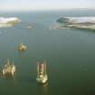
Coastal batteries on the headlands of North and South Sutor protected the port of Invergordon and the Cromarty Firth during the First and Second World Wars. Photographs show that construction of at least one gun emplacement, and associated buildings, began before the start of the First World War.
Information from RCAHMS (SC) 2007
NH86NW 11.00 centred 8103 6695
NH86NW 11.01 NH 80871 67053 Radar Site; Observation Post
NH86NW 11.02 centred NH 8005 6707 Military Camp
NH86NW 11.03 NH 81053 66958 Gun-emplacement
NH86NW 11.04 NH 8102 6699 Observation Post
NH86NW 11.05 NH 81034 66900 and NH 81052 66975 Gun-emplacements
NH86NW 11.06 NH 81014 66926 Observation Post
NH86NW 11.07 NH 81203 67028 and NH 81158 67057 Searchlight Battery
NH86NW 11.08 NH 80885 67272 Gun-emplacement
NH86NW 11.09 NH 81000 67029 Engine House
NH86NW 11.10 NH 81013 66899 Storehouse; Workshop
NH86NW 11.11 NH 80993 66998 Water Tank
NH86NW 11.12 NH 80971 67002 Huts
NH86NW 11.13 NH 80879 67011 Naval Signal Station; Military Camp
NH86NW 11.14 NH 80897 67003 Air Raid Shelter
NH86NW 11.15 NH 80899 67051 Engine House
NH86NW 11.16 NH 80834 67081 Engine House
NH86NW 11.17 NH 80824 67271 Military Camp
NH86NW 11.18 NH 80821 67302 Searchlight Battery
NH86NW 11.19 NH 80840 67264 Engine House
NH86NW 11.20 NH 80710 67046 Anti Aircraft Battery
NH86NW 11.21 NH 80602 66958 Searchlight Battery
NH86NW 11.22 NH 80702 67229 Building
NH86NW 11.23 NH 80871 67071 Bunker; Observation Post
NH86NW 11.24 NH 81000 68000 Minefield
NH86NW 11.25 NH 80992 66890 Anti-aircraft Battery
NH86NW 11.26 NH 80846 67037 Engine House
NH86NW 11.27 NH 80861 67030 Latrine
NH86NW 11.28 NH 80872 67031 Hut
NH86NW 11.29 NH 80872 67277 Building Platform; Quarry
NH86NW 11.30 NH 80890 67131 Fence
NH86NW 11.31 NH 80866 67140 Garage
NH86NW 11.32 NH 80856 67152 Boundary Stone
NH86NW 11.33 NH 80919 67100 Military Road
NH86NW 11.34 NH 80836 67168 Building Platform
NH86NW 11.35 NH 80810 67179 Building
NH86NW 11.36 NH 80836 67202 Path
NH86NW 11.37 NH 80826 67233 Staircase; Slide
NH86NW 11.38 NH 80845 67278 Building; Store
NH86NW 11.39 NH 80850 67247 Building Platform; Latrine
NH86NW 11.40 NH 80840 67285 Latrine
NH86NW 11.41 NH 80825 67286 Building Platform
NH86NW 11.42 NH 80823 67270 Barracks
NH86NW 11.44 NH 80255 67236 Submarine Mining Station
NH86NW 11.45 NH 80068 67247 Searchlight Battery
NH76NE 339 NH 79227 67315 Searchlight Battery
NH76NE 340 NH 79223 67332 Concrete Blocks
Two bunkers are set at the edge of a cliff, held number one and number two guns. Guns date from both the First and Second World Wars. These emplacements are accompanied by lockers for shells and a fire command post. Much of the site is overgrown and survey has revealed two major parts of the site, one at the top of the cliff and one at the base.
Information from the Independent 7 September 1994.
Military coastal battery; bunkers - Visited, Good condition.
20th century; WW1 & 2.
CFA/MORA Coastal Assessment Survey 1998.
Photographic illustrations of these batteries can be found in Mr J Guy's volume for Historic Scotland.
J Guy 2000; Vol.3, 49-59
A large group of brick and concrete buildings which make up the World War One and Two coast batteries at South Sutor. In addition, there are accommodation camps, a Chain Home Low Radar Station (NH86NW 13.00), Submarine Mine Field Control Station, Royal Observor Corps post (NH86NW 13.01), Fire Command Post, the now demolished Port War Signal station and Mine Watching Post.
The main WW I and WW II elements of the site are still discernable and many of the structures remain substantially intact.
Manning of 242 battery was undertaken by 501 Regiment (Public Record Office ref: WO 192/247; WO 199/2627).
The coast battery is visible on RAF vertical air photographs (106G/UK/751, 6035-6037, flown 31 August 1945) and the images show the full extant of the WW II installations including the Chain Home Low radar station. The air photographs also show that the battery had been provided with anti-aircraft cover in the form of Unrotating Projectile (UP) mounts and light anti-aircraft gun positions.
Visited by RCAHMS, (DE, GS, SW) August 2000
Photographic Record (2 May 1913 - 29 August 1913)
Reference (7 September 1994)
Two bunkers are set at the edge of a cliff, held number one and number two guns. Guns date from both the First and Second World Wars. These emplacements are accompanied by lockers for shells and a fire command post. Much of the site is overgrown and survey has revealed two major parts of the site, one at the top of the cliff and one at the base.
Information from the Independent 7 September 1994.
Field Visit (1998)
Military coastal battery; bunkers
20th century; WW1 & 2
Seen Good condition
CFA/MORA Coastal Assessment Survey 1998
Field Visit (August 2000)
A large group of brick and concrete buildings which make up the World War One and Two coast batteries at South Sutor. In addition, there are accommodation camps, a Chain Home Low Radar Station (NH86NW 13.00), Submarine Mine Field Control Station, Royal Observor Corps post (NH86NW 13.01), Fire Command Post, the now demolished Port War Signal station and Mine Watching Post.
The main WW I and WW II elements of the site are still discernable and many of the structures remain substantially intact.
Manning of 242 battery was undertaken by 501 Regiment (Public Record Office ref: WO 192/247; WO 199/2627).
The coast battery is visible on RAF vertical air photographs (106G/UK/751, 6035-6037, flown 31 August 1945) and the images show the full extant of the WW II installations including the Chain Home Low radar station. The air photographs also show that the battery had been provided with anti-aircraft cover in the form of Unrotating Projectile (UP) mounts and light anti-aircraft gun positions.
Visited by RCAHMS, (DE, GS, SW) August 2000
Field Visit (2000)
Photographic illustrations of these batteries can be found in Mr J Guy's volume for Historic Scotland.
Photographic Survey (14 May 2002)
Note (23 July 2013)
Plans were drawn up in the spring of 1913 for the construction of coast defences on the South Sutor to protect the fleet anchorage in the Cromarty Firth. The main armament on the South Sutor was a single 9.2-inch gun (NH86NW 11.03), the calibre of coast gun intended to tackle the largest size of enemy warship that might attack. There was also a battery of two 4-inch Quick Firing guns (NH86NW 11.08), intended to tackle smaller, faster-moving enemy boats, such as destroyers or fast motor boats.
The gun emplacements on the South Sutor were constructed in 1913. In a unique case the batteries at the South and North Sutors were built not by the army, but by the Admiralty and manned by the Royal Marines. As a result the batteries have a very different design to those at other coast batteries in the UK. There are two First World War batteries on the South Sutor and two on the North Sutor numbered 1-4 on the construction plans (The National Archive WO 78/5192). The main site on the South Sutor (site no.4) comprised a single 9.2-inch gun. The second battery (site No. 3) was for two 4-inch quick firing (QF) guns. Each battery had its own accommodation, power houses, searchlights and cook house. Access to site No. 3 was particularly difficult as it lies at the bottom of an extremely steep hill.
In 1939 the main South Sutor battery (site No. 4) was completely rebuilt with new buildings, a new access road and two 6-inch guns replacing the earlier single 9.2-inch gun. One gun (No. 2 gun) made use of the First World War magazine, but a new gun house was built to the north of the original 9.2-inch emplacement. A new gun emplacement was built to the south of the First World War emplacement, and comprised a gun house and new magazine. The magazine is identical to the 6-inch emplacement at Ness Battery (see HY20NW 27). The buildings within the battery were mostly new and a large Battery Observation Post (BOP) built. The battery, according to the Fort Record Book (The National Archives WO 192/248) was constructed during 1939 and the guns were operational on the 11th November 1939 and the searchlights completed by end of December 1939.
The 4-inch QF battery (site no. 3) was not re-used in the Second World War, although a brick building, possibly of Second World War date may suggest some activity here, however it was out of use and unroofed on a 1945 vertical air photographs (106G/UK/751, 6035-7, flown 31 August 1945).
A Royal Navy Port War Signal Station, Mine Watching Service and associated Naval camp site was established above the Second World War Battery.
The Battery was protected on the landward side in both the First and Second World Wars. In the First World War a system of trenches and barbed wire stretched across the headland from Marquis's Cave to the coast road below Newton of Cromarty Farm. In the Second World War 1945 vertical air photographs (106G/UK/751, 6035-7, flown 31 August 1945) show a system of barbed wire fences and firing positions enclosing the radar station and the battery.
After the war the battery was placed in care and maintenance and closed in 1956. It was used as a TA centre after that for a period of time.
Information from RCAHMS (AKK) 23 July 2013.

