Scheduled Maintenance
Please be advised that this website will undergo scheduled maintenance on the following dates: •
Tuesday 3rd December 11:00-15:00
During these times, some services may be temporarily unavailable. We apologise for any inconvenience this may cause.
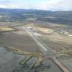
Evanton Airfield
Pillbox (20th Century)
Site Name Evanton Airfield
Classification Pillbox (20th Century)
Alternative Name(s) Novar Camp; Evanton Airfield Defences
Canmore ID 119769
Site Number NH66NW 34.08
NGR NH 62829 66554
Datum OSGB36 - NGR
Permalink http://canmore.org.uk/site/119769
- Council Highland
- Parish Kiltearn
- Former Region Highland
- Former District Ross And Cromarty
- Former County Ross And Cromarty
NH66NW 34.08 62829 66554
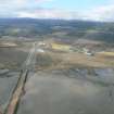
(NH 6283 6655) A second pillbox is situated some 250m S of NH66NW 34.07 on the raised bank above the intertidal area facing Alness Bay.
Immediately beyond in an area of scrub and just outside the runway permeter track are the bases of several perimeter and dispersal buildings.
Visited by RCAHMS (DE) May 1997.
Pillbox - stable condition.
CFA/MORA Coastal Assessment Survey 1998.
Field Visit (2013 - 2014)
ARCH Evanton Wartime Remains project information: Rectangular brick pillbox, still roofed and with turf on top. Pictures from the 1960s also show it with turf, and it may well have been during the wartime as another disguise, although no one remembers it from this time.
Visited by Scotland's Coastal Heritage at Risk (SCHARP) 2013


