Pricing Change
New pricing for orders of material from this site will come into place shortly. Charges for supply of digital images, digitisation on demand, prints and licensing will be altered.
Torr An Daimh
Burnt Mound (Prehistoric)(Possible), Cairnfield (Prehistoric), Hut Circle(S) (Prehistoric), Rig And Furrow (Medieval) - (Post Medieval)
Site Name Torr An Daimh
Classification Burnt Mound (Prehistoric)(Possible), Cairnfield (Prehistoric), Hut Circle(S) (Prehistoric), Rig And Furrow (Medieval) - (Post Medieval)
Alternative Name(s) Achnabat; Loch Nan Geadas
Canmore ID 13263
Site Number NH63SW 30
NGR NH 6010 3093
NGR Description Centred NH 6010 3093
Datum OSGB36 - NGR
Permalink http://canmore.org.uk/site/13263
- Council Highland
- Parish Dores
- Former Region Highland
- Former District Inverness
- Former County Inverness-shire
NH63SW 30 centred 6010 3093
At NH 6010 3093 there is a circular stone-walled hut, measuring 14.4m overall diameter with a wall spread to c. 2.5m all round. Several outer facing stones set on edge are discernible, but no inner face can be seen. The entrance in the E arc is splayed from c. 1.5m wide inside to c. 2.5m outside. There are no cultivation plots in the immediate vicinity (but see NH53SE 7).
Visited by OS (N K B) 2 March 1970.
Hut-circle scheduled as 'Achnabat, hut circle 815m NNE of... visible as a low rubble wall, situated on level, heavily grazed pasture to the NE of Loch nan Geadas. [It] measures 13.6m in external diameter, with enclosing faced rubble walls 1.9m wide and up to 0.4m high. An entrance to the hut is visible to the E, varying in width from 1.5m on the inside to 2.5m on the outside.' [Map indicates Hut Circle at NH 60090 30918].
Information from Historic Scotland, scheduling document dated 16 July 2009.
Hut Circle [NAT] (at NH 60090 30918]
OS (GIS) MasterMap, August 2006.
Field Visit (2 March 1970)
At NH 6010 3093 there is a circular stone-walled hut, measuring 14.4m overall diameter with a wall spread to c. 2.5m all round. Several outer facing stones set on edge are discernible, but no inner face can be seen. The entrance in the E arc is splayed from c. 1.5m wide inside to c. 2.5m outside. There are no cultivation plots in the immediate vicinity (but see NH53SE 7).
Visited by OS (N K B) 2 March 1970.
Field Visit (22 October 1992)
This hut-circle, which is situated in level, heather-clad ground to the NE of Loch nan Geadas, measures 8.8m in diameter within faced-rubble walls 1.9m in thickness and up to 0.4m in height, which thicken towards an entrance on the E.
The ground on the N displays traces of rig cultivation, about 4m in breadth, aligned on an ESE-WNW axis.
(USN93 30, 155)
Visited by RCAHMS (PJD) 22 October 1992.
Aerial Photographic Interpretation (30 January 1997)
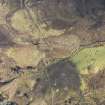
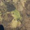
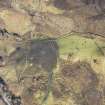
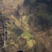
Aerial photographs (RCAHMSAP 1994) reveal what may be a further hut-circle (NH 3127 3102) situated on a well-drained ridge across the burn to the ENE of the previously recorded hut-circle. A scatter of small cairns and field-banks are also visible on the ridge and may be an extension of the field-system to the NE (NH 63SW 52).
What may be a burnt mound (NH 6017 3083), comprising parallel mounds, is also visible on the aerial photographs to the SSE of the of the line of electricity pylons. It is situated on the N bank of the burn and backs on to the better drained ground.
Information from RCAHMS (DCC) 30 January 1997


