
Pricing Change
New pricing for orders of material from this site will come into place shortly. Charges for supply of digital images, digitisation on demand, prints and licensing will be altered.
Upcoming Maintenance
Please be advised that this website will undergo scheduled maintenance on the following dates:
Thursday, 9 January: 11:00 AM - 3:00 PM
Thursday, 23 January: 11:00 AM - 3:00 PM
Thursday, 30 January: 11:00 AM - 3:00 PM
During these times, some functionality such as image purchasing may be temporarily unavailable. We apologise for any inconvenience this may cause.
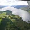
Aldourie Farm


Palisaded Enclosure (Period Unassigned), Roundhouse (Prehistoric)
Site Name Aldourie Farm
Classification Palisaded Enclosure (Period Unassigned), Roundhouse (Prehistoric)
Canmore ID 76682
Site Number NH63NW 34
NGR NH 6029 3650
Datum OSGB36 - NGR
Permalink http://canmore.org.uk/site/76682


- Council Highland
- Parish Dores
- Former Region Highland
- Former District Inverness
- Former County Inverness-shire
NH63NW 34 6029 3650
Air photography has revealed a large circular enclosure c22m in diameter c375m S of Aldourie Farm. Within the enclosure is at least one circular slot c18m in diameter and an internal pit circle c8m in diameter. (AP nos. 8903.17-22 held in Inverness Museum; see also Archive.)
Information from J Harden 1989.
See also NH63NW 60 for another pit-circle immediately to the SE.
Aerial Photographic Interpretation (11 April 2014)
Following a review of the aerial photographs, the enclosure and circle of pits have been reinterpreted as a circular palisaded enclosure and the remains of a later prehistoric roundhouse. As such, the enclosure classification has been upgraded and pit circle has been removed.
Information from RCAHMS (KMM) 11 April 2014

