Dun Troddan
Boundary Marker(S) (19th Century), Broch (Iron Age)
Site Name Dun Troddan
Classification Boundary Marker(S) (19th Century), Broch (Iron Age)
Alternative Name(s) Glenelg
Canmore ID 11797
Site Number NG81NW 6
NGR NG 83400 17244
Datum OSGB36 - NGR
Permalink http://canmore.org.uk/site/11797
First 100 images shown. See the Collections panel (below) for a link to all digital images.
- Council Highland
- Parish Glenelg (Skye And Lochalsh)
- Former Region Highland
- Former District Skye And Lochalsh
- Former County Inverness-shire
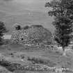
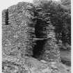
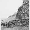
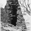
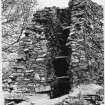
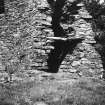
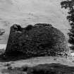
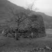
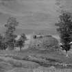
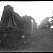
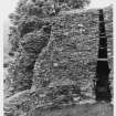
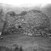
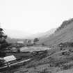
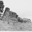
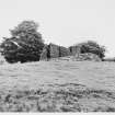
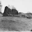
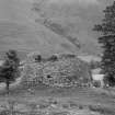
Dun Troddan is one of the best-preserved examples of an Iron Age broch in Scotland, consisting of a round tower with dry-stone walls, parts of which survive to over 7m in height. In 1920, excavations revealed a hearth in the centre and places where timber posts once stood, supporting upper levels. Another well-preserved broch, Dun Telve, is situated only 500m away, but it is unknown if they were occupied at the same time.
Information from RCAHMS (SC) 10 August 2007
Ritchie, A and Ritchie, G 1998
Glen Beag. Nowhere is the prehistoric architecture of the West Highlands best preserved than at Corrary, in the rare setting of a secluded and fertile glen.
The Glenelg Brochs are a pair of fortified homesteads built by Iron Age farmers sometime between the 4th century BC and end of the 1st century AD; excavated in 1914 and 1922. Dun Telve is unrivalled on the Scottish Mainland for the degree to which it survives - a section of walling still rises to some 10 m beneath its canopy of oak and sycamores.
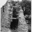
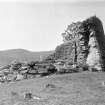
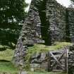
Dun Troddan was badly plundered in 1722, when 'some Goth purloined from the top seven feet and a half' during the construction of Bernera Barracks, but a section of its walling still rises to over 7 m, and it is possible to ascend nine stairs to a passage in the mural cavity.
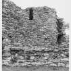
Intact, these drystone brochs would have borne a curious resemblance to great industrial cooling towers. Ruinous, they reveal in cross-section their ingenious double-skinned construction. Rising in thin courses from a solid base some 15 ft thick, the inner wall (with long voids to lessen its load) is clearly vertical, while the outer wall tapers, with bridging slabs tying the two together. A guard's cell opens off the entrance passage, where door-checks and draw-bar holes are still evident. The brochs had central stone hearths and were probably roofed with timber and thatch, incorporating smoke holes. It is now believed that their mural galleries, linked by staircases, were probably used mostly for storage, with principal living accommodation provided in thatched wooden shelters built on several levels against the inner wallface.
[For centuries, the Glenelg brochs have been the subject of intense interest from antiquarians and travel writers, whose various interpretations of their origins include Pictish towers and Danish forts. In folklore, the brochs were the homes of Fingalian giants.]
Taken from "Western Seaboard: An Illustrated Architectural Guide", by Mary Miers, 2007. Published by the Rutland Press http://www.rias.org.uk
NG81NW 6 83400 17244.
(NG 83381723) Dun (NR) (In Ruins Supposed Pictish Tower)
OS 6"map, Inverness-shire, 2nd ed., (1902)
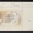
Dun Troddan. A Broch excavated up to 1920 by Curle for the Office of Works. Three superimiposed hearths indicated separate occupation periods. The finds (in the National Museum of Antiquities of Scotland [NMAS] {PSAS 1923}) were few; 7 stone whorls, 2 schist discs, a vitrified bead etc. but no pottery. The lowest hearth (of oblong form) and the vitrified bead compared with material from a 2nd c. RB context at Traprain Law.
A O Curle 1921; A Young 1964; R W Feachem 1963; PSAS 1963.
As described and planned by Curle. Under guardianship.
Surveyed at 1/2500.
Visited by OS (R L) 4 October 1966.
Antiquarian Observation (1850 - 1901)
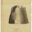
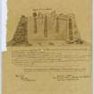
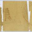
Drawings by Christian MacLagan of sites across Scotland in the Society of Antiquaries of Scotland Collection at HES.
Antiquarian Observation (1866 - 1876)
Photographic Record (1897)
Excavation (1910 - 1920)
A Broch excavated up to 1920 by Curle for the Office of Works.
Field Visit (1962)
Field Visit (1968)
Field Visit (1981)
Field Visit (1981)
Field Visit (1984)
Field Visit (1985)
Field Visit (1989)
Publication Account (1995)
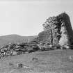
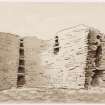
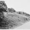
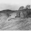
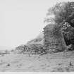
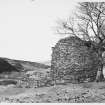
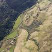
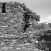
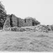
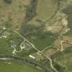
Dun Troddan is set on a terrace on the side of a hill, looking down on its neighbour Dun Telve from a little further up the glen. About one-third of its wall still stands to a height of some 7.6m, making it the third best preserved broch after Mousa and Dun Telve, and in its structural details it is very like Dun Telve.
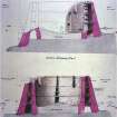
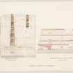
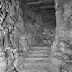
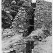
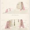
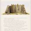
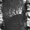
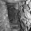
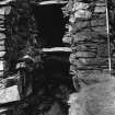
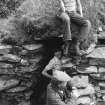
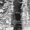
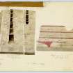
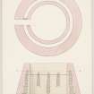
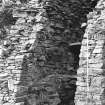
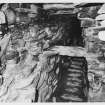
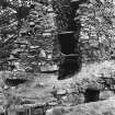
From the entrance with its door checks a long cell, now only partly roofed, leads off to the left. Inside the broch a doorway opens to a cell on the left, with its corbelled roof intact, and to a stair on the right. Nine steps lead up to a level passage running round inside the wall for some 5.50m; after this the stair rose again, though only one step of the second Bight has survived. It is probable that here, as at Totaig (no. 85), a doorway gave access from the passage onto the floor supported on the scarcement, but at Dun Troddan this part of the wall has fallen and no trace of such a door remains. Like Dun Telve, Dun Troddan has a series of voids over the door to the stairs and another set high up in the wall. Three galleries survive in the wall of which only the lowest, at first-Boor level, would have been used by the inhabitants. The hollow walls and the slabs forming the galleries can be seen clearly in the broken ends of the walls. A good idea of the blank and impregnable appearance of an intact broch can be got by looking at the highest part of the wall from outside.
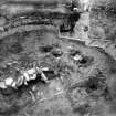
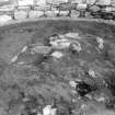
Dun Troddan was cleared out by the then Office of Works over a number of years, and its floor excavated, though not to modern standards, in 1920. A ring of postholes were found which would have held wooden posts to support the upper floor, and a central stone hearth, which had been rebuilt several times. Later hearths were built above a layer of rubble and seem to show continued use of the structure as a dwelling after the upper part of the tower had fallen. Part of a rotary quem can still be seen in the paving of the lowest hearth. Among the few objects found in the broch were stone spindle whorls and a tiny yellow glass bead.
It is unusual to find brochs so close together as Dun Troddan and Dun Telve, but a few other instances are known such as Keiss (see no. 44).
Information from ‘Exploring Scotland’s Heritage: The Highlands’, (1995).
Watching Brief (1 March 1996 - 31 March 1996)
Report of an archaeological watching brief at Corrary, Gleann Beag, Glenelg, Inverness, by James B Kenworthy.
Project (1 December 1998)
Survey: Gleann Beag, Glenelg, Highland.
16 sites recorded.
Project (1 April 2004 - 30 April 2004)
Publication Account (2007)
NG81 3 DUN TRODDAN (‘Castle Troddan’)
NG/8338 1723
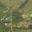
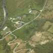
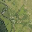
This solid-based broch in Glenelg, western Inverness-shire, is the second of the pair of well preserved such structures standing in Glen Beag, an isolated valley opening on the narrows of Kyle Rhea, between the mainland and the Isle of Skye. It stands on a shallow slope just above the valley floor and only a quarter of a mile from Dun Telve (NG81 2) (visited Sept. 1962, 1963, 1971 and 20/8/85).
The broch was cleared of debris and consolidated by the then Office of Works in the years leading up to 1920, and A O Curle "was privileged to superintend the final stage" (of the clearance) "with somewhat happy results" [4, 84]. The structure is in a similar state to Dun Telve, though slightly lower, and four complete levels survive for about a third of its circumference, including three tiers of intra-mural galleries on top of the solid base. The published description of this broch is not so detailed as that of Dun Telve, nor are the plans and elevations so comprehensive [4].
1. Description
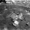
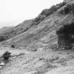
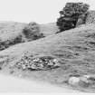
The broch stands on a level rock platform on the side of the north slope of the glen, only a short distance above its flat bottom. There is a moderately difficult approach immediately below the site and the entrance passage faces down this (Illus. 8.176).
Level 1: the broch wall has a solid base, rising to a height of about 2.1m (7 ft), which contains only the entrance passage with its guard cell on the left, and the base of the stairway with its guard cell. These intra-mural spaces are all in the 6-10 o'clock sector. The masonry of the outer face in Level 1 is remarkably good, with very careful under-pinning between the larger blocks.
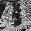
In contrast with the nearby Dun Telve (above) the entrance passage is in the low sector of the wall and is now roofless, as also is part of the long guard cell which opens off it to the left. The passage is not radial to the centre of the broch (its axis passes well to the left of such a line) and faces south-west, looking down the glen; it is 4.05m (13.5 ft) long with the door-frame, formed of built checks, at 1.35m (4.5 ft) from the outer end. The short part of the passage outside the checks is unusually narrow at about 83cm (2 ft 9 in), and the right check is correspondingly deep; the inner-most part has the more normal width of 1.5m (5 ft). It seems very probable that the outer part of the passage was constructed during a secondary phase of the broch's occupation, although no clear signs of this are visible in the masonry. A bar-hole and its opposed socket are preserved immediately behind the left check
Because it faces down the slope the floor of the passage rises from the exterior; there is a small level platform, or pavement edged with stones, outside which was evidently designed for the convenience of people standing there. This pavement extends only about 30cm (1 ft) to the right of the door jambs but about 4.58m (15 ft) to the left. This suggests that the normal approach to the broch entrance was along the base of the tower from the north. The passage enters the central court at a lower level than the rest of the floor and there is a small circular area of low floor here with a kerb or step 45cm (1 ft 6 in) high separating it from the remaining area, which is fairly level.
The guard cell is an elongated chamber, following the curve of the wall, 1.5m (5 ft) wide and 5.41m (17 ft 9 in) long; the low, lintelled door to it from the passage is 1.22m (4 ft) inwards from the left check. At its innermost end are several stepped lintels which suggest that, as at Dun Telve, the entire cell was never corbelled but was once roofed with flat stones (which served as the floor of the gallery above).
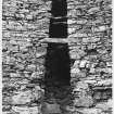
The door to the mural stair is at 9 o'clock, in the remaining high part of the wall, and is 90cm (3 ft) wide although its lintel has disappeared (this would have formed a continuation of the scarcement on the inner wallface – below). It forms the base of a long, vertical opening in the inner wallface which reaches to the present top of the tower and which is divided into several voids by upper cross-lintels. The gap narrows gradually, from 75-15cm (2ft 5 in - 6 in) as it rises. A stair-foot guard cell opens to the left of the door and is 1.8m (6 ft) deep; it is roofed with lintels which also form the floor of the first gallery. For some reason Curle describes the guard cell as having a corbelled roof but there is no doubt that it is lintelled [4, 87]. A corbelled dome would interrupt the Level 2 gallery, as at Dun Mor Vaul (NM04 4).
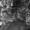
The stairway rises to the right in a flight of nine steps, and the sides of the passage leading to and containing this are smooth and well built. The ninth step reaches a long landing (below).
The inner court is almost exactly circular, and Curle gives the diameter as 8.40m (28 ft) all round. In 1971 a new theodolite survey showed that it was a fraction larger, with a radius of 4.28 +/- 0.03m, equivalent to a diameter of 8.56m or 28.07 ft. The clearance of the accumulated debris from the central court revealed a series of superimposed central hearths [4, figs. 4 and 5) and a ring of post -holes in the primary floor, features which are described further in Section 3 below. The artifacts found in the broch floor are described there also.
The thickness of the wall at the base of the tower varies from 4.05m (13.5 ft) at the entrance to 4.5m (15 ft) almost everywhere else. Because of the exact circularity of the central court this irregularity can be seen to be caused partly by the outer face on the west curving inwards slightly as it approaches the entrance passage, and partly by that east of the passage being slightly thicker than normal to accommodate the sloping ground.
As at Dun Telve the masonry of both faces of the wall in Level 1 is of high quality, having been formed of many large, regular stone blocks that appear to have been hit with heavy hammers so that they split along the grain; the interstices are neatly packed with smaller stones. The external profile of the tower is even and smooth and the quality of the masonry among the highest to be found in the whole of the broch province.
Level 2: the lowest flight of the intra-mural stair leads to a first floor landing 5.67m (18 ft 6 in) long, at a height of 2.44m (8 ft) above the central court, and at the end of which only the first step of the next flight is preserved. This paved landing emerges from the surviving high part of the wall and most of it runs along the present wallhead of the low segment. A scarcement, partly corbelled and partly of the ledge type, runs round the inner wallface at a height of about 1.8m (6 ft) above the floor – about 60cm below the landing. One would suppose that – assuming that the purpose of the stone ledge was to support a raised wooden floor (Section 3) – the first floor landing of the stairway should have passed a large void or doorway which gave access to this raised floor. The left jamb of this raised door is in fact well preserved though it has never previously been identified as such. No doubt it has been thought to be a product of modern consolidation but its nature is quite clear and is confirmed by the evidence of an early 18th century visitor (below). Presumably when the broch was occupied one or two wooden steps led down from its sill on to the structure resting on the stone ledge slightly below.
The lowest of the mural galleries – resting on a solid base except where it crosses the two ground level cells – is 1.5m (5 ft) high and 1.05m (3.5 ft) wide at the base. From the single published cross-section this wall base appears to rise to about 2.15m (7 ft 3 in) above the ground floor level where the Level 2 gallery overrides the guard cell at about 8 o'clock. On the opposite side, at about 2 o'clock, the paved stair landing is slightly higher, at about 2.4m (8 ft). As noted these levels are higher than the scarcement which is about 1.8m (6 ft) above the floor.
The first gallery runs round unobstructed for the quarter of that part of its circuit which remains except that, as usual, its floor comes to an end at the left jamb of the stair door. Presumably its other end was once blocked behind the flight of steps above the first landing. The door-sized void over the stair door leads directly out on to the scarcement but, unless wooden planks were used to form a bridge, no easy access to the gallery floor from the stairs seems to have been possible.
However there is a single lintel of the gallery floor preserved just to the right of the stair door so it is more than likely that the floor of lintels originally ran right past this Level 2 doorway; in this case one or two of their inner ends would have rested on the door lintel. In this case access from scarcement floor to first gallery through the Level 2 door here would have been simple. Since the stair only begins a good 60cm (2 ft) to the right of the door there is no danger of anyone banging their head on the solitary lintel as they walk up it.
What happened at the junction of the first gallery with the main entrance is not known, but the similarity with Dun Telve – where there is also a guard cell roofed with flat lintels – suggests that it ran across the cell and met the chamber over the entrance from the left. The opposite gallery, from the right (this one would have ended blind behind the stair), could have met it too, giving the Level 2 plan here a curious cross-shaped pattern, as at Dun Telve.
Level 3: the second mural gallery (like the third) is also continuous and unobstructed throughout its short surviving length. It is 1.95m (6.5 ft) high and 82cm (2ft 9 in) wide at the base. The width of the two uppermost galleries, and the evenness of their inner facings, seem greater than those of Dun Telve.
Level 4: the third and uppermost surviving gallery is about 1.65m (5.5 ft) high and is still more than 45cm (18 in) wide at its floor; its lintels are immediately below the present turfed-over wallhead which is obviously a modern construction. A second raised void is at about 12 o'clock (some 3.3m or 11 ft clockwise from the first) and starts at the floor of the third gallery. It is about 45cm (1.5 ft) wide at the base where it is about 5.4m (I5 ft) above the floor. No doubt another high series of voids reaching into Level 4 once rose above the inner end of the main entrance, but the wall here has vanished.
There are some discrepancies between the various descriptions of the topmost gallery of Dun Troddan. Graham states that –
"the surviving fragment" (of the broch) "shows two galleries intact and a third partially preserved.... In its present state it is about 25 ft. in height." [5]
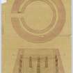
However as noted the gallery is at present complete and roofed, and appears to be the same in the 1920 elevation [4, fig. 3]. This drawing also shows a slightly higher and more irregular wallhead – presumably of rubble covered with turf – and no doubt displays it before the final tidying up had occurred. Curle's description does not say that the third gallery is incomplete, but he does say that "the uppermost gallery has apparently had a height of 5 ft 6 in.” [4, 87]. The drawing shows the wallhead – at the lintels of the third gallery but excluding the turf – at a height of almost exactly 7.63m (25 ft) , the same as that given by Graham for a wall with an incomplete upper gallery. Part of the wall of this broch may well have remained intact to the top of Level 4 since the Iron Age. It is possible of course that this, like the drawn elevation, could show the site after some restoration – particularly the replacement of some lintels on the wallhead – but if so this restoration was not mentioned by Curle. The two neighbouring brochs near Glenelg are so close together and so similar that it is quite likely that occasionally features of one have been attributed to the other in observers' notebooks.
In general the upper galleries of Dun Troddan are wider and more roomy than the corresponding ones in Dun Telve and this tends to confirm that the upper part of the hollow wall of the latter has become crushed inwards over the centuries.
2. 18th century descriptions
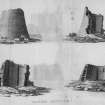
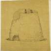
The early records about Dun Troddan were by the same people who described Dun Telve (NG8I 2). In about 1720 Gordon drew a view of the broch from the outside which shows it to be an intact tower. In fact he says that this broch --
" … is by far the most entire of any in that Country, and from whence I had a very clear notion of how these Fabricks were originally contriv'd."
He got inside the tower, apparently through the ragged hole shown in the drawing (presumably the damaged entrance passage) and found four doors in the inner wallface, above each of which were nine “square windows” or voids. This broch too must then have been full of at least 1.8m (6 ft) of debris, so these doors must have been at first floor level. The height is given as exactly 33 ft but this must be from the ground level at the time which, as noted, is likely to have been at least 1.8m (6 ft) or even 2.4m (8 ft) above the broch floor. If Gordon's measurement is accurate this would imply that Dun Troddan was about 12.2m (40 ft) high in 1720; this is an important point when considering the design of the upper part of the tower (below). Its present maximum height is 7.63m (25 ft) to the lintels roofing the top gallery. This question of height is discussed further below.
The four “doors” are described as being on the north, south, east and west sides, but the only one now remaining is the spacious opening over the stair door on the north-west. There was almost certainly another one over the main entrance, not far west of south, and there could have been two more in the part of the wall from north-east to south-east, now reduced to Level 1 and only about 2.44m (8 ft) high at the most. A large door in the south-east (at about 4 o'clock) would have been on the solid base and rather unusual but one in the north-east (at about 1 o'clock) would have been in exactly the right place to lead from the stair landing out on to the scarcement ledge. As noted earlier the vertical left jamb of this door survives though it has not been previously identified as such. Gordon's description thus provides valuable confirmation of its existence.
Four lintelled galleries in the wall are described of which the lowest at least ran continuously round the building; this one is described as partly subterranean, which suggests that the thickness of the fallen debris inside at 1720 was at least 2.44m (8 ft). Here Gordon might have been describing Dun Telve because he mentions the upper “cornice” or scarcement at this point which is now only to be seen in the other broch. On the other hand, as Dun Troddan was so much higher in 1720, Gordon may be providing valuable evidence that an upper scarcement existed then in both brochs, and there is indeed a fairly clear suggestion of such an upper “cornice” in the shaded part of the top of the tower.
3. The excavations of 1920
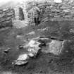
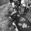
The clearance of the debris inside and around Dun Troddan seems to have been undertaken, without any supervision, by the workmen employed to consolidate it and prepare it for public display. The digging showed that there was a depth of 1.2m (4 ft) or more of debris inside the tower and up to 1.5m (5 ft) piled against the exterior [4, 87]. Alexander O Curle came to the site late in August 1920 and found that all the debris inside the broch had been removed except for a rectangular, paved stone hearth exposed just north of the centre and resting on the gravelly subsoil; it measured 1.35 x 0.9m 4.5 ft x 3 ft) and its long axis was aligned east-west [4, figs. 4 and 5]. Nearby a heap of undisturbed soil 1.2m (4 ft) high had been left, and this was carefully removed by Curle. In it he found a series of paved surfaces and layers of peat and charcoal. Two superimposed hearths were also found in it; the lower one was paved and was about 27cm (11 in) above the one at floor level mentioned above, while a fragmentary second one was above it with its paving 33-36cm (13-14 in) above the subsoil. A 10cm (4 in)-thick layer of peat ash lay on the upper hearth with, above this, a thick layer of tumbled stone debris, presumably fallen from the broch wall. Stone debris in fact occurred in lesser quantities down to the level of the middle hearth. Part of a rotary quern was found 28cm (9 in) above the subsoil.
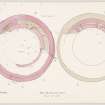
A series of eleven post-holes lined with stone slabs was found in the primary floor level, and ten of them formed a rough circle about 4.5m (15 ft) in diameter and 1.8 - 2.1m (6-7 ft) from the broch wall; nine of these were from 0.9 - 1.5m (3-5 ft) apart but two near the entrance were only 22cm (9 in) apart. The holes were on average 52cm (21 in) deep and 30-36cm (12-14 in) in diameter. There was an extra hole directly inwards from the entrance, further in than the rest. Decayed wood was found in no. 6.
4. Discussion
Interior deposits and finds: Curle thought that the marked lack of finds meant that the broch was only inhabited sporadically and probably only for a short period overall; however it is impossible now to estimate how many other objects were missed during what must have been a fairly vigorous emptying of the broch of its debris and during which two of the massive paved hearths were partly destroyed. Neither can one know how much rubbish was thrown out of the interior during the occupancies of the tower. The three hearths could also imply that debris and rubbish had accumulated in the interior between the various habitations, although the first signs of an extensive collapse of stone from the wall appear to have been at a higher level. From such an early and unsystematic excavation it is difficult to draw firm conclusions about the nature of the primary occupation.
Post-holes: the function of the ring of post-holes inside the broch is of great interest; it was the first time such a feature – subsequently discovered to be common in well excavated sites – had been noticed. Curle thought that the posts once supported a roof resting on the stone scarcement and he evidently thought that a screen of wattling, or something similar, joined the posts to form a barrier between the central area with the hearths and the outer zone. This seems quite possible. The two extra post-holes opposite the main entrance were, he thought, for the doorway through this screen.
However the great size of the sockets – 30-35cm (12-14 in) in diameter and averaging 53cm (1 ft 9 in) deep – suggests that they supported a structure somewhat more massive than the light roof that would have sufficed so far down inside the well of the stone tower. As mentioned earlier the usual explanation for such holes now is that they supported an annular wooden floor, or balcony, running round the outer part of the court (see Caisteal Grugaig, NG82 1). The existence of an upper scarcement at Dun Telve nearby, and very probably at Dun Troddan itself, certainly implies that the main roof was at a higher level.
It is potentially important that the ring of post-holes was not found until Curle had decided, near the end of the operation, to have the gravelly soil of the primary floor (previously exposed by the workmen) scraped over and cleaned; the post-holes then showed up as dark marks. Because of the unsystematic way the overlying deposits were removed before Curle arrived at the site one cannot be sure that traces of the posts were not visible some distance up into the overlying deposits.
However it is at least if not more likely that they were not, and that the ring of posts and its associated wooden raised roof or floor had been dismantled before much of the secondary deposits had accumulated in the interior. In this case only the central hearth on the subsoil would be associated with the broch in its primary state. The later hearths and burnt deposits, on top of increasing deposits of accumulating debris, would represent qualitatively different habitations of the tower. The evidence found at Mousa (HU42 6), Clickhimin (HU44 1), Midhowe (HY33 1), Gurness (HY33 2) and Leckie (NS69 3) show clearly that this happened many times inside brochs.
It might be argued that the floor level with the ring of posts was itself a secondary occupation, the evidence being the kerbed area of a lower floor immediately inside the entrance passage. However Curle specifically describes the gravelly early floor as “subsoil” [4, 88] and must surely therefore have observed that the base of much of the interior wallface was at this level. The slope on which the broch was built probably accounts for the lower level inside the entrance. On the other hand at Dun Ardtreck a small flight of steps was built from the inner end of the similarly sloping entrance up to the higher secondary floor; the latter how-ever was of black earth on top of an earlier horizon, not of gravel or rock (NG33 2).
Height in 1720: on the basis of Gordon's description of the broch in 1720 the height of Dun Troddan at that time was estimated by Graham as in the region of 10.07 - 10.37m (33 - 34 ft) [5, 80-81]. In 1720 Gordon gave the height of the building as exactly 9.9m (33 ft), and this must have been above the immediately surrounding and internal debris; that there was at least 2.44m (8 ft) of this is implied by his statement that the lowest gallery was "somewhat below the surface of the ground."
Assuming the accuracy of Gordon’s figure for the overall height in 1722 (which Graham doubts) this does suggests a height above the old ground surface of about 12.2 - 12.81m (40 - 42 ft). How-ever Gordon also stated that there were then four tiers of wall galleries intact but, as noted, there are now only three (not two and a bit as stated by Graham) and the present height is 7.68m (25 ft) above the original ground surface. If each Level is about 1.83m (6 ft) high, five such (including the four galleries) would only reach about 9.15m (30 ft). It is difficult to reconcile these two alternative estimates; if Gordon measured the tower correctly there must have been another one and a half galleries on top of the four he mentions. It is probably best to agree with Graham – that Gordon’s height is exaggerated and that Dun Troddan was about 10.07 - 10.37m (33 - 34 ft) in his time.
In 1772 Pennant gave the height of Dun Troddan as 7.47m (24 ft 5 in) with only three galleries visible. He could not see the stair mentioned by Gordon so the segment of the high wall containing its upper parts must have been demolished between 1722 and 1772. Presumably the actual height in Pennant's time, allowing for the buried basal storey, was about 9.76 - 10.07m (32 or 33 ft), a lot less than Gordon's figure and more or less what Graham inferred (above). This makes it possible that Gordon's description of a “cornice”, or scarcement, near the top of the inside wallface was correct and that the high part of the wall on which this was had been taken, or fallen, down before Pennant arrived. The height of the upper scarcement at Dun Telve is 9.00m (29 ft 6 in), well above the surviving height of Dun Troddan. Thus even if the lower of the two estimates for the height of Dun Troddan in Gordon's time is correct – say 9.15 - 9.46m (30 - 31 ft) – there would still have been room for the upper scarcement he mentions.
Original height: Graham also tried to estimate how much stone had fallen from the wallhead before 1720. He suggests that the 1.8m (6 ft) of debris cleared from the inner court can be used to estimate how much of the wall had already fallen. Assuming that laid stone occupies only half the volume of randomly fallen debris, the approximately 3,700 cubic feet of rubble removed from the broch in 1919-20 (which presumably fell only from the inner half of the wall) would carry the tower up about another 2.1m (7 ft).
However this last calculation is very doubtful, firstly because Curle describes the internal debris as consisting largely of earth (whereas a broch wall is normally built of pure stone) and secondly becausemuch of the rubble in the tower surely came from a large part of the upper wall which was removed by “some Goth” not long after Gordon's visit, to about 1.83m (6 ft) above the ground. Further extensive destruction obviously took place between 1772 and 1914.
Adding about 0.92m (3 ft) to the 1720 height of the wall would seem more realistic, and that does not bring the broch up to more than about 10.07m (33 ft) originally. However the great width of the upper galleries of this broch, which contrast with the extremely narrow ones of Dun Telve (though these were surely once wider), may mean that there were one or even two galleries on top of the four seen by Gordon, and that the wall did originally rise to over 12.2m (40 ft). However the fact that Gordon's estimate of height can be interpreted in two different ways (above) means that there can be no certainty about these figures. The author is inclined to think that the higher one of 12.2m (40 ft) or more is more likely, simply because of the spaciousness of the surviving galleries.
Primary purpose of broch: the lowest hearth, resting directly on the subsoil, was probably inserted near the beginning of the use of the broch and is a valuable further clue that most of these structures, no matter how tall, were built as the permanently inhabited dwellings of a single family. A similar arrangement was found in Mousa (HU44 6).
5. The finds
The methods employed in removing the debris were doubtless not conducive to the discovery of small objects and few artifacts were found, and no pottery. There are no indications of which strata the finds came from.
Metal: the only find was some small pieces of iron, perhaps a nail, resting on the paving of one of the upper hearths.
Bone tools: these included a curved whalebone object 15cm (6 in) long and a disc.
Stone tools included 7 whorls, 2 perforated discs of schist with diameters of 12.0 and 19.4cm (4.8 and 7.75 in), 1 hammerstone, 1 pebble polisher, ovoid pebbles and a fragment of a rotary quern.
Glass: a small bead of opaque yellow glass of standard Iron Age type was also found.
6. Dimensions
The thickness of the wall at the base of the tower is 4.05m (13.5 ft) at the entrance and 4.5m (15 ft) almost every-where else; the overall diameter varies from 17.07 - 17.52m (55ft 11.5 in, or 57.44 ft); the central court as noted fits an exact circle with a radius of 4.28 +/- 0.03m, giving a diameter of 8.56m (28.07 ft). The wall proportion is therefore about 50.4%.
Sources: 1. NMRS site no. NG 81 NW 6: 2. Gordon 1726, 166: 3. Pennant 1784-96, 239-40 and 1998: 4. Curle 1921: 5. Graham 1947, 80-81: 6. Young 1962, 187: 7. MacKie 1965: 8. MacKie 1975, 161: 9. Feachem 1976.
E W MacKie 2007
Field Visit (September 2012)
NG 83400 17244 In 1920 AO Curle discovered what he described as the first clear evidence for an internal postring within a broch (Curle 1921). Site inspection in 2010 raised doubts whether Curle had reached primary levels, as the interior survives at a substantially higher level than the current floor of the entrance passage (Romankiewicz 2011). Using Curle’s 1921 account published in PSAS and photographs of his investigations held at RCAHMS, a non-invasive survey (photographs and levels) was undertaken in September 2012. This established a height difference of about 0.85m between the currently exposed hearth stone in the centre and the level of the inner end of the entrance passage. The marked step up at the inner end of the entrance passage into the presently sloping grassed-over interior was recorded as c0.55m. The recorded profile, here superimposed onto Curle’s section intimates, but cannot prove, that Curle’s postring sits high above the level of the entrance passage and may be set into substantial deposits that had accumulated above the original floor; if so, the postholes identified by Curle were not a primary feature of the broch. An invasive investigation is needed to clarify this issue.
Archive: RCAHMS (intended)
Funder: University of Edinburgh
Tanja Romankiewicz, University of Edinburgh
Ian Ralston,
2012
Watching Brief (18 March 2013)
NG 8339 1725 A watching brief and evaluation was carried out, on 18 March 2013, during minor alterations to the broch entrance. Within the area of the entrance passage and connected guard cell a minimal amount of work was undertaken, principally weeding and the removal of superficial surface deposits. A photographic survey was undertaken of the guard cell. The excavation of a small trench in the broch revealed that archaeological deposits survive at a depth of 450mm, with evidence for some of these continuing into the entrance passage.
Archive: RCAHMS (intended)
Funder: Historic Scotland
David Murray, Kirkdale Archaeology, 2013
(Source: DES)
OASIS Id: kirkdale1-311429


