Pricing Change
New pricing for orders of material from this site will come into place shortly. Charges for supply of digital images, digitisation on demand, prints and licensing will be altered.
Barra, Dun Cuier
Broch (Iron Age), Galleried Dun (Iron Age)
Site Name Barra, Dun Cuier
Classification Broch (Iron Age), Galleried Dun (Iron Age)
Alternative Name(s) Dun Chuidhir
Canmore ID 9710
Site Number NF60SE 1
NGR NF 66420 03406
Datum OSGB36 - NGR
Permalink http://canmore.org.uk/site/9710
- Council Western Isles
- Parish Barra
- Former Region Western Isles Islands Area
- Former District Western Isles
- Former County Inverness-shire
NF60SE 1 66420 03406
(NF 6641 0340) Dun Cuier (NR)
OS 6"map, Inverness-shire, 2nd ed., (1903)
Dun Cuier, a fairly well preserved galleried dun, was excavated by Young between 1953 and 1955.
The finds, dated from the 4th to the 7th centuries AD, including pottery sherds of late and post-wheel-house types, metal objects, bone combs, bone gaming pieces, bone pins, stone tools, querns, etc., were presented to the National Museum of Antiquities of Scotland (NMAS) by The MacNeil.
Intrusive walls within the dun can be dated to c. 1746.
A Young 1958 and 1964; RCAHMS 1928; Proc Soc Antiq Scot 1961.
Dun Cuier is a broch, 29 ft in internal diameter within a wall 16 ft thick with a scarcement 4 ft 6 ins above ground-level. A few of the small finds are typical of the main broch period at the turn of the eras. Evidence of later occupation sugests a period early in the 7th century AD.
MacKie (E W MacKie 1965) classifies this as a 'curious galleried dun'.
R W Feachem 1963; E W MacKie 1965.
The remains of this structure are as planned and described by Young.
Visited by OS (W D J) 25 May 1965.
Bone dice found.
22. RMS GU 275. Two fragments possibly from the same piece.
a. Three dots enclosed by two concentric circles.
b. Parts of two dots enclosed by two concentric circles.
Found together in the peat ash of the central hearth.
23. RMS GU 276. One end damaged but apparently numbered 6 and 4. Dots enclosed by poorly executed rectangles. On '6' side the two groups of '3' possibly joined by a central line. 51 x 11mm.
24. RMS GU 277. One end damaged. Numbered 6, 4 and 1. The 1 and three dots of the '6' side enclosed by poorly executed rectangles. 52 x 10mm. 25. RMS GU 278. One end damaged but apparently numbered 6 and 4. Dots enclosed by poorly executed rectangles. On '6' side the two groups of '3' joined by a central line. 50 x 9mm.
23-25 found in spread of the peat ash around central hearth; Young (A Young 1958) regards them as part of a set.
26. RMS GU 279. One face numbered 4. Dots enclosed by two concentric circles. 55 x 13mm. To east of central hearth in spread of peat ash.
27. RMS GU 280. Badly damaged; some details obscured by restoration. Numbered 1 (? originally 3), 4 (? originally 6), 4, 5. Dots on '4' side enclosed by two concentric circles, dots on other sides show traces of enclosing single circles. From greasy earth of enclosure formed by inner wall.
D V Clarke 1970; E W Mackie 1971.
Field Visit (7 June 1915)
Dun Cuier, Allasdale.
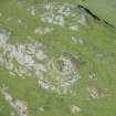
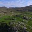
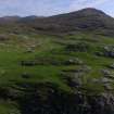
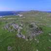
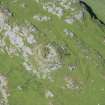
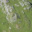
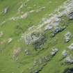
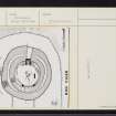
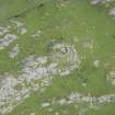
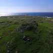
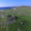
On the summit of a rocky hill rising about 150 feet above sea-level, about 300 yards south-east of the road between Allasdale and Cuier, and some 750 yards west of the parish church of Barra at Cuier, is Dun Cuier, apparently a broch. It commands a fine view of the Atlantic to the west, and northwards the hills of South Uist appear, while through a narrow gap in the hills to the east a glimpse of the Sea of the Hebrides is obtained. It is in a very ruinous condition, and appears as a stony mound from 5 to 12 feet in height, according to the unevenness of its rocky foundation, with a deep hollow on the summit. The outer face of the wall has been removed, leaving little more than the foundation course, which can be traced for the greater part of the circumference. The inner face of the wall can just be detected for a short distance on the northern arc, but excavation might possibly reveal about 5 feet of building. It is circular on plan, measuring about 30 feet in diameter internally, and the wall which is measurable on the north is some 14 feet thick. The inner wall of a gallery within the thickness of the wall, measuring from 4 feet 6 inches to 5 feet in width, can be distinguished on the south-western curve of the building. The entrance has been destroyed, but a gap on the south-east probably indicates its position.
RCAHMS 1928, visited 7 June 1915.
OS map: Barra lxii.
Publication Account (2007)
NF60 5 DUN CUIER
NF/6641 0340
This massive roundhouse, or 'galleried dun', in Barra in the Outer Hebrides, stands on the summit of a rocky hill about 45.8m (150 ft) above sea level. Excavations in the 1950s [3] showed that its main occupation occurred in the 7th and 8th centuries, in the late Iron Age. Notwithstanding this the site has also been claimed as a middle Iron Age broch [5] and considerable argument has resulted [6] (below). Dun Cuier is included here because, first – and in the author's view – it provides a clear example of the kind of structure, and the associated material culture, which followed “the age of brochs” and, second, because it well illustrates the kind of argument that can spring up about archaeological evidence when rival general interpretations clash. The site was refilled with rubble after excavation so remains in a good state of preservation though most of the structural features are now hidden (visited Aug. 1988 and in 2003).
Dun Cuier is also an extremely important site in the sense that it was the first to produce clear evidence for what was happening on the island at the transition between the middle and late Iron Age cultures of the Outer Isles, probably in the 6th and 7th centuries AD. Only Beirgh broch in Lewis (NB13 3) has since produced anything comparable. The finds are therefore shown here in some detail. The report is relatively brief but reasonable sense can be made of it.
1. Introduction
The Commission thought Dun Cuier was a ruined broch, and its overall diameter of about 17.69m (58 ft) and the traces of an apparently continuous intra-mural gallery seemed to confirm this [2]. However excavations in the early 1950s showed that, though the building did possess a scarcement on the interior wallface, it appeared to lack certain other basic features of broch architecture like the intra-mural stair; no unequivocal evidence was found for its ever having had a high, hollow wall. Dun Cuier thus comes into the category of broch-like structures, although the finds indicate that – unlike such buildings in the Orkney islands for example – this one was occupied relatively late.
2. The excavations [3]
Late use. Traces of a recent occupation were found on top of the ruined dùn, associated with fragments of recent craggans and a clay pipe bowl [3, fig. 5].
The wall. The excavator described three concentric walls – an outer, a main and an inner one – but the plan clearly suggests a primary thick-walled building – containing some kind of continuous intra-mural space or gallery – to the inner face of which a later thin skin of masonry has been added. The 'gallery' is unusual in that it does not seem to have been continuous; it peters out into wall core rubble at both ends and in the sector from 11 to 1 o'clock only the inner face could be traced, with rubble resting against it.
This intra-mural space was full throughout with ashy sand in which artifacts were found at all levels – potsherds, hammerstones and bone and shell refuse. The excavator surmised that the space had been filled with rubbish at the time of construction, to form a sort of draught-proof wall core, rather as in the traditional west highland blackhouses. She made no mention of any lintels covering the gallery and it is hard to believe that – had any such existed – they would not have been found during the three seasons of excavation at the site and described in the report. Ian Armit claims that gallery lintels are still visible. The author did not see any when he was there in 1988 or 2003.
The excavator thought that the secondary (innermost) wall was hollow. It ran back as a single course of stones (of which only the footings were found) clockwise from the left of the entrance and from the inner end of its inward extension; it thus appeared to enclose a long, narrow chamber. Since the wall gradually came close to the primary wallface – and from about 11 to 1 o'clock actually rested against it – the “chamber” narrowed to a point. A similarly pointed, long narrow “chamber” existed from 1 - 4 o'clock. The diagnosis of these features as chambers seems strained, and it is surely better to regard the whole structure as an almost completely ruined secondary wall of uneven width. No clear mention was made in the report of any doorways in this wall which one would surely expect in order to link any chambers in it with the interior. However there was a 90cm (3 ft) gap in the secondary facing on the north side, with a possible lintel nearby, which may mark the site of such an opening.
There is a narrow scarcement on the inner face of the primary wall, about 1.5 - 1.8m (5-6 ft) above the floor [3, fig. 6, section XYZ and pl. xxiv].
The entrance. The paved entrance faces east and is 4.88m (16 ft) in length. It did not possess the standard broch door-frame, the passage walls for most of their length being uninterrupted and slightly concave. Only at about 61cm (2 ft) from the inner end was there a 10cm (4 in) rebate in the north or right wall with a bar-hole running into the opposite face. The passage floor was paved and two massive lintels remained in position at the inner end, over the door-frame , giving a height here of only 1.30m (4 ft) . In contrast to all known broch entrances the passage actually widens steadily in front of the single door-check, reaching 1.68m (5.5 ft) just before the outer end where it narrows again slightly. Judging from the plan, the width immediately inwards from the door-check is about 1.14m (4 ft 3 in). The passage had been extended 1.22m (4 ft) into the interior by the two ends of the added secondary facing (below), which here reached its greatest thickness.
The central court. The interior of the dùn contained a clearly stratified floor level of dark material which rested on a layer of white seashore sand; this had evidently been brought in to level off the irregular rocky interior, and a boss of rock projected through the sand on the west. On top of the clean sand was a deep deposit of peat ash containing artifacts and overlaid by a layer of blown sand of varying depth; this was covered by a layer of stone rubble which had evidently fallen from the wall.
One stone-lined post-hole was found, 1.22 or 1.53m (4 or 5 ft) west of the central point. Iron slag was found in a heap next to the central hearth – a rectangular kerbed structure covered by peat ash – and the excavator assumed that this was for metalworking. Bone tools were found next to the stone “working bench” – a row of stone blocks – which had been built on top of the rocky outcrop. The second hearth (not marked on the plan) had near it a mass of coarse sherds, 14 bone pins and the remains of 5 composite bone combs; it was thought to be the dùn fireplace. On the kerbed and paved area just north of the entrance was half of a rotary quernstone (apparently an upper one) and a heap of burnt kerb-stones from the hearth. A sherd decorated with the impression of a bronze ring-headed pin came from this area [3, pl. xxvii, no. 109].
3. Discussion
The structure. Half a century after its excavation Dun Cuier is still an unique site and its exact relationship with the broch/roundhouse cultural complex has been much debated. The author concluded in 1974 that there was little doubt that the structure had never been a hollow-walled broch, despite the appropriate size and proportions of the building and despite the fact that there is a ledge scarcement on the inside wallface (MacKie ms 1974, 2, 174). The apparent absence of internal doorways to the intra-mural gallery, and of any stair in this gallery, seemed decisive evidence against the broch diagnosis. Moreover the entrance passage is completely atypical for a broch, with the door-frame right at the inner end of the passage.
More recently however it has been argued forcefully that, because the structure was not completely excavated, an intra-mural stairway and gallery doors may in fact exist and that Dun Cuier is very probably a ruined broch [5]. Lintels are also said to be visible projecting from the refilled gallery debris [5] (as noted the author did not see any such in 1988.). The secondary walling built round the central court, and the attached inward extension of the entrance passage, is taken to be the crucial evidence for a re-occupation of Dun Cuier in the late Iron Age and for putting the main building back into the middle Iron Age.
Clearly without re-excavating the mural gallery it is not possible to be absolutely certain about the absence of a stair and internal doorways – or about the presence of lintels – but the design of the entrance is clear and it is not that of a broch. Moreover the late date of the primary occupation of the interior seems conclusive; no other broch or roundhouse has produced such finds in a stratified context which were not in a clear secondary level (for example the roundhouse site A' Cheardach Mhor in South Uist (NF74 2) and the Broch of Burrian in North Ronaldsay in Orkney (HY21 5)). A third point is the apparent function of the wall gallery; in the absence of any lintels and of a stairway it seems to have been designed – as the excavator suggested – as an insulating wall core to keep the interior warm rather than as the foundations of a high, hollow wall.
Leaving aside for the moment the nature of the internal occupation it is of course possible to ask why Dun Cuier had to have such a thick, broch-like wall if it was never intended to be very high, and why it has a scarcement ledge if it was not to contain the complex, two-storeyed wooden roundhouse of a broch tower. One answer might be that it was an unskilfully built 'imitation broch' (there must have been examples of the real thing not far away which were still standing quite high in the 6th/7th centuries), massively constructed for prestige reasons, and that the relatively low roof – or even a raised wooden floor – could have rested partly on the ledge.
The stratigraphy. However it is surely the internal stratigraphy which decisively refutes the hypothesis of a middle Iron Age construction date. As noted the floor deposits inside Dun Cuier were relatively simple. Working down-wards from the surface the strata were – (1) fallen rubble, (2) blown sand, (3) an occupation layer of peat ash and (4) clean, white beach sand laid on the rock. Young specifically says of the LIA bone objects (the pins and fragments of composite combs) "… many of the small objects had been trodden into the sea shore sand which levelled the boulder foundation, showing sharp and clear in striking contrast to the overlying peat ash." [3, 300].
In other words some of the 7th century and later bone material was resting directly on the sand foundation layer and had been dropped in that position when hardly any peat ash had accumulated, that is near the beginning of the dún's occupation. The hypothesis of a middle Iron Age broch demands an earlier occupation in the interior (probably starting in the 1st century AD at the latest) – presumably under the sand – with substantially earlier pottery, but there was no such stratum. One cannot legitimately re-date a site by inferring a completely vanished primary occupation layer.
One occupation or two? Considering all the available evidence it seems most likely to the author that Dun Cuier is what its excavator believed – a relatively low-walled 'galleried dun' albeit one with a remarkably broch-like plan and pro-portions. If the ashy fill in the gallery was dumped when the dun was built (as the excavator thought) then the Everted Rim sherd found at a high level in that fill would have been swept up with other occupation debris from some nearby source.
We now know that the characteristic late Iron Age bone pins found have been dated to the 7th century at the earliest by radiocarbon (Foster 1990), and the composite combs are of similar age, so there is no doubt about the lateness of the main occupation.
There are however some aspects of the material culture of Dun Cuier which are not entirely straightforward in terms of the author's interpretation and which could favour Armit's hypothesis, or at least a modification of it (these points have not been mentioned in print before). In the first place two quite distinct kinds of pottery were found inside Dun Cuier – namely the cordoned ware named after the site and rough, plain pottery – and this obviously hints at two distinct occupations. This idea is supported by the excavator’s observation that the Dun Cuier ware consisted mainly of small sherds while many of the plain ware sherds were quite large [3]; this strongly suggests that the latter were the remains of the final occupants, who were not there long but managed to trample on the remains of the Dun Cuier pots they found inside.
The hypothesis of two distinct occupations is also supported by the bone dice found. At the time the excavation report was published there was little reason to doubt that the bone dice were of the same age as the composite bone combs and the ornamental-headed bone pins – that they belonged to what we now call the late Iron Age in the Atlantic Province (equivalent to the Early Historic period on the mainland) (Stevenson 1955). Since then however it has become clear that parallelopiped bone dice are a specifically middle, not late Iron Age phenomenon and that they were in use in the broch province many centuries before the composite bone combs and pins appeared. The broken no. 5, as well as nos. 9 and 10, are examples of the elegant, well crafted MIA form (in these the dot-and-rings symbols were made with some kind of sharp iron tool with three, close-set points, acting as a compass) while the others – nos. 6, 7 and 8, are crude copies. This could mean that the occupation began in the MIA or, alternatively, that the LIA inhabitants found the old broken dice when sweeping up old midden material to put in the mural gallery and made unskilful copies of them. The pottery sheds more light on this problem.
The second element of ambiguity about the date and the primary cultural context of Dun Cuier derives from the fact that – as noted earlier – two quite distinct pottery styles were found in the interior. The large sherds of plain ware evidently belonged to the latest occupation and were clearly associated with LIA composite bone combs and ornamental-headed bone pins. This assemblage could represent the arrival in the Western Isles of Gaelic-speaking Scots from Ireland from the 6th century onwards, as Young hinted at (1956, 301).
Dun Cuier ware by contrast looks like the late and final development of the MIA Everted Rim cordoned jars – a long-lived ceramic tradition which probably did not survive into the LIA (the style was emerging at the very end of the occupation of Dun Mor Vaul – NM04 4). The sheer number of these sherds inside Dun Cuier (but not in the rubblish in the intra-mural gallery) must surely mean that the first inhabitants used this pottery; yet LIA combs and pins were also found in the earliest levels.
What can be the explanation of this apparent paradox? Is Dun Cuier ware primarily a LIA style – and does the dun itself also therefore belong entirely to that period? Or was the dun occupied in quick succession by two entirely distinct cultural traditions? If the latter was the case why do the LIA pins and combs apparently occur in all levels? The interesting stratigraphy which Alison Young found at A Cheardach Mhor wheelhouse (NF74 2) strongly suggests that Dun Cuier ware was in use on that site before the composite bone combs arrived.
The apparent paradox might be resolved by supposing – contrary to what the author has previously argued – that there were indeed two distinct occupat-ions but that the earlier one belonged to the very end of the middle Iron Age – probably not earlier than the 5th or even the 6th centuries – rather than to the main period of broch construction and primary occupation which probably ended in the about the 2nd centuries AD. This would have been at a time when cordoned Everted Rim jars had reached their final development and when the classic MIA bone dice were still in use, but also when composite bone combs and the ornamental-headed bone pins were becoming available to indigenous communities – perhaps in the early stages of the Scots' colonisation of southern Argyllshire in the later 6th or 7th centuries.
This hypothesis would make more plausible the idea that Dun Cuier is a late imitation broch, perhaps built when rumours of the invaders arrived. The second occupation would then have taken place when these new settlers finally reached the Outer Isles and when the local, presumably Scots, immigrant chief dispossessed the native tribal élite of their local stronghold. This would presumably have happened early in the 7th century and the fact that the newcomers seem to have copied the old bone dice they found there strongly suggests that the two phases of occupation were almost continuous. As far as the author is aware no other late Iron Age context has yielded these dice.
4. The finds
Iron artifacts included the mass of slag mentioned. There were also 3 fragmentary knives, one showing a V-shaped cross-section, from the primary occupation layer, 1 possible sickle blade [3, pl. xxi, 2], 1 nail [3, fig. 13, 23] and 1 fragment with a textile impression [3, pl. xxi, 1]. There were also small rivets in the composite bone combs (below).
Bronze artifacts included 1 fragment of an open clay mould, probably for a penannular fibula [3, fig. 13, 19] (found in the sand at the foot of the “bench”), 1 broken clay crucible of the hemispherical type [3, fig. 13, no. 22], fragments of scrap metal in the entrance, and a ring-headed pin in the form of an impression on a potsherd [3, pl. xxvii, no. 109].
Bone tools included 1 single-edged composite comb with a curved, ornamented back and formed of a single plate with two opposed bone bars, the three elements being clamped together with iron rivets, the back decorated with a cut-out design and the whole with incised dot-and-ring symbols [3, fig. 13, no. 1 and pl. xxviii], There were also 2 complete double-edged composite combs, one ornamented with dot-and-circle symbols [3, fig. 13, nos. 2 and 3; pls. xxvii, no. 2 and xx, no. 3] and 3 fragments of others [3, pl. xx, nos. 3A and 3B and fig. 13, no. 4].
In addition there were pieces of well made parallelopiped dice with dot-and –double-circle symbols [3, fig. 13, no. 5], 3 complete cruder dice [3, fig. 13, nos. 6-8], 1 unfinished die with dot and double ring markings [3, fig. 13, no. 10: pl. xx, no. 9], 1 counter made from a trimmed human vertebra (not illus.), 1 cut horn or antler tine [3, fig. 13, no. 20], 4 whorls or buttons of human femur-heads [3, fig. 13, nos. 11-14], 1 needle with a pointed butt [3, fig. 14, no. 39], 1 socketed whalebone handle [3, fig. 14, no. 41] and 14 ornamental-headed pins found in the ash spread from Hearth 2. These last included 2 nail-headed, 1 ball-headed, 1 cylindrical-headed and several spatula-headed examples [Illus. 9.067].
Stone implements included many hammerstones and rubbers [3, fig. 15, nos. 42-45], several worn whetstones [3, fig. 15, no. 46], 1 thin grooved slab, perhaps a sinker, 1 scratched beach pebble, perhaps a strike-a-light [3, fig. 15, no. 48], 1 quartz rubber [3, fig. 15, no. 49], 1 saddle quern [3, fig. 16, no. 1], possibly reused as a building stone in the dùn wall, 2 broken upper stones of rotary querns [3, fig. 18, no. 53] (no. 53 was used as the base of Hearth 3, the other was in wall tumble south of the entrance), 2 ovoid upper stones of rotary querns [3, fig. 16, no. 54] (one with a vertical handle hole, the other with a feed groove near the central hole), 1 fragment of the upper stone of a rotary quern with concentric grooves on top [3, fig. 16, no. 55] (belonging either to the late occupation or part of fallen wall material – probably the former), and several crude discs.
Pottery. The contexts of most of the numerous sherds found are not given in the report, with the exception that all the large, plain, coarse, jar sherds illustrated [3, fig. 7] came from Hearth 2, were sooty and presumably were fragments of cooking vessels used in the latest occupation. Only one has any decoration – two rows of shallow finger- impressions just below the rim and along the shoulder [3, fig. 7, no. 4]. This is similar to the large sherd from the Sithean a Phiobaire midden (NF72 6), where late Iron Age bone pins were also found (Lethbridge 1952, fig. 8, no. 1), and the pottery – though slightly different in shape – is broadly similar also to the plain pottery at the end of the Beirgh sequence (NB13 3).
One curious aspect of this late pottery from Dun Cuier is the resemblance of two of the vessels (nos. 4 and 5) to the late Bronze Age style of almost a millennium and a half earlier and known from mainland sites like Sheep Hill in West Dunbartonshire (MacKie 1977, 440, fig. 2) and Crosskirk broch in Caithness. The significance of this striking similarity – both groups have the slightly out-turned rim with a row of light finger-impressions below it – is unclear.
The remainder of the pottery consisted of small decorated sherds with long, pulled out rims of a type – now known as Dun Cuier ware – never found in classic middle Iron Age contexts. The only good example of a sherd of broch pottery – with a sharply everted rim – came from the fill of the mural gallery [3, fig. 8, no. 37]. Some of the long, pulled-out rims of the Dun Cuier sherds have crude, applied cordons, with a zig-zag pattern, in the angle of the neck [3, fig. 9, no. 50] and many of the wall sherds have similar decoration. Incised decoration is extremely sparse [3, fig. 12, nos. 106-08] and there was also a sherd decorated with the head of a ring pin [Ibid., no. 9]. Also of interest is a shallow bowl with a carinated profile recalling pottery styles of the early Iron Age [3, fig. 8, no. 18].
Animal bones. The bones from Dun Cuier were evidently submitted to a zoologist (Dr Fraser) for identification but only a summary of his report is given. Species found included shorthorn cattle, sheep (many being immature), fragments of pony, pig, seal and otter, some red deer antler fragments and pieces of whalebone. Birds included shag or cormorant. Shellfish included oyster, scallop, limpet, cockle, whelk and mussel. Fish included wrasse, black bream, cod, ling and saith; the presence of sea fish suggests the use of boats and nets or lines.
Dimensions: taken from the plan [3, fig. 6a] the average external diameter is 16.87m (55.3 ft), the internal 8.45m (27.7 ft) and the average wall thickness 4.12m (13.5 ft).
Sources: 1. NMRS site no. NF 60 SE 1: 2. RCAHMS 1928, 129, no. 441: 3. Young 1956: 4. Feachem 1977, 163: 5. Armit 1988a: 6. Armit 1990a: 7. MacKie 1989: 8. MacKie 1997, 153, 154 and 158: 9. Harding 1997, 126-28: 10. Lane 1988, 55: 11. Topping 1988, 82: 12. Proc Soc Antiq Scot 92 (1958-59), 120 (donations).
E W MacKie 2007


