
Pricing Change
New pricing for orders of material from this site will come into place shortly. Charges for supply of digital images, digitisation on demand, prints and licensing will be altered.
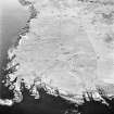
Stroma, The Haven


Harbour (Period Unassigned)
Site Name Stroma, The Haven
Classification Harbour (Period Unassigned)
Alternative Name(s) Stroma Harbour; Pentland Firth
Canmore ID 140748
Site Number ND37NE 17
NGR ND 3526 7634
Datum OSGB36 - NGR
Permalink http://canmore.org.uk/site/140748


- Council Highland
- Parish Canisbay
- Former Region Highland
- Former District Caithness
- Former County Caithness
ND37NE 17 3526 7634
See also ND37NE 15.
Air photographs (RCAHMSAP 1995) show the harbour of the deserted township of Uppertown (see ND37NE 15) on the S coast of the Island of Stroma.
Information from RCAHMS (KB) 5 February 1999.

