Crosskirk
Broch (Iron Age), Inorganic Material (Glass), Unidentified Pottery (Roman)
Site Name Crosskirk
Classification Broch (Iron Age), Inorganic Material (Glass), Unidentified Pottery (Roman)
Alternative Name(s) Chapel Pool
Canmore ID 8019
Site Number ND07SW 4
NGR ND 0248 7012
Datum OSGB36 - NGR
Permalink http://canmore.org.uk/site/8019
First 100 images shown. See the Collections panel (below) for a link to all digital images.
- Council Highland
- Parish Reay
- Former Region Highland
- Former District Caithness
- Former County Caithness
Field Visit (25 August 1910)
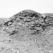
At the edge of the rocks about 30 yards to the N. of the ruined church of St Mary's, Lybster, are the remains of a large broch. The structure has been broken into a small extent on the S., from which direction the entrance appears to have been. The interior diameter is not accurately ascertainable without excavation, but has been approximately 30' to 32'. The thickness of the wall is some 6' above the ground level on the exterior and 5' on the interior. On the left of the position of the entrance the sides of a chamber are visible in the wall. On the exterior, at the edge of a cliff, for a distance of some 20', a portion of wall, about 10' from the broch, are the remains of an outer bank or wall now some 8' wide at base.
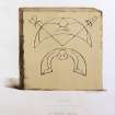
The symbol stone, said to have been found in this broch, is illustrated in 'The Early Christian Monuments of Scotland', pt.111.p.30.
Visited by RCAHMS, 25th August 1910
Field Visit (28 October 1964)
This broch survives as a grass-covered circular enclosure, 1.1m maximum height internally. Traces of the outer wall face, 1.5m maximum height, are exposed in the SW, and in the N where the cliff edge has eroded. There the thickness of the wall is 5.5m. There is no evidence of the original entrance but it may have been in the S where the feature has been mutilated by excavation. Around the E periphery of the broch there is a shallow depression, and on the SW side a bank, 0.5m maximum height, may have formed part of the outer defences.
No further information could be found regarding the symbol stone found here.
Resurveyed at 1:2500.
Visited by OS (N K B) 28 October 1964.
Excavation (1966 - 1972)
Excavated by Fairhurst and Taylor from 1966 to 1972 on behalf of DoE, before being demolished.
H Fairhurst, D B Taylor and A Morrison 1966; H Fairhurst 1969; H Fairhurst and D B Taylor 1970; H Fairhurst and D B Taylor 1971; H Fairhurst and D B Taylor 1972.
Field Visit (13 November 1981)
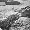
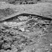
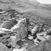
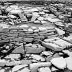
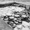
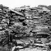
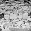
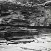
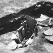
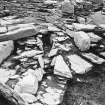
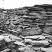
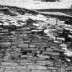
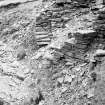
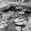
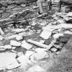
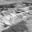
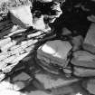
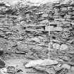
This broch was excavated by Dr H Fairhurst and Mr D Taylor between 1966 and 1972. The wall survived to a maximum height of about 2.0m internally, and contained a rock-cut well. A rock-cut ditch encircled the tower, and the area between ditch and broch was fully occupied by secondary domestic structures. At the conclusion of the excavation the broch was buldozed over the edge of the cliff, and nothing remains of it or the outworks apart from some walling in the cliff face. A modern cairn marks the site.
A full excavation report is pending.
Visited by OS (N K B) 13 November 1981; Information from R B Gourlay, Highland Region Archaeologist.
Note (1 June 2016 - 16 November 2016)
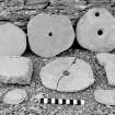
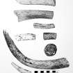
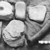
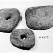
The broch between St Mary's Chapel (Canmore 8005) and the coastal cliffs at Crosskirk stood behind an outer wall, which had been drawn across the neck of the shallow promontory to enclose an area measuring at least 60m from E to W by 30m transversely. The wall measured in the order of 5m in thickness and was still standing 1.25m high, and it was pierced on the S by an entrance with stone slab checks and a bar-hole. The broch was first surveyed in detail in 1871 by Sir Henry Dryden (RCAHMS CAD 68/1), while in 1910 Alexander Curle noted the outer wall, but following excavations by Horace Fairhurst 1966-72 to mitigate the impact of coastal erosion, the greater part the broch and the surrounding structures was bulldozed over the edge of the cliff. The excavation revealed a complex sequence in which the excavator believed that the broch, and a settlement that subsequently developed around it, had succeeded an earlier promontory fort (Fairhurst 1984). No stratigraphic evidence was advanced to sustain this aspect of the sequence, which seems largely based on the character of the pottery found on the floor of a mural cell that was uncovered, and the evidence of activity preceding what was considered to be the primary broch floor. Seven radiocarbon dates that were obtained merely suggest that the origins of the site lie rather earlier than the dates that would have been ascribed to the broch on the strength of sherds of Samian and late Roman ware (see discussion by Mackie 2007, 407-26). Though little of the assemblage recovered from the broch and the later settlement can be ascribed to an earlier occupation, it also included: plain coarse sherds and decorated pottery; bronze ring-headed pins and spiral finger rings; both rotary and saddle querns; a painted pebble; stone lamps, whetstones, spindle whorls and discs; weaving combs and other bone tools; six beads; and a Pictish symbol stone had been found previously.
Information from An Atlas of Hillforts of Great Britain and Ireland – 16 November 2016. Atlas of Hillforts SC4348
Desk Based Assessment
ND07SW 4 0248 7012.
(ND 0248 7112) Broch (NR) (rems of)
OS 1:10,000 map, (1975)
The broch at Crosskirk Bay, Reay, has an internal diameter of approximately 30 to 32ft and a wall 14 to 15ft thick. It has been broken into from the S, where there appears to have been an entrance to the left of which the sides of a chamber are visible in the wall. At the edge of the cliff, some 20ft of wall about 4 to 5ft high is exposed. On the landward side about 10ft from the broch are the remains of an outer bank or wall, now some 8ft wide at the base.
RCAHMS 1911; H Dryden 1871 (Soc of Antiqs Ms No. 21)
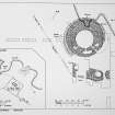
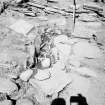
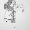
The remains of this broch, unsafe through coastal erosion, was excavated by Fairhurst and Taylor from 1966 to 1972 on behalf of DoE, before being demolished, earthed over and seeded with grass. The excavation revealed evidence of a secondary settlement within an outwork on the east, and an extension of the entrance passage east-wards, part of which was converted,in the last stages of occupation, into a souterrain. The outwork commenced in the east in front of the broch entrance, as a wall 15'thick with an earth core. Further to the west where bedrock came near the surface, the outwork continued as a terrace-like feature with a 'cell-like' structure behind. In front was a ditch, largely natural, which was 3m deep. In the extreme west fence of flag-stones seems to have completed the defences. One of the final episodes in the occupation of the site was a burial in the centre of a roughly circular dwelling. The body had been placed in a sitting position and was unaccompanied by grave-goods. As well as native pottery, bonework, querns, etc., finds included 2nd century Samian and a fragment of possibly Roman glass, now in the National Museum of Antiquities of Scotland (NMAS).
H Fairhurst, D B Taylor and A Morrison 1966; H Fairhurst 1969; H Fairhurst and D B Taylor 1970; H Fairhurst and D B Taylor 1971; H Fairhurst and D B Taylor 1972.
Bronze spiral finger-rings.
E W MacKie 1971
Evidence of occupation as late as the 8th century was found during the excavations.
E W MacKie 1975.
Information from OS.


