
Scheduled Maintenance
Please be advised that this website will undergo scheduled maintenance on the following dates: •
Tuesday 3rd December 11:00-15:00
During these times, some services may be temporarily unavailable. We apologise for any inconvenience this may cause.
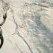
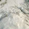
Urachoile


Corn Drying Kiln (Period Unassigned), Head Dyke (Post Medieval), Township (Period Unassigned)
Site Name Urachoile
Classification Corn Drying Kiln (Period Unassigned), Head Dyke (Post Medieval), Township (Period Unassigned)
Alternative Name(s) Uarachoile
Canmore ID 74509
Site Number NC81SW 42
NGR NC 819 103
NGR Description centred on NC 819 103
Datum OSGB36 - NGR
Permalink http://canmore.org.uk/site/74509


- Council Highland
- Parish Clyne
- Former Region Highland
- Former District Sutherland
- Former County Sutherland
NC81SW 42 centred on 819 103
Uarachoile (Urachoile on OS 6-inch map 1969): the ruins of a few dwellings situated c.1/2 mile NW of Kilbraur. The walls stand about 3ft high (Name Book, compiled 1872).
Name Book, Sutherland
Footings of about six buildings 18.0m by 4.0m to 34.0m by 4.0m up to 0.5m high, enclosures and kiln.
Visited by OS (RDL) 28 April 1964
Note (1 November 1995)
A township comprising three unroofed buildings, four enclosures and a length of wall which may be a head-dyke is depicted on the 1st edition of the OS 6-inch map (Sutherland 1879, sheet xcvii). Six unroofed buildings and an enclosure are shown on the current edition of the OS 1:10,560 map (1969).
Information from RCAHMS (SAH) 1 November 1995

