
Pricing Change
New pricing for orders of material from this site will come into place shortly. Charges for supply of digital images, digitisation on demand, prints and licensing will be altered.
Cnoc Dubh


Cairnfield (Prehistoric), Track (Period Unknown)
Site Name Cnoc Dubh
Classification Cairnfield (Prehistoric), Track (Period Unknown)
Canmore ID 5850
Site Number NC70NW 14
NGR NC 7145 0630
Datum OSGB36 - NGR
Permalink http://canmore.org.uk/site/5850


- Council Highland
- Parish Rogart
- Former Region Highland
- Former District Sutherland
- Former County Sutherland
NC70NW 14 7145 0630
(Area NC 714 062) Tumuli (NR)
OS 6"map, Sutherland, 2nd ed., (1907)
About half a mile N of Breackue, on the Cnoc Dubh, is a small group of about half a dozen mounds of the ordinary type.
RCAHMS 1911.
There are about twenty field clearance heaps here; there is, however, no evidence of hut circles in association with this previously cultivated area.
Visited by OS (R B) 10 February 1966.
Along the southern flank of an exposed ridge are a number of rickles and heaps of stone clearance of a type normally found in association with hut circles. There are no huts within the area of clearance but the hut circles to the E (see NC70NW 54, NC70NW 55, NC70NW 57 ) may be contemporary.
Visited by OS (N K B) 12 June 1981.
Field Visit (18 May 1995)
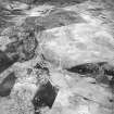
There is a scatter of small cairns, which measure up to 4m in diameter and 0.3m in height, along the crest and SW side of a well-drained heather-covered ridge. A slightly hollowed trackway runs along the ridge from NW to SE, and disappears into the peat at either end of the ridge.
(ROG95 930)
Visited by RCAHMS (DCC) 18 May 1995

