
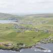
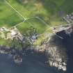
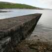
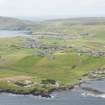
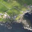
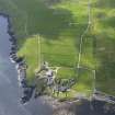
Sand Lodge, Fishery And Jetty


Fishing Station (19th Century), Jetty (19th Century), Pier (19th Century)
Site Name Sand Lodge, Fishery And Jetty
Classification Fishing Station (19th Century), Jetty (19th Century), Pier (19th Century)
Alternative Name(s) Leebotten Jetty; Fishery, Sand Lodge; Sandsair Pier
Canmore ID 950
Site Number HU42SW 11
NGR HU 43571 24920
Datum OSGB36 - NGR
Permalink http://canmore.org.uk/site/950


- Council Shetland Islands
- Parish Dunrossness
- Former Region Shetland Islands Area
- Former District Shetland
- Former County Shetland
HU42SW 11.00 43571 24920
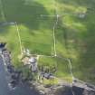
HU42SW 11.01 HU 4355 2487 Boathouse.
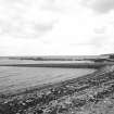
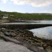
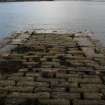
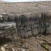
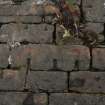
(Location cited as HU 437 249). Fishery, Sand Lodge, 19th century. A masonry jetty, with corrugated-iron store and three interesting winches (one of them made in Hull) for hauling boats.
J R Hume 1977.

