Broch Of Burland
Broch (Iron Age)(Possible)
Site Name Broch Of Burland
Classification Broch (Iron Age)(Possible)
Canmore ID 998
Site Number HU43NW 5
NGR HU 4455 3607
Datum OSGB36 - NGR
Permalink http://canmore.org.uk/site/998
- Council Shetland Islands
- Parish Lerwick
- Former Region Shetland Islands Area
- Former District Shetland
- Former County Shetland
HU43NW 5 4455 3607.
(HU 4455 3607) Brough of Burland (OE)
O.S.6"map, Shetland, 2nd ed., (1903).
The site of this broch is bounded on three sides by precipitous cliffs, and the only approach from the north, is barred by three cross-walls with external ditches. The broch wall is 15' thick and the courtyard 35' in diameter. The entrance, remarkably, is in the SW where it now opens only a few uncertain feet from the brink of the cliff. Various later walls and piles of debris indicate secondary occupation.
RCAHMS 1946, visited 1930; R W Feachem 1963.
Broch of Burland as described.
Re-surveyed at 1/2500.
Visited by OS (NKB) 16th May 1968.
In 1983 a section was cut across the ramparts along the W cliffs by the Central Excavation Unit, as part of an SDD-funded programme of excavation at five Iron Age sites in Shetland threatened by coastal erosion. The work was intended to define the nature of the outer and central ramparts and to seek dating evidence for their construction. Both the outer and central ramparts were shown to have stone faces to rubble and soil cores, suggesting that all three ramparts are of similar construction. The excavations revealed evidence of chronological complexity: the central rampart was constucted after the adjacent ditches had, at least partially, infilled and may have replaced an earlier bank. The other rampart may be a later addition, although this is less certain. The only artefact type found was pottery, which was chronologically undiagnostic. The excavation was supervised by Peter Strong.
S Carter, R McCullagh and A MacSween 1995
The excavation archive from the 1983 investigation has been catalogued.
Historic Scotland Archive Project (FD) 1996.
Field Visit (4 September 1930)
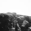
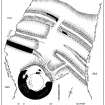
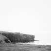
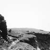
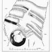
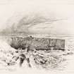
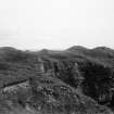
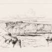
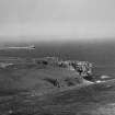
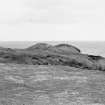
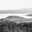
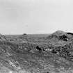
Broch of Burland, Brindister. This ruined broch stands just beyond the neck of a rocky, turf-covered headland which projects southwards into the sea between Gulber Wick and the East Voe of Quarff. The site is protected on three sides by precipitous cliffs, while approach to it from the N. is barred by the formidable series of defensive works which are shown on the plan. The wide. outermost line is a shallow ditch 22 ft. wide. Behind this there comes what has been a rampart revetted with stone, or possibly a stone wall, 18 ft. thick. Nearly midway in its length it is broken by an entrance gap, 8 ft. Within are two very shallow ditches with a wall or rampart between them, all three being interrupted opposite the gap so as to leave room for a roadway. The innermost line is formed by a rampart or wall,* the W. portion of which was probably carried right on until it abutted on the outer face of the broch. The E. portion, on the other hand, seems to have stopped short on the edge of the roadway, indicating that those making for the door of the main structure must have turned to the left here.**
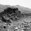
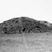
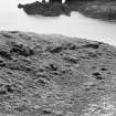
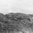
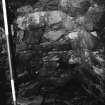
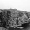
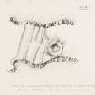
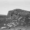
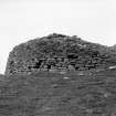
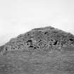
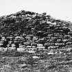
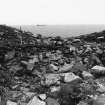
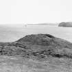
The broch itself stands close to the edge of the cliff on the W. side of the headland. It is now in a ruinous condition, the interior being a mere mass of debris. Apparently, however, it has had an over-all diameter of about 65 ft. The greater part of the wall, which is about 15 ft. thick, survives to a height of 9 or 10 ft., and occasionally more. At the N. and N.E. it is broken down for quite one third of its circumference, though even in this segment it is still possible to detect traces of a gallery. Galleries at an upper level can also be seen within the wall-thickness on the E. and W., and there is a single oval-shaped cell on the E. side of the entrance-passage at the S.W. This passage, the opening into which is only a few feet from the edge of the cliff, is 3 ft. wide at its outer extremity. About halfway in, it has an upright door-check on either side. Beyond the checks it gradually widens to 5 ft. and then contracts to barely 4 ft. 6 in. at the inner end. On the right or E. side a short, narrow passage leads to the cell or 'guard-chamber' mentioned above. This cell is now partly choked with debris, so that entrance can be had only through a hole in the roof. At the lowest level now exposed it measures 9 ft. 3 in. in length by 4 ft. 6 in. across the widest part. The passage has been prolonged through two lines of later concentric walling, each of which obviously belongs to a different period. The first of these rests against the inner face of the broch wall and measures 5 ft. 6 in. in thick- ness, while the second rests against the first and is 4 ft. 6 in. thick. The effect must thus have been a final reduction of the internal diameter to 14 or 15 ft. The debris which fills the central court obscures nearly all signs of the additions.
RCAHMS 1946, visited 4 September 1930.
O.S. 6"map, Shetland, 2nd ed., (1903).
*For some distance at least on the west side of the approach it is quite definitely a wall, 10 feet thick.
**The low ridge joining the eastern portion to the broch is probably nothing more than an accumulation of debris.
Measured Survey (1930)
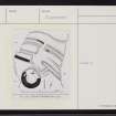
RCAHMS surveyed the Broch of Burland c.1930 using plane-table alidade. The drawings were reproduced in ink and published at a reduced size (RCAHMS 1946, figs. 574-5).
Excavation (1983)
In 1983 a section was cut across the ramparts along the W cliffs by the Central Excavation Unit, as part of an SDD-funded programme of excavation at five Iron Age sites in Shetland threatened by coastal erosion. The work was intended to define the nature of the outer and central ramparts and to seek dating evidence for their construction. Both the outer and central ramparts were shown to have stone faces to rubble and soil cores, suggesting that all three ramparts are of similar construction. The excavations revealed evidence of chronological complexity: the central rampart was constucted after the adjacent ditches had, at least partially, infilled and may have replaced an earlier bank. The other rampart may be a later addition, although this is less certain. The only artefact type found was pottery, which was chronologically undiagnostic. The excavation was supervised by Peter Strong.
S Carter, R McCullagh and A MacSween 1995
Publication Account (2002)
HU43 2 BURLAND 2 ('Broch of Bur-land')
HU/446361 (visited 5/6/63 and 30/-6/87).
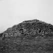
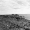
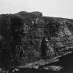
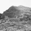
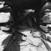
This probable solid-based broch in Dunrossness, near Lerwick, is situated on a high, steep cliff promontory the approach to which -- from the north -- is defended by a massive series of ditches and walls across its neck (Ill. 4.89 - 4.95). The outer wall face stands 9-10 ft. high most of the way round. The lintel of an intra-mural gallery is visible at about 8 o'clock on the wallhead of this ruined and unexcavated building and, since its lintels are some 8 ft. above the floor of the outer end of the entrance passage, it is almost certainly an upper rather than a ground level gallery. The Commission saw another fragment of this gallery at 10 o'clock [2, fig. 574] and in 1963 a door in the inner wall face was visible at about 10 o'clock; it may be the entrance to a cell. The unexcavated interior appears to be filled with a secondary circular structure which has contracted the central court considerably; because of this the primary broch wall face cannot be seen.
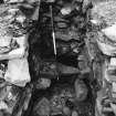
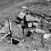
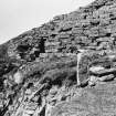
During the 24 years between the writer's first and second visits a considerable amount of damage was done to the entrance passage. The chamber over the entrance is now completely exposed, as far back as its inner end (Ill. 4.92); the outer wall face in front of this has either been knocked down or -- more probably -- was never there. Although the writer's original 1963 description of the site says that all the lintels were in position over the entrance, none are now (apart from one immediately in front of the pole in Ill. 4.92). In view of what follows it seems likely that he made a mistake then and did not realise that the extensive lintelled passage which can be seen is a secondary construction (the Commission's description does not mention any primary lintels).
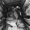
The lintels having been removed, the passage below can be seen fairly clearly, and the two massive door-checks -- formed of stone slabs -- are visible 3.05m (10 ft. 0 in.) from the outer end. The upper part of the corbelled guard cell can be seen on the right, full of debris (Ill. 4.93); the door from this cell to the passage, seen and planned by the Commission, is now buried. The outer end of the entrance passage is only about a metre (3 ft.) from the edge of the sheer cliff, and a direct approach to it is now impossible. The width of the passage is 0.9m (3 ft.) at its outer end but it widens to 1.52m (5 ft.) within the checks, contracting again to 1.37 m (4 ft. 6 ins.) at the inner end.
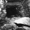
The Commission noted two concentric lines of secondary walling at the inner end of the passage, which was thus prolonged inwards. This secondary entrance can be seen clearly now, starting immediately below the now visible inner end of the chamber above the broch entrance. There is a straight joint on each side between broch wall and secondary wall, and the continuous row of lower lintels starts here; the resemblance to Dun Ringill on Skye is very striking (NG51 4). There is a tertiary wall beyond this, also with the lintelled entrance prolonged through it with higher lintels (Ill. 4.95); the straight joint on the left hand side forms a door check, and is visible in Ill. 4.95 on the right, just in front of the first lower lintel. The excellent state of preservation of this inwardly extended passage-- the lintels of which can only be a short distance below the surface of the interior rubble -- makes Burland unique in Shetland and well worthy of protection and preservation.
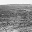
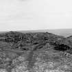
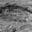
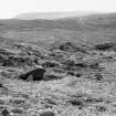
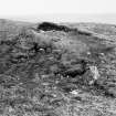
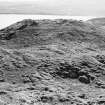
The outer defences consist of three massive banks with three ditches between and in front of them. The shallow, outer ditch is about 22 ft. wide, then comes a probably stone wall 18 ft. thick with a distinct gap or doorway in its centre 8 ft. wide. Within this are two shallow ditches with a wall or rampart between them; the central gap runs through these also. The innermost defence is another wall, clearly visible as such at its west end and 10 ft. thick; the west half appears to turn in to abut the broch wall. These defences enclose an area of the promontory -- which has cliffs 100 ft. high -- about 50 ft. long by 30 - 40 yds. wide, of which the broch occupies only a tiny part.
During the 1980s a section was cut across the outer defences (except for the inner rampart) close to the west cliff [3, Ill. 18]. Both ramparts appeared to be of the dump type, with rubble and soil cores, with revetted drystone faces.
Dimensions: External diameter 65 ft., wall about 15 ft. thick: wall pro-portion thus about 46.2%.
Sources: 1. OS card HU 43 NW 5 (with plan): 2. RCAHMS 1946, vol. 3, no. 1247, 70-2 and figs. 574-5 and 578-9 (plates): 3. Carter, McCullagh and MacSween 1996, 464-67.
E W MacKie 2002
Field Visit (2 September 2015)
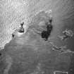
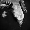
This probable broch with later modifications is a scheduled monument. It has a SW facing entrance with an exterior diameter of 19.5 metres, walls 4.5 metres width. To the north is a series of three walls and ditches that span the promontory which is about 45 metres. Numerous cells and galleries are visible and roughly two floors are still visible.
Visited by Scotland's Coastal Heritage at Risk (SCHARP) 2 September 2015
Note (2 March 2016 - 18 May 2016)
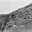
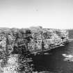
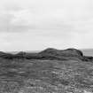
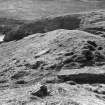
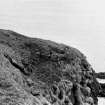
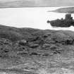
The Broch of Burland stands on a precipitous promontory some 30m above the sea and in addition to the broch three ramparts with external ditches cut across the neck to bar access from the NNW. The broch itself is choked with rubble, but nonetheless in places the outer wall-face stands 3m high, and at the entrance, which opens onto the present cliff-edge on the WNW and displays door-checks and a guard cell, evidence of a complex building history can be seen, with two skins of masonry added to the internal wall-face. The broch appears to stand to one side of the promontory immediately to the rear of the outer defences, but apparently dominates the entrance through the middle of the three outer ramparts. These are conventionally interpreted as outworks to the broch, but they have enclosed a much larger area, now measuring 85m from NNW to SSE by 45m transversely (0.34ha). How much has been lost to the sea down the W flank is unknown, but the curiously oblique course of these defences across the neck of the promontory, might be explained if they had once formed one side of a wider arc. The entrance through the middle of the ramparts on the NNW is complex, probably reflecting several separate periods of construction. The gap in the outermost, where there is no causeway across the broad external ditch, has simple opposed terminals, but the terminals to either side of the gaps in the middle and innermost rampart appear to have been staggered. In 1983 a trench was excavated across the eroding W ends of the outermost and middle ramparts (Carter et al 1995, 464-7), not extending to the then stable innermost, which in the sector W of the entrance is a faced wall 3m in thickness. Both the middle and outer ramparts were also found to be faced with stone, and the middle rampart not only overlay the upper fills of the ditches to either side, but there was also slight evidence that the outer overlay the ditch to its rear. While this does not contradict the interpretation of the outer ramparts as outworks, this longer building history is perhaps evidence that the broch has been inserted into an earlier promontory fort.
Information from An Atlas of Hillforts of Great Britain and Ireland – 18 May 2016. Atlas of Hillforts SC4185


