Scalloway, General
Burgh (Medieval), Town (18th Century)
Site Name Scalloway, General
Classification Burgh (Medieval), Town (18th Century)
Canmore ID 992
Site Number HU43NW 27
NGR HU 40213 39515
NGR Description Centred on HU 40213 39515
Datum OSGB36 - NGR
Permalink http://canmore.org.uk/site/992
- Council Shetland Islands
- Parish Tingwall
- Former Region Shetland Islands Area
- Former District Shetland
- Former County Shetland
HU43NW 27 40213 39515
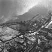
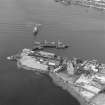
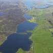
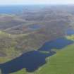
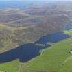
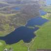
Aerial Photography (1971)
Oblique aerial photographs of Scalloway Castle, Shetland Islands, taken by Mr John Dewar in 1971.
Publication Account (1997)
Scalloway was the ancient capital of Shetland, but it was overtaken in importance both as a harbour and as administrative centre by Lerwick in the 18th century. Its former dominance came about because Earl Patrick Stewart chose to build his tower house here in AD 1600, as his main residence in Shetland. His choice was probably dictated by political and economic factors. Firstly the old Norse judicial centre of the earldom was less than 5km away, Law Ting Holm at the north end of the Loch of Tingwall (no. 42), and there were two important churches on islands to the south (Papil on West Burra and St Ninian's Isle, no. 38). Scalloway is an excellent natural harbour, for it is sheltered on the west by the Ness of Westshore and to the south by the island of Trondra, and there is likely already to have been a fishing community here. Certainly in 1665 it was described as consisting of 'about 100 poor houses and one pretty stone house', the latter being Earl Patrick's castle (no. 27). The number of inhabited houses had dwindled to thirty-one by the end of the 18th century, but the town's fortunes revived with the expansion of the fishing industry in the 19th century.
Scalloway Castle is the oldest surviving building, but its situation has been greatly altered by 20th century expansion of the harbour-works below. When it was built, it stood close to the tip of Blacks Ness overlooking the voe on either side. The Old Haa or Muckle Haa was in existence by 1750, and it is a stately if dilapidated house, with its double stair to the street below. The steps were added in the 19th century to ease access to New Street and the modern level of the reclaimed shoreline. The house is a substantial three stories, and its entrance was once very elegant, with its moulded surround and armorial panel above. The panel
commemorated the marriage in 1750 of the Scalloway merchant James Scott and local heiress Katharine Sinclair, who owned land both in Scalloway and in Burra.
By the end of the century, the prosperous Scott family was feeling the need for a more modern house, which they built farther west at the head of the bay. This is Gibblestone House, which is visible on the left of the drawing of 1801, with the original pier in front. It was designed as a two-storey house
with symmetrical wings and a walled garden, to which in Victorian times were added bay and dormer windows and a pilastered porch at the entrance. Another mansion existed at Westshore Ness overlooking the voe on either side. The Old but only its walled garden survives intact today. It was built for the Mitchell family, whose burial-aisle may be seen at Tingwall (no.34), and the trees in its garden were notable for their rare size even in the late 18th century.
On the seaward side of New Street is an early merchant's booth, while among the 19th century cottages lining its landward side is one with an intriguing plaque on its wall. This was carved by William Johnson, who was an inventor and philosopher as well as a stone mason, and who thus recorded his ideas (and his prejudices) about the working of the tides. On the hillside above the Old Haa is the earliest surviving church in Scalloway,the Congregational Church of 1838, which was soon followed by the Church of Scotland on Main Street in 1840. Prior to these, people would have walked or ridden on horseback to the church at Tingwall. Scalloway Museum is in an attractive building at the junction of New Steet and Main Street, and has an excellent exhibition about the exploits of the 'Shetland Bus' of World War II (see chapter 1). The Kiln Bar preserves the tall vented roof of the original kippering kiln of the later 19th century.
Information from ‘Exploring Scotland’s Heritage: Shetland’, (1997).


