
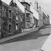
Elie, School Wynd, General


General View (Period Unassigned)
Site Name Elie, School Wynd, General
Classification General View (Period Unassigned)
Canmore ID 98887
Site Number NO40SE 165
NGR NO 491 000
Datum OSGB36 - NGR
Permalink http://canmore.org.uk/site/98887


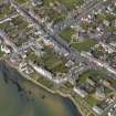
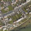
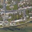
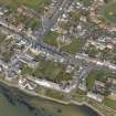
- Council Fife
- Parish Elie
- Former Region Fife
- Former District North East Fife
- Former County Fife
Photographic Survey (June 1964)
Photographs of buildings in Elie, Fife, by the Scottish National Buildings Record in June 1964.

