
Creca


Village (Period Unassigned)
Site Name Creca
Classification Village (Period Unassigned)
Canmore ID 98190
Site Number NY27SW 32
NGR NY 22740 70349
Datum OSGB36 - NGR
Permalink http://canmore.org.uk/site/98190


- Council Dumfries And Galloway
- Parish Annan
- Former Region Dumfries And Galloway
- Former District Annandale And Eskdale
- Former County Dumfries-shire
NY27SW 32 22740 70349
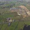
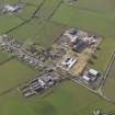
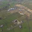
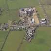
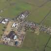
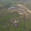
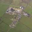
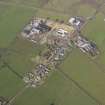
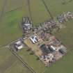
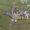
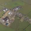
Creca village is situated to the NE of Chapelcross Nuclear Power Station (NY26NW 29), on both sides of a minor road running NW to SE from the B722 to the B6357 roads.
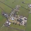
The village consists of a single row of cottages and houses on the N side of the road with a few cottages on the S side at the SE end. Part of the area was utilised during World War II as a domestic site for Annan Airfield (NY27SW 39.03 and 39.04), with a few huts and buildings from that period surviving.
The village is depicted on the 1st Edition of the OS 6-inch map ((Dumfriesshire 1862, sheet lvii), which shows at least thirteen roofed buildings on the N side of the road and four on the S side. The village pump and the farmstead of 'Beechhill' with a horse-engine house is situated at the NW end of the village.
Information from RCAHMS (DE), April 2010

