Accessibility

Font Size

100% 150% 200%

Background Colour

Default Contrast
Close Reset

West Linton, Main Street, St Andrew's Parish Church, Churchyard

Burial Ground (17th Century)

Site Name West Linton, Main Street, St Andrew's Parish Church, Churchyard

Classification Burial Ground (17th Century)

Canmore ID 98070

Site Number NT15SW 64.01

NGR NT 14970 51648

NGR Description Centred NT 14970 51648

Datum OSGB36 - NGR

Permalink http://canmore.org.uk/site/98070

Ordnance Survey licence number AC0000807262. All rights reserved.
Canmore Disclaimer. © Bluesky International Limited 2025. Public Sector Viewing Terms

Toggle Aerial | View on large map

Digital Images

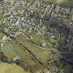
Oblique aerial view of West Linton centred on the church and the burial-ground, looking NW.
Oblique aerial view of West Linton centred on the church and the burial-ground, looking NW.Shelter for bee-hives in Churchyard.
Digital image of PB 485View of East face of headstone commemorating John Allan, died 1798, in the churchyard of St Andrew's Parish Church, West Linton.Headstone, 1708.
Digital image of A 34913 POHeadstone.
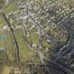
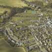
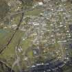
Digital image of PB 744.General oblique aerial view of the village centred on the churches, remains of the church and the burial-ground, taken from the SW.General oblique aerial view of the village centred on the churches, remains of the church and the burial-ground, taken from the SSW.General oblique aerial view of the village centred on the churches, remains of the church and the burial-ground, taken from the E.Oblique aerial view of West Linton centred on the church and the burial-ground, looking WNW.General view from NE.General oblique aerial view of the village centred on the churches, remains of the church and the burial-ground, taken from the SE.Detail of 1601 memorial panel of Lawson of Cairnmuir, presumably James Lawson, in churchyard gatepost.Headstone for Archibald Wilson.
West face.
Digital image of A 34914 POView from S.Alexander Monument.
Digital image of PB 743.

Administrative Areas

  • Council Scottish Borders, The
  • Parish Linton (Tweeddale)
  • Former Region Borders
  • Former District Tweeddale
  • Former County Peebles-shire

Activities

Sbc Note (15 April 2016)

Visibility: Standing structure or monument.

Information from Scottish Borders Council

Measured Survey (21 March 2019 - 5 May 2019)

NT 14961 51637 A plane table survey at 1:100 scale was completed to show the exact location of gravestones. These were first identified by Sheila Scott in Monumental Inscriptions (pre-1855) in Peeblesshire, 1971. The Carved Stone Decay Project in 2002 and 2003 recorded further, more modern, inscriptions. A new database was created linking this survey with original and newly found inscriptions. Supplementary photographs were taken.

Archive: Biggar and Upper Clydesdale Museum

Brenda Dreghorn, David Drury, Bill Glass, Jim Ness, Ian Aitken – Biggar Archaeology

(Source: DES Volume 21)

Sbc Note

The churchyard contains armorial panels, one in each of the gateposts in the main entrance. On the south-east side is the Burial Aisle of the Lawsons and Douglases. The graveyard also contains tombstones of an earlier date than 1707 which may indicate the presence of an earlier church here, or nearby.

Information from Scottish Borders Council

References

MyCanmore Image Contributions


Contribute an Image

MyCanmore Text Contributions