Following the launch of trove.scot in February 2025 we are now planning the retiral of some of our webservices. Canmore will be switched off on 24th June 2025. Information about the closure can be found on the HES website: Retiral of HES web services | Historic Environment Scotland
Raeburnfoot
Bank Barrow (Neolithic)
Site Name Raeburnfoot
Classification Bank Barrow (Neolithic)
Alternative Name(s) Lamb Knowe; Rae Burn; Moodlaw Burn
Canmore ID 97647
Site Number NY29NE 75
NGR NY 2501 9935
NGR Description NY 2501 9935 to NY 2519 9997
Datum OSGB36 - NGR
Permalink http://canmore.org.uk/site/97647
- Council Dumfries And Galloway
- Parish Eskdalemuir
- Former Region Dumfries And Galloway
- Former District Annandale And Eskdale
- Former County Dumfries-shire
For S end of earthwork on Tom's Knowe (NY 2501 9798), see NY29NE 102.
This monument is plotted as a bank barrow on a distribution map of Neolithic monuments covering southern Scotland (RCAHMS 1997, 115, fig. 110).
Information from RCAHMS (ARG), 7 April 1998
Field Visit (7 September 1992)
NY 2501 9935 to 2519 9997 NY29NE 75
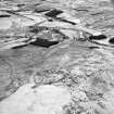
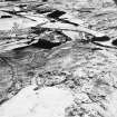
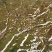
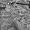
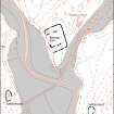
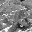
(Formerly classified as cursiform earthwork). The remains of this bank barrow are situated on the SSW flank of Lamb Knowe, a ridge which lies between the Rae and the Moodlaw burns, and descend unevenly towards the River White Esk on the SSW.
For most of its surviving length of about 650m, the earthwork comprises a central mound, measuring up to 6.2m in thickness and 0.5m in height, accompanied by a ditch on either side. The ditches measure up to 3.8m in breadth and 0.3m in depth, and are separated from the mound by a flat berm up to 3.2m wide. At its NNE end, the central mound narrows slightly and runs up on to the side of a barrow-like terminal without actually reaching the flat top. This barrow-like terminal is roughly oval on plan and measures about 9.7m from NE to SW by 8m and 1.5m in height. The ditches return around the NE end of the mound and unite in the form of a hairpin. At its SSW end the earthwork has been levelled by cultivation, and it is not now possible to estimate where the monument originally ended.
It is likely, however, that this earthwork and another (NY29NE 102) of similar description on the opposite side of the valley, are actually two ends of the same monument, and that it is only the central section that is missing, having been obliterated by modern agriculture and by erosion to the river terraces of the River White Esk.
Visited by RCAHMS (JRS) 7 September 1992.
Listed among 'cursus monuments and bank barrows; name cited as Lamb Knowe, Raeburnfoot
RCAHMS 1997.
Measured Survey (7 September 1992)
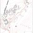
RCAHMS surveyed the bank barrow at Raeburnfoot on 7 September 1992 with plane-table and self-reducing alidade at a scale of 1:250. The plan was redrawn in ink and published at a scale of 1:500 (RCAHMS 1997, Fig. 99).


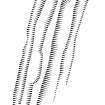
![Computer-generated three-dimensional view of (N end of) Neolithic bank barrow at Lamb Knowe (Raeburnfoot) from NE, generated in SDRMAP software from computer file LAMBSK3D.TIF. Unattributed, [1996].](http://i.rcahms.gov.uk/canmore/l/SC01918322.jpg)











![Computer-generated three-dimensional view of (N end of) Neolithic bank barrow at Lamb Knowe (Raeburnfoot) from NE, generated in SDRMAP software from computer file LAMBSK3D.TIF. Unattributed, [1996].](http://i.rcahms.gov.uk/canmore/s/SC01918322.jpg)
