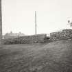
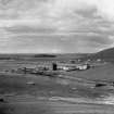
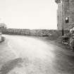
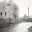
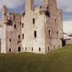
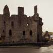
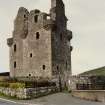
Scalloway, Castle Street, Scalloway Castle
Tower House (Medieval)
Site Name Scalloway, Castle Street, Scalloway Castle
Classification Tower House (Medieval)
Canmore ID 973
Site Number HU43NW 1
NGR HU 40430 39231
Datum OSGB36 - NGR
Permalink http://canmore.org.uk/site/973
First 100 images shown. See the Collections panel (below) for a link to all digital images.
- Council Shetland Islands
- Parish Tingwall
- Former Region Shetland Islands Area
- Former District Shetland
- Former County Shetland
HU43NW 1 40430 39231
(HU 4043 3922) Scalloway Castle (NR) (In Ruins).
OS 6" map, Shetland, 2nd ed., (1902).
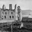
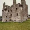
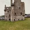
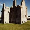
Scalloway Castle was built in 1600 and comprises an oblong block 58ft 6ins (17.83m) from E to W by 33ft 9ins (10.3m) from N to S, with a wing attached to its SW corner, 26ft 3ins (8m) by 26ft (7.92m). The remains, four storeys and a garret in height, rise almost to the wall-head and are in the care of the M of Public Buildings and Works.
RCAHMS 1946; B H St J O'Neil 1950.
Scalloway Castle is as described and illustrated by the RCAHMS.
Visited OS (NKB) 16th May 1968.
EXTERNAL REFERENCE:
National Library of Scotland:
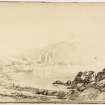
MSS of General Hutton Vol 1 No 185 - illustration of a sketch by Capt. Columbine 1792
Society of Antiquities - Topographical collection - pen and ink sketch
Field Visit (29 July 1930)
Scalloway Castle.
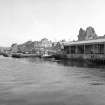
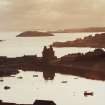
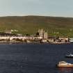
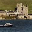
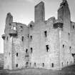
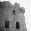
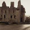
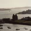
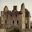
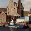
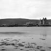
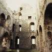
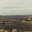
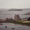
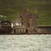
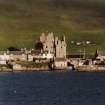
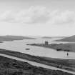
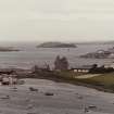
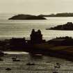
This castle (RCAHMS 1946 Figs. 641, 642), built in 1600 by Patrick Stewart, Earl of Orkney (1), stands close to the shore at the end of a peninsula between the East Voe of Scalloway and the harbour. Four storeys and a garret in height, it rises almost entire to its wall heads. It is now under the guardianship of H.M. Office of Works, which has recently effected some necessary repairs.
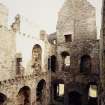
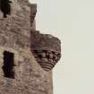
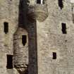
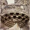
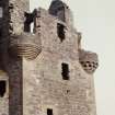
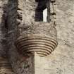
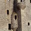
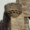
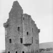
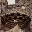
The building consists of an oblong block, with a practically square wing attached to its S.W. corner. The former measures 58 ft. 6 in. from E. to W. by 33 ft. 9 in. from N. to S., while the dimensions of the latter are 26 ft. 3 in. by 26 ft. The masonry is harled rubble with exposed dressings of freestone, and shows an almost entire absence of mouldings, the principal adornment of the building being the turrets corbelled out from each corner and from the W. re-entrant angle. At the N.W. and S.E. corners of the wing the corbelling of the turrets is simply moulded, but in the other five cases it includes members arranged chequer-wise, the chequers at the two E. corners of the main block having ornamental sinkings, like "shot holes", in the spaces. Two of the turrets—that at the N.E. corner and that in the re-entrant angle—are staircases (RCAHMS 1946 Fig. 641), and accordingly start from the first floor. The others, which contain little rooms or "studies", are set at a much higher level. The windows, where unaltered, have their breasts pierced by "shot-holes" either circular or quatrefoiled. Above those of any size on the upper floors relieving arches have been formed. All have been grated with iron, which had already rusted away before 1786.
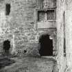
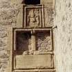
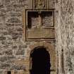
The doorway is in the E. wall of the wing, and low down on the S. side of it is a small square opening. It is simply moulded with a semi-circular head, over which is inserted a horizontal panel, containing a now wholly illegible inscription (2), and supporting two empty panel-spaces placed side by side. Above is a third panel-space, in which there still remains an armorial panel, unfortunately much weatherworn. The coat of arms is defaced, but the supporters and the insignia of the Thistle can be deciphered and suggest a representation of the Royal Arms, which occur in the same position in Earl Patrick's Palace at Kirkwall (RCAHMS 1946 No. 401 [HY41SW 11]). The entrance has had two doors, which have perished, only the bar-hole and the iron crooks and bands of the inner one having escaped destruction. The latter opens at the foot of the main stair, which is of scale-and-platt type and of such generous proportions that it occupies the greater part of the wing between the ground and the first floors. Beneath its upper flight is a vaulted chamber on the ground floor, while on the first floor another vaulted chamber is contrived above the lower flights. Both rooms are well lit, and the upper of the two has a fireplace.
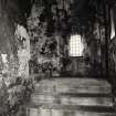
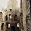
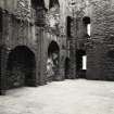
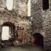
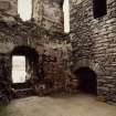
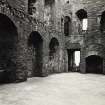
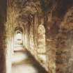
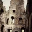
On the ground floor of the main block a well-lighted vaulted passage runs from end to end along the S. wall, giving access to two vaulted apartments on the N. That on the W., which is lit from the N., is the kitchen, the remains of the fireplace being still apparent in the W. gable. The wall opposite contains a draw-well, beneath an arched recess, and an aumbry. In each of the side walls is a smaller aumbry. The other apartment has been a storehouse, lit from N. and E. Although it is possible that the first floor was divided into two rooms, it is more likely to have formed but a single hall, which, in that case, must have been a stately room, measuring 46 ft. by 22 ft. 6 in. It is well lighted from every side, for there are no fewer than nine windows. The principal fireplace is in the S. wall, and has a locker in either jamb, while a smaller fireplace occupies the centre of the E. gable. In the middle of the N. wall is a high, arched recess, which probably contained a "dresser." The turret-stairs are entered at the N.E. and S.W. angles respectively, in each case through the embrasure of a window. The S.W. stair ends at the second floor, and the ascent is then continued by a newel-stair within the walls of the opposite re-entrant angle. The N.E. stair, on the other hand, rises continuously and opens into the E. room on each of the upper storeys. In the second floor there were two well-lighted chambers, both having close garderobes and fireplaces. On the third floor there have been three rooms, each with a fireplace and each lit from the sides by dormer windows. The two end rooms, however, have windows also in the gables and provide access to the turret-rooms at the N.W. and S.E. corners.
On the second floor of the wing is a single room with a fireplace to the N. and windows in each of the other walls. The third floor contains likewise only a single room. It has a fireplace in the S., with a close garderobe in the wall opposite and a window in each of the side walls. At three of its corners doors open into the little circular rooms contained in the turrets.
The plan of this building seems to have been based to some extent on that of Noltland Castle (No. 1033 [HY44NW 1]) and to have influenced the design of the Earl's Palace, Kirkwall (No. 401 [HY41SW 11]). It took shape under Andrew Crawford, Master of Works to the Earl of Orkney, who is buried in Tingwall Churchyard (No. 1496 [HU44SW 20]). ‘The Earl of Morton [1761-1827] granted leave to Sir Andrew Mitchell to plunder the gateways and windows of their ornaments, in order to furnish materials to adorn the house which he erected at Sand, in the parish of Sandsting’ (3).
RCAHMS 1946, visited 29 Jul 1930.
(1) Brand, A New Description of Orkney, Zetland, &c. (1703), p. 90.
(2) Brand (loc. cit .) gives the inscription as PATRICIUS ORCHADIAE & ZETLANDIAE COMES, but in Gifford's Historical Description of the Zetland Islands [in 1733], p. 9, it appears as PATRICIUS STEUARDUS ORCHADIAEET ZETLANDIAE COMES I.V.R.S. If, however, the initials are intended for Jacobus V Rex Scotiae, there must be some mistake, as that monarch died fifty-eight years before the date on the panel itself. Below the inscription was the couplet: CUJUS FUNDAMEN SAXUM EST DOMUS ILLA MANEBIT LABILIS E CONTRA SI SIT ARENA PERIT (‘The house whose foundation is rock will stand, But will perish, if built upon shifting sand’). Brand says that the reference ‘Luke 6’ was ‘added to the Verse’, which he attributes to Mr. Pitcairn, minister of Northmaven, ‘The Minister thereby insinuating that this House could not stand long, having such a Sandy Foundation as Oppression’, since the Earl had caused the poor people ‘in great numbers to be imployed about the Building, which could not but divert them from their ordinary Work as Fishing, &c. whereby they provided Sustinance for themselves and Families’ (Op. cit., p. 90).The Earl, however, is said to have taken the allusion as referring to his father's house at Jarlshof (No. 1139), which, as being built upon sand, was collapsing, while his own house at Scalloway was built upon rock (Tudor, The Orkneys and Shetland, p. 465). ‘Jarlshof’, however, was not founded upon sand, but upon the ruins of a broch and its outbuildings. Moreover, a legal deed of 1605, now in the charter-room at Sand Lodge, proves that ‘Jarlshof’ was habitable at least five years after Scalloway Castle was built.
(3) Edmonston, View of the Ancient and Present State of the Zetland Islands, vol. i, p. 126. Cf. Cast. And Dom. Arch., ii, pp. 90-3.
Aerial Photography (1971)
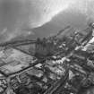
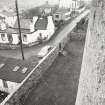
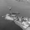
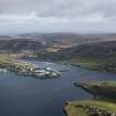
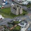
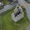
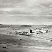
Oblique aerial photographs of Scalloway Castle, Shetland Islands, taken by Mr John Dewar in 1971.
Publication Account (1997)
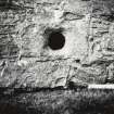
The basic design of this castle consists of a rectangular main block, some 18m by 10m, with a 8m square tower at its south-west angle. It has four storeys and an attic, and turrets at each corner, and it is intact apart from the roof and the two uppermost floors. The entrance is sited in the tower, strategically close to the angle with the main block, and it is covered by a circular gun-loop at ground-floor level in the tower. Many if not all of the windows were originally furnished with gunloops, but there has been much alteration. Surviving in the window-sills of the second floor of the main block are quatrefoil gun-loops, while there are circular gun-loops in the north-east turret. Both types were also used at Muness.
The doorway would have looked splendid when the carved panels above it were intact. At the top there is a weathered armorial panel, and the empty double panel below may also have held armorial carvings. It has been suggested that the double panel held the arms of Patrick Stewart and his wife, with the royal arms above. The bottom panel was carved with an inscription, now so worn as to be barely discernable, but fortunately it was recorded in the 18th century. It read 'Patrick Stewart Earl of Orkney and Shetland/James V King of Scots/That house whose foundation is on a rock will stand/but if on sand it shall fall/AD 1600'. There has been much speculation about the meaning of this enigmatic statement about foundations, but it is possible that it should simply be taken at face value, as a reflection on the strong foundations of the castle and the strength of the family that built it.
The tower is mostly taken up by the stairway and landings, and the major rooms are in the main block. On the ground floor is a large kitchen with a massive fireplace and well, together with a storeroom. The whole of the floor above is taken up by a spacious hall served by nine windows and two fire places. An account of the ruined castle written in 1701 mentions decorative wall paintings and suggests that the great hall may have been a colourful and sumptuous sight in its heyday. The upper floors were divided into private apartments, and there were also small rooms on the upper floors of the tower and in the turrets.
The castle was a major building project for Earl Patrick in 1600, but it seems unlikely that he spent much time there. His rule in Shetland was very harsh and led to his arrest in 1609, when he was taken to Edinburgh. His son Robert attempted to restore the family fortunes by instigating a rebellion, but it failed and both he and his father were executed in Edinburgh in 1615. Apart from a brief period of garrison by Cromwellian troops in the mid 17th century, the castle was left to fall into disrepair, though admired by visitors, until it was taken into State care in 1908.
Information from ‘Exploring Scotland’s Heritage: Shetland’, (1997).


