
St Kilda, Hirta, Village Bay, Cleit 61


Cellular Building (Medieval)(Possible), Cleit (Post Medieval)
Site Name St Kilda, Hirta, Village Bay, Cleit 61
Classification Cellular Building (Medieval)(Possible), Cleit (Post Medieval)
Canmore ID 9673
Site Number NF19NW 21.14
NGR NF 09968 99482
Datum OSGB36 - NGR
Permalink http://canmore.org.uk/site/9673


- Council Western Isles
- Parish Harris
- Former Region Western Isles Islands Area
- Former District Western Isles
- Former County Inverness-shire
NF19NW 21.14 09968 99482
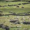
This drystone structure lies across the head dyke and its door faces down the slope. It is wider than most true cleitean, and though there are no visible traces of attached cells, its general character and position suggest that it is part of a remodelled cellular structure.
The fact that the head dyke abuts it clearly indicates that it antedates the 1830s.
Internally, the building measures 3.35m by 1.91m within walls up to 1.32m thick. The corbelled ceiling rises to a height of 1.52m above the existing floor. A mound outside the doorway drops sharply to the natural slope, and some stones to the N, which form no discernible pattern, may have been associated with this structure.
G P Stell and M Harman 1988.
A survey was carried out by the National Trust for Scotland on over 300 cleitean (singular cleit) on St Kilda. They are double-walled, drystone-built oval or rectangular structures, used primarily for storage of food and fuel resources. Many have survived well after being abandoned in 1930 when the islands were evacuated. The survey recorded their condition, construction and location.
M Taylor 2001
Conservation (2001)
NF 101 991 (centre) As part of the Management Agreement with Historic Scotland, the monuments within Village Bay were recorded and monitored, and certain cleits, dykes and enclosures were repaired in 2001 under supervision by members of the two volunteer work parties. Detailed work included the completion of the identification of around 300 cleits for active management, and the production of a report on cleit preservation, as well as rapid assessments of coastal erosion and the deposition of builders' debris within some of the roofless structures along the village street.
Report to be deposited in the NMRS.
Photographic Survey (2002)
NF 101 991 (centre) As part of the Management Agreement with Historic Scotland, the monuments within Village Bay were recorded and monitored, and certain cleits, dykes, drains and enclosures were repaired under supervision by members of the volunteer work parties which went out to St Kilda in 2002.
A photographic survey of the coastline in Village Bay was carried out and compared to images taken in 1999. The survey indicated erosion along the NE side of the bay. Two sherds of hand-made pottery were recovered and a layer of burning noted in an exposed section.
The annual monitoring of cleits across the island was carried out and the photographic survey of them continued.
Report to be deposited in the NMRS.
Sponsors: HS, NTS.
S Bain 2002

