Pricing Change
New pricing for orders of material from this site will come into place shortly. Charges for supply of digital images, digitisation on demand, prints and licensing will be altered.
Upcoming Maintenance
Please be advised that this website will undergo scheduled maintenance on the following dates:
Thursday, 9 January: 11:00 AM - 3:00 PM
Thursday, 23 January: 11:00 AM - 3:00 PM
Thursday, 30 January: 11:00 AM - 3:00 PM
During these times, some functionality such as image purchasing may be temporarily unavailable. We apologise for any inconvenience this may cause.
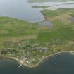
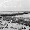
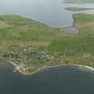
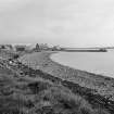
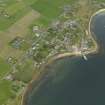
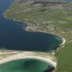
Burray, Pier
Pier (Period Unassigned)
Site Name Burray, Pier
Classification Pier (Period Unassigned)
Canmore ID 9573
Site Number ND49NE 13
NGR ND 4724 9544
Datum OSGB36 - NGR
Permalink http://canmore.org.uk/site/9573
- Council Orkney Islands
- Parish South Ronaldsay
- Former Region Orkney Islands Area
- Former District Orkney
- Former County Orkney
ND49NE 13.00 4724 9544
ND14NE 13.01 4725 9549 winch
For nearby warehouse, see ND49NE 14.
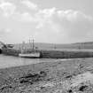
(Location cited as ND 472 953). Burray, pier. A neatly-built dressed-stone pier. At the seaward end is an inset stairway.
J R Hume 1977.
Field Visit (August 1997)
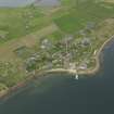
This village grew up in the 19th C as the premier centre of the herring industry in Burray. Its prosperity dwindled after WWI when the blockship barrier across Water Sound cut off direct access to the North Sea.
(i) (ND49NE 29) Storehouse, Westshore: Listed grade 'B' A two-storied building with a loft, probably built as a girnell-house (meal store) for Burray Estate, is dated on the skew-putt to 1645. It has a harled exterior and a roof of Caithness flags. There is a forestair to an entrance on the second story.
(ii) (ND49NE 13) Burray Pier, wide sandstone pier, still in use.
(iii) (ND49NE 14) Warehouse, a two-storied former herring store, packing and curing house (now renovated as Sands Motel), dates to 1860. It is built from variegated local stone with sandstone dressings.
Moore and Wilson, 1997
Coastal Zone Assessment Survey


