
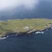
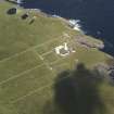
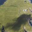
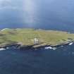
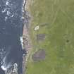
Muckle Skerry


Mound (Period Unassigned)
Site Name Muckle Skerry
Classification Mound (Period Unassigned)
Alternative Name(s) Pentland Skerries; Pentland Firth
Canmore ID 9503
Site Number ND47NE 14
NGR ND 4628 7835
Datum OSGB36 - NGR
Permalink http://canmore.org.uk/site/9503


- Council Orkney Islands
- Parish South Ronaldsay
- Former Region Orkney Islands Area
- Former District Orkney
- Former County Orkney
ND47NE 14 4628 7835.
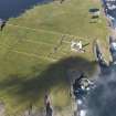
An uneven turf-covered mound about 9.5 in diameter and 0.5m high with the tops of four slabs on edge at various angles protruding.
Visited by OS 8 May 1973

