Stroma, Nethertown
Midden (Period Unassigned), Structure (Period Unassigned)
Site Name Stroma, Nethertown
Classification Midden (Period Unassigned), Structure (Period Unassigned)
Canmore ID 9366
Site Number ND37NE 7
NGR ND 356 784
Datum OSGB36 - NGR
Permalink http://canmore.org.uk/site/9366
- Council Highland
- Parish Canisbay
- Former Region Highland
- Former District Caithness
- Former County Caithness
ND37NE 7 356 784.
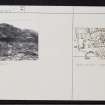
(ND 356 784) Ruins etc., Nethertown: Immediately to the S of Nethertown harbour are remains which are probably prehistoric. Some 20ft to the S of Whitehouse there protrude, a few inches through the turf, two slabs set on edge, parallel and 3ft apart, while 2ft to the W of the most northerly is another in alignment with it. It was stated that, along the coast, towards the N, were many such cist-like settings of slabs, known as "Picts' Beds", but no others, except such as here recorded, have been noted. On the N side of the house, at the edge of the bank, are exposed the ruins of a structure in which upright slabs are visible, set parallel 2ft 10ins apart, with bones and shells intermingling with the debris.
RCAHMS 1911.
In the eroded coastline at ND 3569 7847 N and E of White- house, can be seen a section of old walling about 1.6m high by 30.0m long in which there is a great amount of kitchen midden material, animal bones and shells, and also three stone slabs set on edge at the S end of the wall, possibly the remains of cists or "Picts' Beds". The parallel slabs "set on edge, some 20ft to the S of Whitehouse" could not be found. No further information on this site could be obtained locally.
Surveyed at 1:2500.
Visited by OS (R D) 1 March 1965.
No change to the previous field report.
Visited by OS (J M) 8 July 1982.


