
Pricing Change
New pricing for orders of material from this site will come into place shortly. Charges for supply of digital images, digitisation on demand, prints and licensing will be altered.
Sandygate


Croft (Period Unassigned)(Possible)
Site Name Sandygate
Classification Croft (Period Unassigned)(Possible)
Alternative Name(s) Wic 111
Canmore ID 9341
Site Number ND36SW 17
NGR ND 3359 6098
Datum OSGB36 - NGR
Permalink http://canmore.org.uk/site/9341


- Council Highland
- Parish Wick
- Former Region Highland
- Former District Caithness
- Former County Caithness
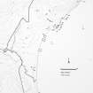
ND36SW 17 3359 6098.
A possible croft, modern but in very poor condition represented by grassy ridges only and measuring 20m E-W by 7m N-S with a possible dividing wall 3m from the E end.
C E Batey 1981.
Project (1980 - 1982)
Field Visit (1981)
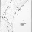
A possible croft, modern but in very poor condition represented by grassy ridges only and measuring 20m E-W by 7m N-S with a possible dividing wall 3m from the E end.
C E Batey 1981.

