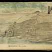
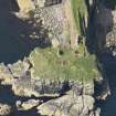
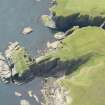
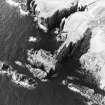
Bucholly Castle
Castle (Medieval), Field Boundary(S) (Period Unassigned), Midden (Period Unassigned), Rig And Furrow (Medieval) - (Post Medieval)
Site Name Bucholly Castle
Classification Castle (Medieval), Field Boundary(S) (Period Unassigned), Midden (Period Unassigned), Rig And Furrow (Medieval) - (Post Medieval)
Alternative Name(s) Bucholie, Can 078
Canmore ID 9301
Site Number ND36NE 7
NGR ND 3821 6583
Datum OSGB36 - NGR
Permalink http://canmore.org.uk/site/9301
- Council Highland
- Parish Canisbay
- Former Region Highland
- Former District Caithness
- Former County Caithness
ND36NE 7 3821 6583.
(ND 3821 6583) Bucholly Castle (NR) (remains of)
OS 1:10,000 map, (1975)
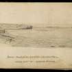
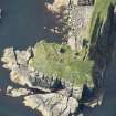
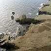
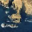
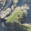
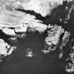
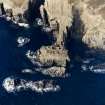
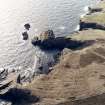
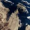
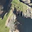
Buchollie (Mowat 1931) or Bucholie (RCAHMS; MacGibbon and Ross) Castle: This castle, dating from the period 1400 - 1542, stands on a peninsula 100ft high, cut off from land by a trench 7ft wide and 9ft deep.
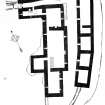
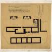
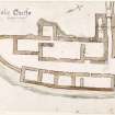
The keep which rose from the edge of this trench measured only 14 by 20ft over all. Only the W wall, standing 30ft high, and a part of the S wall remain. The walls of the vaulted basement are 4ft thick, but on the floors above, only about 2 1/2ft.
An entrance passage 4 1/2ft wide gave access to a long narrow courtyard, flanked by buildings mostly bonded with clay.
An extensive kitchen midden lies along the cliff-top to seaward. The castle was formerly known as Freswick. The property belonged to the Mowats from the time of Robert I (1306-29) until 1661, when it passed to the Sinclairs.
RCAHMS 1911, visited 1910; D MacGibbon and T Ross 1887-92; J Mowat 1931.
Bucholly Castle (the locally accepted spelling) is as described and planned by the previous authorities. The buildings on the W side of the courtyard survive as grass-covered walling about 1.3m high. The kitchen midden is no longer visible.
Revised at 1:2500.
Visited by OS (R D) 9 September 1965.
Seven small fragments of brownish unglazed pottery from a refuse heap at Bucholly Castle were donated to the National Museum of Antiquities of Scotland (NMAS) by A O Curle.
Proc Soc Antiq Scot 1911
Midden deposit sampled. Erosion is extreme on all sides of the castle.
C E Batey 1982.
Bucholie Castle has been identified with 'Lamba-borg' mentioned about 1143 in the Orkneyinga Saga. This would imply an earlier castle on the site. (But see also ND36NE 1.)
R G Lamb 1980
Bucholly Castle is as described and illustrated. The surviving lower foundations are covered by thick vegetation.
Visited by OS (J B) 12 August 1982.
Project (1980 - 1982)
Field Visit (1982)
Midden deposit sampled. Erosion is extreme on all sides of the castle.
C E Batey 1982.


