Scheduled Maintenance
Please be advised that this website will undergo scheduled maintenance on the following dates: •
Tuesday 3rd December 11:00-15:00
During these times, some services may be temporarily unavailable. We apologise for any inconvenience this may cause.
Freswick Links
Cist (Period Unassigned), Midden (Period Unassigned), Settlement (Period Unassigned), Lithic Implement (Flint), Pin(S) (Bronze), Unidentified Pottery
Site Name Freswick Links
Classification Cist (Period Unassigned), Midden (Period Unassigned), Settlement (Period Unassigned), Lithic Implement (Flint), Pin(S) (Bronze), Unidentified Pottery
Alternative Name(s) Lady's Brow; Freswick Bay, Can 058-9 And 061-5
Canmore ID 9293
Site Number ND36NE 4
NGR ND 3760 6762
Datum OSGB36 - NGR
Permalink http://canmore.org.uk/site/9293
First 100 images shown. See the Collections panel (below) for a link to all digital images.
- Council Highland
- Parish Canisbay
- Former Region Highland
- Former District Caithness
- Former County Caithness
ND36NE 4 3760 6762.
(ND 3670 6762) Viking Settlement (NR) (remains of)
OS 1:10,000 map, (1975)
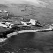
Freswick Links, an area of sandy beach and dunes whose profile is subject to continual change, presents evidence of multi-period occupation from the Mesolithic to the medieval in the form of stone industries, kitchen midden deposits, a broch (ND36NE 5) which produced a cup-marked stone, a settlement which began in the pre-Viking period and continued into the full medieval, and enigmatic structures which were thought to be 'earth-houses'.
The kitchen-middens, mostly of limpet shells and fish bones, occur mainly in the area of Lady's Brow (ND 375 677), but material, including pottery ranging from Neolithic to Iron Age, and even underlying Freswick Castle (ND36NE 3) is found all over the links. One midden, situated 100 yds inland from the bay, was explored about 1954 and proved to be the site of a Bronze Age food-gatherer's encampment. As well as shell refuse it yielded bone tools, flint implements and beaker-type sherds. It overlay a mesolithic stratum containing flakes, cores and scrapers (Lacaille 1954) Microliths have also been found in the neighbourhood. Other kitchen-middens at ND 376 676 (Morris, Batey and Rackham 1979) and ND 3769 6750 (information from Dr J Close-Brooks, NMAS, 20 April 1976) have produced grass-tempered sherds which at Jarlshof (HU30NE 1) proved to be 12th to 13th century Norse (Hamilton 1956) although such pottery is no longer regarded as exclusive to this period and culture (Ritchie and Lane 1981) Similar sherds have been collected from a sand-blow at ND 3776 6724 (information from Dr J Close-Brooks, NMAS, 20 April 1976). These are obviously associated with the later phases of the late 11th to late 13th centuries settlement excavated by Curle in 1937-8 at ND 3765 6745 (information from P K Miller, Post Office, Freswick) and by Childe in 1941, probably about ND 3768 6749, since his site lay NE of Curle's, was associated with the same midden deposit and was threatened by a sand-pit.
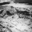
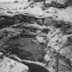
Curle's excavation revealed the remains of one, and possibly two, substantial Viking houses overlying the incinerated remains of a wattle and daub structure, and followed by two successive Norse complexes of less substantial construction. Childe's excavation confirmed the Norse succession but revealed evidence of an appreciably earlier, though still Iron Age, occupation, in the form of a structure of edge-set stones.
In 1910 the RCAHMS noted the ruins of a rectangular building, exposed by excavation, about 200 yds SE of the of the modern chapel (ND 3762 6791). Its walls were 4ft thick, with traces of lime on the inner face, and had a doorway 2ft 5ins wide in the SE, behind the jambs of which were bar-holes. Iron slag covered the paved floor. Since a smithy formed part of the upper levels of Curle's excavation, this structure might be interpreted as fulfilling a similar function in a northward extension of the settlement, although the use of lime might suggest it was not an early structure. This may be the 'stone and lime building' at the N end of Freswick Links from which came a whorl of cetacean bone which was donated to the NMAS in 1929 (PSAS 1929). That occupation did extend northward is shown by the extensive area at ND 378 677 in which cliff-face erosion has exposed burnt stone and midden material.
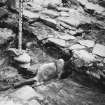
In 1965 (OS field investigator {RD}) Curle's excavation could still be identified with, 50 yds S of it, at ND 3765 6741, a long cist 2.1m long by 0.6m broad and 0.6m deep, unpaved and lacking the E end-slab, but containing an adult skeleton lying face down. Otherwise all that could be identified was a short stretch of walling and a slight rickle of stones at ND 3770 6776, which might be the RCAHMS site; and 7.5m of curved walling at ND 3770 6733 (OS field investigator [RD]).
Freswick has been identified with the 'Thrasvik' of the Orkneyinga Saga. RAF air photographs (CPE/Scot//UK/264: 3007-8) suggest that structural remains of settlement survive over much of the links area, especially at ND 3768 6736, in the vicinity of the broch at ND 3761 6761, and at ND 3757 6776. The last two areas seem to be approximately those in which Edwards excavated in 1924 and 1926. His first excavation was of a hut circle in the E- facing gully, about 600 yds N of Freswick Houe (ND 376 670). It was oval, 17ft by 13ft, composed of single boulders resting on pure sand. An entrance, 3ft 9ins wide, in the SW, was flanked on its S side by a portal 4ft high. The floor was of clay.
About 16ft NE of the hut circle, Edwards (1927) excavated an 'earth-house', and two others, lying within 11 ft of each other, were excavated to the N of Lady's Brow (Edwards 1925). These structures appear to bear more resemblance to some of the elements of a broch settlement, e.g. the two chambers to the W of the broch in the Yarrows complex (ND34SW 1) than to souterrains. Among many small finds from the links in the NMAS, mostly donated by Simon Bremner, Mid Town, Freswick, between 1928 and 1951, are steatite whorl and steatite urn fragments 'from the base of a ruined cairn on Freswick Links', donated in 1935. The finds from Curle's excavation are also in the NMAS.
Visited by OS (R D) 27 October 1965; Information contained in letter and 6" plan from J E Kirby, 3 Ferry Croft, Lairg, to J Close-Brooks, National Museum of Antiquities of Scotland (NMAS).
RCAHMS 1911, visited 1910; A J H Edwards 1925; A J H Edwards 1927; Proc Soc Antiq Scot 1929; Proc Soc Antiq Scot 1935; A D Lacaille 1937; A O Curle 1939; V G Childe 1943; A D Lacaille 1954; J R C Hamilton 1956; J E Burns 1966; C Morris, C Batey and D Rackham 1979; G Ritchie and A Lane 1981.
A detailed survey of the site, as well as exploratory works, midden-sampling, minor excavation, recording of eroding cliff-sections and consolidation was carried out in 1980-1. Possible evidence of cultivation was found, as were traces of walls N and S of Curle's excavation, and a probable cist, empty of contents, in an eroding area above the beach.
C Morris, C Batey and N Pearson 1980; C Morris, C Batey and A K G Jones, 1981
None of the strutures previously exposed, some by excavation, can now be seen on Freswick Links. Further excavation is preceeding at present and a report will be produced (Information from C Batey to OS).
Visited by OS (N K B) 23 August 1982
C Batey, C Morris and A K G Jones 1981; C Batey et al 1981.
ND 376 677. A structure of unknown extent and nature is eroding from the N side of the dune complex known as Lady's Brow. The dimensions are obscured by sand-fall. CAN 058.
ND 3764 6746. Part of one of the Norse structures excavated by Curle is visible as a stretch of walling about 2m long running roughly E-W.
None of the previously recorded flint-producing sites was identified. CAN 059.
C Batey, Caithness Coastal Survey, 1982
Excavation (June 1941)
Excavated by Childe on behalf of the Ministry of Works.
V G Childe 1942
Field Visit (1982)
ND 376 677. A structure of unknown extent and nature is eroding from the N side of the dune complex known as Lady's Brow. The dimensions are obscured by sand-fall. CAN 058.
ND 3764 6746. Part of one of the Norse structures excavated by Curle is visible as a stretch of walling about 2m long running roughly E-W.
None of the previously recorded flint-producing sites was identified. CAN 059.
C Batey, Caithness Coastal Survey, 1982


