
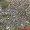
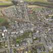
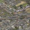
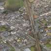
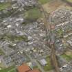
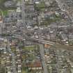
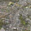
Cowdenbeath, Station Road, Cowdenbeath New Station


Railway Station (19th Century) - (20th Century)
Site Name Cowdenbeath, Station Road, Cowdenbeath New Station
Classification Railway Station (19th Century) - (20th Century)
Alternative Name(s) Factory Road; High Street
Canmore ID 92113
Site Number NT19SE 94
NGR NT 16570 91801
Datum OSGB36 - NGR
Permalink http://canmore.org.uk/site/92113


- Council Fife
- Parish Beath
- Former Region Fife
- Former District Dunfermline
- Former County Fife
NT19SE 94 16570 91801
Station presently in use; opened 29.3.1919 to replace old station.
Present station buildings are recent replacements.
(Undated) information in NMRS.

