Pricing Change
New pricing for orders of material from this site will come into place shortly. Charges for supply of digital images, digitisation on demand, prints and licensing will be altered.
Staxigoe, General
Township (19th Century)
Site Name Staxigoe, General
Classification Township (19th Century)
Alternative Name(s) Wic 151
Canmore ID 9170
Site Number ND35SE 39
NGR ND 3845 5240
NGR Description Centred ND 3845 5240
Datum OSGB36 - NGR
Permalink http://canmore.org.uk/site/9170
- Council Highland
- Parish Wick
- Former Region Highland
- Former District Caithness
- Former County Caithness
ND35SE 39.00 centred 3845 5240
ND35SE 39.01 Centred ND 38466 52431 Granary and Barn
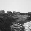
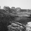
'A small fishing village situated about 2 miles NE of Wick...'
Name Book 1877
A large group of modern buildings, originally a fishing settlement, includes one rectangular building, 5.25 x 5.75m, by the harbour. WIC 151.
C E Batey, Caithness Coastal Survey, 1981.
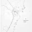
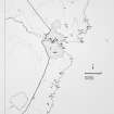
A township comprising at least forty-six roofed, two partially roofed and three unroofed buildings, four structures and numerous enclosures is depicted on the 1st edition of the OS 6-inch map (Caithness 1877, sheet xxv).
At least twenty-nine roofed and eight unroofed buildings are shown on the current edition of the OS 1:10,000 map (1985).
Information from RCAHMS (SAH), 23 January 1996.
ND 385 524. A watching brief was carried out in July 2001 on the excavation of foundation trenches for a house site. The site was found to be extensively disturbed by the construction of a WW2 accommodation camp. A small late 19th-century midden adjacent to a standing ruin was the only archaeological feature.
Report lodged with Highland SMR.
Sponsor: D Fraser.
C Dagg 2001.
Project (1980 - 1982)


