
Liddel Viaduct


Railway Viaduct (19th Century)
Site Name Liddel Viaduct
Classification Railway Viaduct (19th Century)
Alternative Name(s) The Waverley Line; Border Union Railway; River Liddel; Mangerton
Canmore ID 91669
Site Number NY48NE 23
NGR NY 48006 86043
NGR Description NY 47998 86089 to NY 48011 86012
Datum OSGB36 - NGR
Permalink http://canmore.org.uk/site/91669

- Council Scottish Borders, The
- Parish Castleton
- Former Region Borders
- Former District Roxburgh
- Former County Roxburghshire
NY48NE 23 48006 86043 (NY 47998 86089 to NY 48011 86012)
Liddel Viaduct [NAT]
OS 1:10,000 map, 1982.
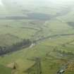
The Liddel viaduct was situated about 573m SSE of the former crossing of the B6357 road. The viaduct crossed the Liddel Water at an angle. The viaduct has been demolished, although the approaches are still visible.
Information from RCAHMS (DE), August 2007

