Swallow Geo
Structure (Period Unassigned)
Site Name Swallow Geo
Classification Structure (Period Unassigned)
Alternative Name(s) Wic 150
Canmore ID 9164
Site Number ND35SE 33
NGR ND 3878 5403
Datum OSGB36 - NGR
Permalink http://canmore.org.uk/site/9164
- Council Highland
- Parish Wick
- Former Region Highland
- Former District Caithness
- Former County Caithness
ND35SE 33 3878 5403.
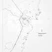
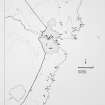
ND 3875 5405. A turf-covered structure of roughly circular form, 12 by 8m.
C E Batey 1981.
An obscure structure at ND 3878 5403 as planned by Miss Batey and averaging 0.2m high. It is too unclear for typological or chronological classification.
Visited by OS (J B) 22 July 1982.
Project (1980 - 1982)
Field Visit (1981)
ND 3875 5405. A turf-covered structure of roughly circular form, 12 by 8m.
C E Batey 1981.


