
Castletown Airfield


Airfield (20th Century)
Site Name Castletown Airfield
Classification Airfield (20th Century)
Alternative Name(s) Castle Town
Canmore ID 91614
Site Number ND26NW 36
NGR ND 21759 67286
NGR Description Centred ND 21759 67286
Datum OSGB36 - NGR
Permalink http://canmore.org.uk/site/91614


- Council Highland
- Parish Olrig
- Former Region Highland
- Former District Caithness
- Former County Caithness
ND26NW 36.00 centred 21759 67286
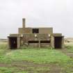
ND26NW 36.01 ND 2145 6607 Pillbox; Bunker
ND26NW 36.02 ND 21065 67898 Parachute Packing Centre
ND26NW 36.03 ND 21306 67884, ND 21419 67854 and ND 21389 67804 Bomb Store
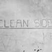
ND26NW 36.04 ND 21170 67668 Gas Decontamination Centre
ND26NW 36.05 ND 21175 67562 Shooting Butt
ND26NW 36.06 Centred ND 21070 67455 Military Camp
ND26NW 36.07 ND 20959 66945 Pillbox
ND26NW 36.08 ND 21144 67130 Pillbox
ND26NW 36.09 ND 21386 67358 Pillbox
ND26NW 36.10 ND 21668 67652 Pillbox
ND26NW 36.11 ND 21965 67637 Pillbox
ND26NW 36.12 ND 22007 67584 Pillbox
ND26NW 36.13 ND 21041 67616 Pillbox
ND26NW 36.14 ND 20915 67649 Pillbox
ND26NW 36.15 ND 2175 6723 Pillbox
ND26NW 36.16 ND 2126 6700 Pillbox
ND26NW 36.16 ND 2207 6688 Pillbox
For associated pillbox at ND 1990 6710, see ND16NE 104.
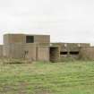
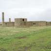
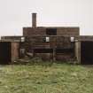
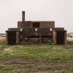
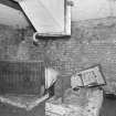
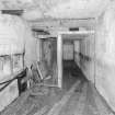
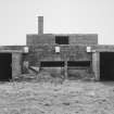
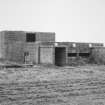
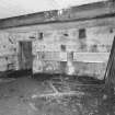
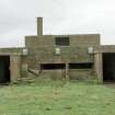
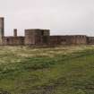
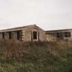
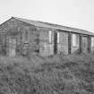
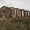
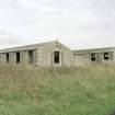
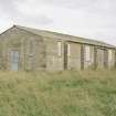
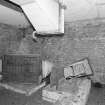
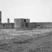
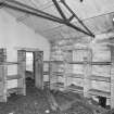
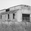
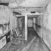
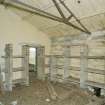
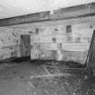
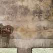
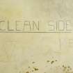
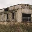
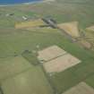
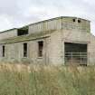
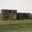
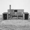
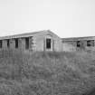
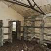
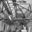
Part of the defence of Scapa Flow and Northern Scotland it opened as a satellite to Wick airfield (ND35SE 103) in May 1940 and closed during April 1944. The airfields surviving remains consist of many buildings including the de-contamination centre, parachute store and several brick and concrete huts. A naval gun salvaged from a shipwreck was placed in concrete outside the station HQ, later reclaimed by the RN.
D J Smith 1983; B Quarrie 1987
This airfield is situated to the SE of Castletown on the E side of the B876. There are many buildings still surviving both around the perimeter of the airfield and to the E of Thurdistoft farmsteading.
J Guy 2000; NMRS MS 810/10, Vol.1, 15
The Control Tower has been removed and though some farm sheds have been built on the NW-SE runway, all are extant, but now overgrown with grass. There is a large electricity generating house on the SE side of the airfield. All of the hangars and most of the other airfield perimeter buildings have been removed, but many of the earth banked dispersal bays survive.
The airfield is visible on WW II vertical air photographs (NLA 16, 632-638, flown 22 June 1941) and postwar RAF vertical air photographs (CPE/Scot/UK185, 4354-4358, flown 9 October 1946 and CPE/Scot/UK/264, 3034-3037, flown 4 August 1947). The photographs show the airfield with all hangars and other ancilliary buildings in place.
Vsited by RCAHMS (DE, SW), August 2000.

