
Noss Head


Cairn (Period Unassigned)
Site Name Noss Head
Classification Cairn (Period Unassigned)
Alternative Name(s) Wic 149
Canmore ID 9147
Site Number ND35SE 18
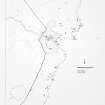
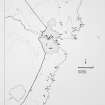
NGR ND 3871 5479
Datum OSGB36 - NGR
Permalink http://canmore.org.uk/site/9147


- Council Highland
- Parish Wick
- Former Region Highland
- Former District Caithness
- Former County Caithness
ND35SE 18 3871 5479.
(ND 3871 5479) Cairn (NR)
OS 6" map, (1968)
This small cairn has been excavated. Its diameter is about 13ft. In the centre a large slab is exposed, which has probably formed one side of a cist, and another slab is displaced near it and measures 5ft 9ins in length.
RCAHMS 1911.
This grass-covered cairn is now reduced to a mound 6.0m in diameter and 0.6m high. Only a small part of the large slab in the centre now protrudes through the turf, and no other large slab is visible.
Revised at 1:2500.
Visited by OS (R D L) 21 April 1963.
A reduced cairn about 4m in diameter with two slabs showing at the cairn and several beside it.
C E Batey 1981
The cairn is now as described by Miss Batey; it remains 0.6m high.
Visited by OS (J B) 22 July 1982.
Project (1980 - 1982)
Field Visit (1981)
A reduced cairn about 4m in diameter with two slabs showing at the cairn and several beside it.
C E Batey 1981

