
Keiss Links, Pillbox


Pillbox (Second World War)(Possible)
Site Name Keiss Links, Pillbox
Classification Pillbox (Second World War)(Possible)
Alternative Name(s) Sinclair's Bay Defences; Wic 117
Canmore ID 9126
Site Number ND35NW 20
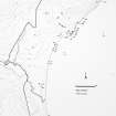
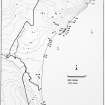
NGR ND 3420 5960
Datum OSGB36 - NGR
Permalink http://canmore.org.uk/site/9126


- Council Highland
- Parish Wick
- Former Region Highland
- Former District Caithness
- Former County Caithness
ND35NW 20 3420 5960.
A modern pill-box, very badly damaged, 3.65m in maximum width and 1.85m in maximum height. Three tiers of concrete remain on the edge of the dunes.
C E Batey 1984.
Though this has been described as a demolished pillbox, reference to OS vertical air photographs (OS/67 102, flown 1967), would suggest that, as all other pillboxes protecting Sinclair's Bay are of hexagonal type 24, this is of a very different appearance.. The aerial photographs would suggest that this structure is almost square and that there is no evidence of any walling or brickwork in the collapsed material.
It is not known what this building was for.
Information from Defence of Britain Project form, (Mr A Gutteridge), 2001
Project (1980 - 1982)
Field Visit (1984)
A modern pill-box, very badly damaged, 3.65m in maximum width and 1.85m in maximum height. Three tiers of concrete remain on the edge of the dunes.
C E Batey 1984.

