
Pricing Change
New pricing for orders of material from this site will come into place shortly. Charges for supply of digital images, digitisation on demand, prints and licensing will be altered.
Clumlie


Broch (Iron Age), Cist (Prehistoric)(Possible)
Site Name Clumlie
Classification Broch (Iron Age), Cist (Prehistoric)(Possible)
Canmore ID 909
Site Number HU41NW 4
NGR HU 40448 18123
Datum OSGB36 - NGR
Permalink http://canmore.org.uk/site/909


- Council Shetland Islands
- Parish Dunrossness
- Former Region Shetland Islands Area
- Former District Shetland
- Former County Shetland
HU41NW 4 4045 1811.
(HU 4043 1812) Brough (OE)
OS 6" map, Shetland, 2nd ed., (1903).
A broch, with later internal walling, which was part- ially excavted by Goudie in 1887, (G Goudie 1904) who also restored part of the walling. The overall diameter is 68' with a wall thickness of 17'-18'. The finding of a carefully constructed cist luted with clay and containing 'unctuous' matter, 2 1/2' above the floor of the broch led Goudie to the belief that the floor of the broch led Goudie to the belief that the structure had been used for interment after its collapse.
RCAHMS 1946, visited 1930 and 1934.
Broch, generally as described and planned. There is slight evidence of secondary buildings in the vicinity of the broch. No trace of the cist found by Goudie.
Resurveyed at 1/2500.
Visited by OS (RL) 18th May 1968.
Field Visit (17 July 1930 - 13 July 1934)
Broch, Clumlie. This broch occupies the crest of a natural elevation known as the Brae of the North Yard, about a quarter of a mile due N. of the Loch of Clumlie. Only the lower levels of the structure survive. These were partially excavated in 1887 by Goudie, who contributed a short account of the results to the Proceedings of the Society of Antiquaries of Scotland, xxiii (1888-9), pp. 249-53. A more detailed description will be found in the same writer's Celtic and Scandinavian Antiquities of Shetland, pp. 21-9.
The over-all diameter is 68 ft., while the thickness of the main or original wall varies from 17 to 18 ft., leaving a diameter of 33 or 34 ft. for the central courtyard. On the N.E. the outer face is 7 or 8 ft. high, but Goudie explains that the upper courses were rebuilt at the time of the excavation. The entrance passage, which is on the S.E., has had a height of about 5 ft., with a width of 3 ft. 6 in. at the outer end and of almost 6 ft. where it opens into the interior. At a distance of 11 ft. from the outside were two upright slabs which had served as door-checks. Goudie found a lintel stone still in position between them, but it is now displaced, the door-check on the N. having fallen. There is no indication of a bar-hole. On each side is a chamber within the thickness of the wall. The chamber on the N., which is 9 ft. 6 in. long by 4 ft. 8 in. wide, is reached from the inner part of the entrance-passage through a small opening 2 ft. above floor-level. The one on the S. is more ruinous, but has measured approximately 14 ft. 6 in. by 5 ft. 3 in. There is no direct communication between it and the entrance-passage, approach in this case having been through an opening in the face of the wall of the central courtyard, at a point about 9 ft. W. of the inner end of the entrance.
The foregoing description deals with the broch as originally built. In this case, however, as in so many others throughout Orkney and Shetland, there is clear evidence that fundamental changes were subsequently made in the arrangement of the interior. A new wall, the thickness of which increases from about 1 ft. at the entrance to about 5 ft. on the W., has been built against the face of the wall which enclosed the central courtyard, thus reducing the size of the latter considerably. This ‘secondary’ wall, however, has not been carried all the way round. On the W. there is a gap, 7 ft. 3 in. wide at the outer end and 8 ft. 3 in. at the original wall-face (Goudie 1904, 26). Judging from the analogy of other brochs, one might be disposed to suggest that the well-finished recess so produced was opposite the beginning of the stair. That proved to be so with a very similar recess at Levenwick (HU41NW 3) (Ibid, 16). On the right of the recess, but unconnected with it, is an empty space of uncertain length and with no visible entrance. It is 3 ft. wide, and lies between the original wall-face and the " secondary" wall, which is here therefore only about 2 ft. thick. The remains of the hearth (H), which Goudie discovered in the central court, can still be readily distinguished on the now grass-grown floor. It was presumably in use during the second period, but it may also have been a feature of the earlier one (Ibid, 27).
In the course of the excavations a good many characteristic broch objects were picked up such as grain-rubbers, whetstones, whorls, hammer-stones, fragments of pottery, animal bones, etc. A number of these were presented to the National Museum (Ibid, 27-8). It should be added that Goudie found evidence that, after its collapse, the structure had been used at least once for what he believed to have been an interment. Within the chamber which was entered from the courtyard, and at a height of 2 ft. 6 in. above its floor-level, he encountered a carefully constructed and clay-sealed cist filled with what he calls "unctuous matter." An analysis of the contents failed to yield any positive results (Ibid, 26).
RCAHMS 1946, visited 17 July 1930, 6 and 13 July 1934.
Measured Survey (July 1934)
The broch at Clumlie was surveyed by RCAHMS in 1934. The plan was redrawn in ink and published at a reduced scale (RCAHMS 1946 Fig. 487).
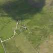
Aerial Photography (October 1973)
Oblique aerial photographs of Clumlie broch, Shetland, photographed by John Dewar in 1973.
Publication Account (2002)
HU41 2 CLUMLIE
HU 404181 (visited 5/6/63)
Probable solid-based broch in Dunrossness, standing on a low rise on flat arable ground. Only the lower levels of this broch remain and modern buildings encroach upon the ruins. Clumlie was partially excavated by Goudie in 1887 and some of the objects recovered are illustrated in Ill. 4.58. Much of the west half of the site is hidden by a stone dyke and was not explored, but the entrance passage -- with door-checks made of up-right slabs set into the wall at 11 ft. from the exterior -- and a guard cell on the right behind these are visible. A mural cell at 7.30 o'clock is also apparent but the interior wall face is too broken down for any trace of a scarcement to be preserved. The outer wall face on the north-east was 7-8 ft. in 1934 but the upper courses were rebuilt at the time of the excavation [3] (Ills. 4.48-52).
The door to the guard cell is only 2 ft. 9 ins. high and makes a contrast with what must have once been a tall beehive cell behind. A secondary wall -- varying in thickness from 1-5 ft. -- runs round the interior of the broch and is of uneven thickness, being about 1 ft. at the main entrance and about 5 ft. on the west side.
The internal diameter of the structure was thereby reduced from 33-34 ft. to about 27 ft.. No mention was made of radial piers by the excavator but a hearth was found in the floor which presumably belonged to the secondary occupation. A carefully constructed gap in the secondary wall at 10.30 o'clock may have led to the original door to the stairway in the broch wall but there is no sign of this now. During the excavations Goudie found a well-built stone cist 2.5 ft. above the floor of the broch and concluded that the structure had been used for burials after falling into disuse [1].
Dimensions: the overall diameter is 68 ft. and the wall is 17-18 ft. thick, giving a wall proportion of 51.5%.
Finds: these included "a large number of grain rubbers" and a photograph [3, 28] shows at least one rotary quern. Other finds were 5 whetstones of micaceous stone, 2 of sandstone, 3 whorls (1 of schist, 2 of steatite) and several hammer stones. There were also many pottery fragments and animal bones, shells and stone implements as well as a fragment of a painted Roman bowl (Ill. 4.58).
Sources: 1. OS card HU 41 NW 4: 2. Goudie 1889, 249-53: 3. Goudie 1904, 21-9: 3. RCAHMS 1946, vol. 3, no. 1145, 15-6 and fig. 487 (plan).
E W MacKie 2002

