Brownaban
Farmstead (Period Unassigned)
Site Name Brownaban
Classification Farmstead (Period Unassigned)
Alternative Name(s) Quarryside; Brounaban
Canmore ID 9087
Site Number ND34SW 77
NGR ND 32263 43489
Datum OSGB36 - NGR
Permalink http://canmore.org.uk/site/9087
- Council Highland
- Parish Wick
- Former Region Highland
- Former District Caithness
- Former County Caithness
ND34SW 77 32263 43489
A farmstead comprising one unroofed long building with an attached enclosure and two other enclosures is depicted on the 1st edition of the OS 6-inch map (Caithness 1878, sheet xxix). One unroofed building of two compartments is shown on the current edition of the OS 1:10000 map (1976).
Information from RCAHMS (AKK), 18 March 1996.
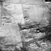
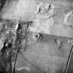
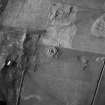
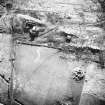
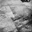
This farmstead, which is situated in a field of rough pasture 370m WNW of the cottage at Quarryside (ND 32638 43394), comprises two buildings and a series of low, boulder walls immediately to their SW. The northern building (YARROWS04 379) is a range measuring 22.8m from ENE to WSW by 4.7m transversely over walls reduced to low, grass-grown footings. The building contains three compartments, each with a central entrance in its SSE side; the central and ENE compartments are linked by a doorway at the SSE end of the shared partition, and the WSW compartment contains a kiln in its SW corner, which lends that end of the building a rounded plan. The kiln is not well preserved, measuring about 1.3m in internal diameter, but a stoke-hole is still visible in its SE side.
The second building (YARROWS04 380) is situated 2.5m S of the E end of the first and it measures 7.9m from ENE to WSW by 3.5m transversely over walls reduced to low, grass-grown footings. The interior contains two compartments, the WSW one having a doorway in its SSE side. The boulder walls immediately SW of the buildings may represent part of an otherwise robbed system of enclosures that has made use of a natural rock-face on the W to form one side. In the improved field to the E of the buildings, between them and the broch ND34SW 33, there is an angular length of wall-footing that represents the SE corner of one of two small fields or enclosures that are depicted on the 1st edition of the OS 6-inch map (Caithness 1877, sheet xxix). On that map the range is depicted unroofed on the S side of another enclosure that is no longer visible. The range is not shown on the 2nd edition of the map (1907, sheet xxix) and the smaller building is not shown on either.
(YARROWS04 379-380)
Visited by RCAHMS (JRS), 30 June 2004.


