
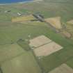
Tain


Farmstead (Period Unassigned)
Site Name Tain
Classification Farmstead (Period Unassigned)
Canmore ID 90774
Site Number ND26NW 33
NGR ND 222 669
Datum OSGB36 - NGR
Permalink http://canmore.org.uk/site/90774

- Council Highland
- Parish Olrig
- Former Region Highland
- Former District Caithness
- Former County Caithness
Note
A farmstead comprising one unroofed long building and three roofed buildings, two of which are long buildings and one of these is T-shaped and has a horse-gang attached to it, is depicted on the 1st edition of the OS 6-inch map (Caithness 1877, sheet vi), but it is not shown on the OS 1:10000 map (1975).
Information from RCAHMS (SAH) 15 December 1995

