
Braehead


Mound (Period Unassigned)
Site Name Braehead
Classification Mound (Period Unassigned)
Alternative Name(s) Wic 210
Canmore ID 9077
Site Number ND34SW 68
NGR ND 31794 40067
Datum OSGB36 - NGR
Permalink http://canmore.org.uk/site/9077


- Council Highland
- Parish Wick
- Former Region Highland
- Former District Caithness
- Former County Caithness
ND34SW 68 31794 40067.
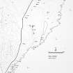
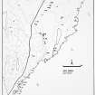
A possible structure comprising irregular turf-covered ridges and depressions, 14.6 by 4m, which could be natural.
C E Batey 1981
This probably natural grass-grown mound is situated in a cultivated field 140m S of Braehead farmsteading and is one of at least three similar features in the same field. It measures about 5m in diameter by 0.3m in height and appears to form the crest of a localised high point that rises gradually from the S and falls sharply to the N.
(YARROWS04 428)
Visited by RCAHMS (JRS, ATW) 7 September 2004
Project (1980 - 1982)

