
Pricing Change
New pricing for orders of material from this site will come into place shortly. Charges for supply of digital images, digitisation on demand, prints and licensing will be altered.
Tain Airfield, Royal Air Force


Airfield (20th Century)
Site Name Tain Airfield, Royal Air Force
Classification Airfield (20th Century)
Alternative Name(s) Raf Tain; Tain Ranges; Morrich More; Fendon; Dornoch Firth
Canmore ID 90553
Site Number NH88SW 14
NGR NH 8302 8170
NGR Description Centred NH 8302 8170
Datum OSGB36 - NGR
Permalink http://canmore.org.uk/site/90553


- Council Highland
- Parish Tain
- Former Region Highland
- Former District Ross And Cromarty
- Former County Ross And Cromarty
NH88SW 14.00 centred 8302 8170
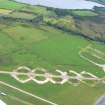
NH88SW 14.01 Centred NH 8320 8390 Bombing Range
NH88SW 14.02 NH 8376 8356 Tracked Target Range
NH88SW 14.03 NH 8374 8330 Operations block
NH88SW 14.04 NH 830 815 Buildings
NH88SW 14.05 NH 8302 8169 Control Tower; Air-raid shelter
NH88SW 14.06 Centred NH 8560 8085 Military Camp
NH88SW 14.07 Centred NH 8455 8105 Military Camp
NH88SW 14.08 NH 8373 8330 and NH 8390 8340 Control Towers; Buildings
NH88SW 14.09 NH 8248 8191 Buildings
NH88SW 14.10 Centred NH 8080 8036 Radio station
NH88SW 14.11 Centred NH 8310 8250 Buildings; Bomb Store; Air-raid Shelters
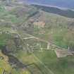
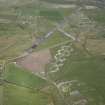
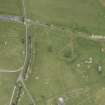
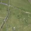
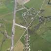
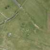
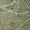
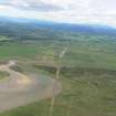
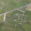
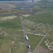
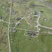
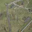
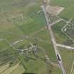
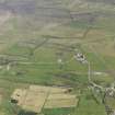
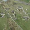
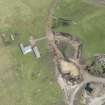
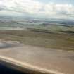
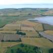
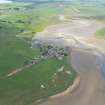
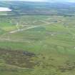
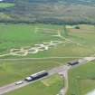
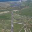
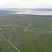
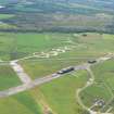
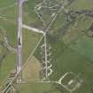
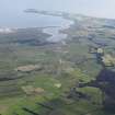
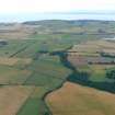
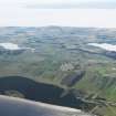
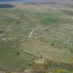
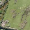
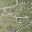
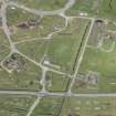
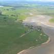
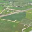
Tain airfield is situated to the S of Morrich More and occupies a large area to the N and S of the public road to Portmahomack. The three runways are still extant, with the main NE-SW strip now occupied by an oil pipeline fabricator, who have laid a large diameter pipe along the full length of the runway. The other runways are grass-grown as are the many hardstandings and parkways.
The airfield is recorded on vertical air photographs taken during 1945 as operational, (Visible on RAF 106G/UK/751 5083-5091, flown 1945) and the frames include the tracked target range, operations building and all the S part of the drome.
Visited by RCAHMS (DE) May 1997
NH 83 81 A photographic survey and limited recording was carried out with ASH Consulting Group of all remaining structures belonging to Tain Airfield.
Report held by the NMRS and Highland SMR.
Sponsor: Highland Council.
J Kendrick and J Wordsworth 1999
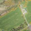
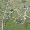
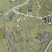
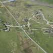
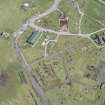
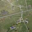
This airfield is situated at Fendon, with the main part of the group on the N side of the road between Tain and Portmahomack. Many buildings are still extant and the runways survives on both sides of the road.
J Guy 2000; NMRS MS 810/10, Vol.2, 122, Vol.3, 60-1

