Ormiegill
Natural Feature (Period Unknown), Pit (Period Unassigned)
Site Name Ormiegill
Classification Natural Feature (Period Unknown), Pit (Period Unassigned)
Alternative Name(s) Wic 199
Canmore ID 9027
Site Number ND34SW 26
NGR ND 33373 42944
Datum OSGB36 - NGR
Permalink http://canmore.org.uk/site/9027
- Council Highland
- Parish Wick
- Former Region Highland
- Former District Caithness
- Former County Caithness
ND34SW 26 33373 42944
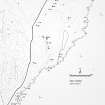
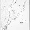
A large accumulation of stones, resembling a crescentic cairn, 100 yds long, lies near the base of the slope NE of the Ormiegill cairn (ND34SW 2), on what has been an old lake margin.
One end of it, which seemed to terminate in a circular cairn, was dug into by Anderson in 1865. He found the stones disposed at the end in a regular line, forming a kind of entrance-way, but discovered no trace of a chamber. No further excavation was attempted, and the character of the construction is still unkown.
Miss Henshall, quoting the same sub-reference, described it as a chambered cairn.
J Anderson 1866; RCAHMS 1911; A S Henshall 1963.
At ND 3340 4295, a large bank, about 1.3m maximum height and composed of earth and stones, forms three sides of a subrectangular enclosure. There is no trace of a bank to the E. This is the 'crescentic' structure referred to by the RCAHMS.
The S bank, the broadest, has been excavated through the centre, presumably by Anderson, exposing two parallel walls some 0.5m high, which may have been an entrance.
The remains of a shieling within the enclosure and of a rectangular building to the S may be associated with the enclosure. It is not a cairn.
Surveyed at 1:2500.
Visited by OS (R L) 25 April 1967.
(ND 3340 4295) Enclosure (NR)
OS 1:10,000 map, (1976)
An enclosure comprising a large accumulation of stones in crescentic form about 90m by 1.3m high. There is now no trace of the rectangular structure nearby.
C E Batey 1981.
What has previously been described as an enclosure (YARROW04 258), lying at the foot of the heather- and bracken-grown NE-flank of the Hill of Ulbster, is probably a natural feature of fluvio-glacial origin, comprising a broad, C-shaped bank-like feature, with its open side facing E. Anderson's excavation trench (YARROWS04 259) into the crest of the feature on the NW is still visible, measuring 1m from E to W by 0.9m transversely and 0.6m in depth. The N side of the trench appears to have exposed a roughly-coursed drystone wall, while the E and W sides are formed by thick slabs, their southern ends each marked by single stones set at right angles to them. A large boulder lying W of the pit may be associated with the remains.
(YARROWS04 258-9)
Visited by RCAHMS (ATW), 24 August 2004.
Project (1980 - 1982)


