Pricing Change
New pricing for orders of material from this site will come into place shortly. Charges for supply of digital images, digitisation on demand, prints and licensing will be altered.
Upcoming Maintenance
Please be advised that this website will undergo scheduled maintenance on the following dates:
Thursday, 9 January: 11:00 AM - 3:00 PM
Thursday, 23 January: 11:00 AM - 3:00 PM
Thursday, 30 January: 11:00 AM - 3:00 PM
During these times, some functionality such as image purchasing may be temporarily unavailable. We apologise for any inconvenience this may cause.
Innermessan, Cairnryan Military Railway
Nissen Hut(S) (20th Century), Slipway (20th Century), Workshop(S) (20th Century)
Site Name Innermessan, Cairnryan Military Railway
Classification Nissen Hut(S) (20th Century), Slipway (20th Century), Workshop(S) (20th Century)
Canmore ID 90259
Site Number NX06SE 94.01
NGR NX 0830 6372
NGR Description Centred NX 0830 6372
Datum OSGB36 - NGR
Permalink http://canmore.org.uk/site/90259
- Council Dumfries And Galloway
- Parish Inch
- Former Region Dumfries And Galloway
- Former District Wigtown
- Former County Wigtownshire
NX06SE 94.01 centred 0830 6372
Workshops were built for the Cairnryan Railway at Innermessan 300m N of the Motte (NX06SE 3). A series of nissen huts were located to the E of the railway and a slipway was constructed for this site. The site is depicted on the latest edition of the OS map (OS 1:10000 map, 1986).
M Christensen 1995 (two parts)
A small port, workshops and accommodation camp situated on the foreshore W of Innermessan farmsteading, served by the Military Railway. The site was constructed to build concrete ships to replace those being sunk by the unrestructed U-boat war. At NX 082 643 is a Pioneer Corps Badge picked out in coloured pebbles and sea shells on the former railway embankment. Many foundations remain, but some brick built buildings still stand. Only part of the jetty is still extant.
Information from Defence of Britain Project recording form, 1997
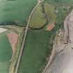
The site is visible on vertical air photographs (106G/ LA 136, 1055-1056, flown 20 February 1945 and 106G/Scot/UK 41, 3400-3401, flown4 May 1946), which show that in addition to the slipway there was a pier immediately to the N.
On the E side of the railway and at right angles was a row of twenty huts, the bases of which are still visible.
Information from RCAHMS (DE), March 2006


