
Following the launch of trove.scot in February 2025 we are now planning the retiral of some of our webservices. Canmore will be switched off on 24th June 2025. Information about the closure can be found on the HES website: Retiral of HES web services | Historic Environment Scotland
Brough


Croft (Period Unassigned)
Site Name Brough
Classification Croft (Period Unassigned)
Alternative Name(s) Wic 178
Canmore ID 8962
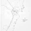
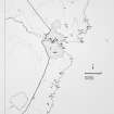
Site Number ND34NE 9
NGR ND 3653 4833
Datum OSGB36 - NGR
Permalink http://canmore.org.uk/site/8962


- Council Highland
- Parish Wick
- Former Region Highland
- Former District Caithness
- Former County Caithness
ND34NE 9 3653 4833.
A ruinous croft, 10.5m by 11m, shown roofed in 1873.
C E Batey 1981; OS 6" map, Caithness, 1st ed., (1873)
The footings of a croft-house. The dwelling house is 10m by 4.5m by 0.4m high.
Visited by OS 1 September 1982.
Project (1980 - 1982)
Field Visit (1981)
A ruinous croft, 10.5m by 11m, shown roofed in 1873.
C E Batey 1981; OS 6" map, Caithness, 1st ed., (1873)

