Pricing Change
New pricing for orders of material from this site will come into place shortly. Charges for supply of digital images, digitisation on demand, prints and licensing will be altered.
Sumburgh Head
Fort (Prehistoric)
Site Name Sumburgh Head
Classification Fort (Prehistoric)
Alternative Name(s) Geo Of Toun
Canmore ID 896
Site Number HU40NW 1
NGR HU 4077 0803
Datum OSGB36 - NGR
Permalink http://canmore.org.uk/site/896
- Council Shetland Islands
- Parish Dunrossness
- Former Region Shetland Islands Area
- Former District Shetland
- Former County Shetland
HU40NW 1 4077 0803.
(Area: HU 407 079) The Mul of Sumburgh or the extreme point of the headland is fortified in the same manner as the Mul of Uist. Here the neck of land is cut by a ditch and strong wall, which must in old times have formed a considerable fortification. It encloses a plain and hill (The head); at the entrance, still observable, the foundation of a large house, which probably served as a guardroom ; along the wall and at some distance the marks of numerous small buildings. (G Low 1879).
J Stewart 1956.
Dryden says that a broch stood where the present lighthouse is (H Dryden 1873). He cites no evidence and it may be that he was relying on the place-name which is certainly significant. On the other hand, between 80 and 90 yards within the gate which gives access to the lighthouse grounds, there is something which might be called a mound, and on the face of this there are traces of what may possibly be artificial construction.
Blaeu's Atlas (1649-55) marks the 'Ancient Fort of Swenbrugh' on Sumburgh Head.
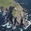
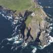
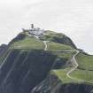
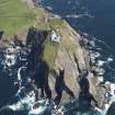
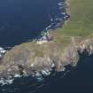
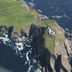
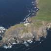
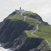
At HU 4077 0803, where the neck of land, joining the mainland to Sumburgh Head, narrows to about 50.0m there are traces of two stony ramparts with possibly external ditches. The ramparts are reduced to scarps 0.8m and 0.5m high respectively and the ditches to mere terraces. A short stretch of walling is visible in the inner rampart at its west end before all traces of these defences are obliterated by the modern road to the lighthouse. No evidence was seen of a broch on the headland. Surveyed at 1/2500.
Visited by OS(WDJ) 20th May 1968.
Field Visit (3 September 1930)
Broch, Sumburgh Head. Dryden says that ‘a broch stood where the present lighthouse is’ (1). He cites no evidence, and it maybe that he was relying on the place-name, which is certainly significant (2). A later writer, however, adds that ‘its stones were used to make the dykes round the Lighthouse buildings, but its site is indicated by a grass mound, a few yards N.E. of the Lighthouse tower’ (3). It is difficult to believe that the statement as to the dykes is accurate, for the stones of which they are composed have all the appearance of having been quarried. On the other hand, between 80 and 90 yds. within the gate which gives access to the lighthouse grounds there is something which might be called a mound, and on the face of this there are what may possibly be traces of artificial construction. Blaeu's atlas (1649-55) marks ‘The Ancient Fort of Swenbrugh’ on Sumburgh Head.
RCAHMS 1946, visited 3 September 1930.
(1) Arch. Scot., v, p. 211. (2) The oldest extant spelling is ‘Soundburche’, and to this day the fishermen speak of the stretch of sea between Fitful and Sumburgh Heads as ‘the Soond’. (3) Nelson, The Cult of the Circle Builders p. 10.
Publication Account (2002)
HU40 1 SUMBURGH HEAD
HU/407079
A possible broch in Dunrossness, on the site of the present lighthouse, claimed as an antiquity by Dryden on unknown evidence, perhaps the name of the headland [2]. Ramparts cross the neck of the headland [1].
Sources: 1. OS card HU 40 NW 1: 2. Arch. Scot. vol. 5 (1890), 211: 3. Discovery and Excavation, Scotland, 1956, 26.
E W MacKie 2002
Note (2 March 2016 - 1 June 2016)
There is a long-standing tradition that Sumburgh Head is the site of a fortification of some description, though the assertion by Sir Henry Dryden that it was a broch (1874, 211) is otherwise unsupported by any evidence. Nevertheless, George Low, visiting in 1774, claimed that access across the neck of the promontory was barred by 'a ditch and strong wall' (1879, 185), and in 1968 the OS identified two possible ramparts and ditches spanning the 50m wide neck where the road to the lighthouse zigzags up towards the summit; the ramparts, which are plainly visible on satellite imagery taken in 2004, have been reduced to scarps between 0.5m and 0.8m in height. This implies a large fort some 300m in length enclosing about 1.9ha along its crest, though the area of broken outcrops and bare rock descending to the sea covers a considerably larger area. Inevitably these possible defences are set at the point where any later agricultural boundary enclosing the headland is likely to have been placed and the true character of these remains can only be established by excavation. No trace of any entrance is visible at the neck, and nothing of the 'foundation of a large house' that Low observed at what he considered to be the entrance, nor of the numerous small buildings that lay 'along the wall and at some distance' (1789, 185), features that Raymond Lamb has suggested might have been comparable to the structures found in several promontory enclosures that are likely to have served as early medieval monastic sites (1973, 78).
Information from An Atlas of Hillforts of Great Britain and Ireland – 01 June 2016. Atlas of Hillforts SC4184


