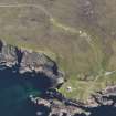
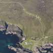
Accessibility

Font Size

100% 150% 200%

Background Colour

Default Contrast
Close Reset

Meall An Sgriobain

Building (Period Unassigned)

Site Name Meall An Sgriobain

Classification Building (Period Unassigned)

Canmore ID 89534

Site Number NC03SW 19

NGR NC 004 327

Datum OSGB36 - NGR

Permalink http://canmore.org.uk/site/89534

Ordnance Survey licence number AC0000807262. All rights reserved.
Canmore Disclaimer. © Bluesky International Limited 2025. Public Sector Viewing Terms

Toggle Aerial | View on large map

Digital Images

Oblique aerial view of the Stoer Head lighthouse, taken from the W.
Oblique aerial view of the Stoer Head lighthouse, taken from the W.Oblique aerial view of the Stoer Head lighthouse, taken from the WSW.

Collections

Administrative Areas

  • Council Highland
  • Parish Assynt
  • Former Region Highland
  • Former District Sutherland
  • Former County Sutherland

Activities

Note

An unroofed building is depicted on the 1st edition of the OS 6-inch map (Sutherland 1878, sheet lviii), but it is not shown on the current edition of the OS 1:10,000 map (1971).

Information from RCAHMS (SAH), 5 September 1995.

References

MyCanmore Image Contributions


Contribute an Image

MyCanmore Text Contributions