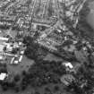
Edinburgh, Cramond, Cramond Road North, Dunfermline College Of Physical Education
College (Period Unassigned)
Site Name Edinburgh, Cramond, Cramond Road North, Dunfermline College Of Physical Education
Classification College (Period Unassigned)
Alternative Name(s) Moray House College; Cramond Campus
Canmore ID 89457
Site Number NT17NE 96
NGR NT 1923 7657
NGR Description Centred NT 1923 7657
Datum OSGB36 - NGR
Permalink http://canmore.org.uk/site/89457
- Council Edinburgh, City Of
- Parish Edinburgh (Edinburgh, City Of)
- Former Region Lothian
- Former District City Of Edinburgh
- Former County Midlothian
Watching Brief (1950 - 2000)
NT 1914 7660
Trench for an electrical cable to supply lighting for the path between college and Cramond Road South revealed wall foundations possibly the Gardener's cottage indicated on estate plan. Since then a considerable pool of water has formed within the possible area of the house.
Information from E.A.F.S.
Watching Brief (1950 - 2000)
NT 1933 7665
Pipe trench cut by the college behind the students' union running towards games hall revealed stone surface of probable Roman road running from east gate of fort about 1.5 m below turf level.
Information from E.A.F.S.
Archaeological Evaluation (1998)
NT17NE 96 centred 1923 7657
NT 193 765 An evaluatory excavation was undertaken at Cramond Campus to determine the nature and extent of any archaeological remains outwith the Scheduled area.
Excavation consisted of 11 hand-dug trenches located to define the limits of Roman occupation to the SE of the Roman fort. Apart from confirming the line of a known Roman road, no other Roman remains or traces of Roman occupation were found. Evidence of landscaping of the southern end of the site was apparent, presumably undertaken in order to level the playing fields.
Sponsor: Moray House Institute of Education (latterly University of Edinburgh).
M Bishop 1998.


