
Pricing Change
New pricing for orders of material from this site will come into place shortly. Charges for supply of digital images, digitisation on demand, prints and licensing will be altered.
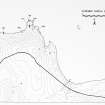
Longgeo South


Naust(S) (Period Unassigned)
Site Name Longgeo South
Classification Naust(S) (Period Unassigned)
Alternative Name(s) Can 023
Canmore ID 8869
Site Number ND27SE 14
NGR ND 2931 7463
Datum OSGB36 - NGR
Permalink http://canmore.org.uk/site/8869


- Council Highland
- Parish Canisbay
- Former Region Highland
- Former District Caithness
- Former County Caithness
ND27SE 14 2931 7463.
A group of five modern boat nausts on the shoreline. They face W and are mostly grass-covered, but the most northerly measures about 11m long by 2.2m to 2.5m wide and has walling 1.17m high exposed.
C E Batey 1982.
Field Visit (1982)
A group of five modern boat nausts on the shoreline. They face W and are mostly grass-covered, but the most northerly measures about 11m long by 2.2m to 2.5m wide and has walling 1.17m high exposed.
C E Batey 1982.

