
Pricing Change
New pricing for orders of material from this site will come into place shortly. Charges for supply of digital images, digitisation on demand, prints and licensing will be altered.
Comrie - Braco


Roman Road (Roman)(Possible), Track (Period Unassigned)
Site Name Comrie - Braco
Classification Roman Road (Roman)(Possible), Track (Period Unassigned)
Alternative Name(s) Langside; Dalginross To Ardoch Roman Road
Canmore ID 87348
Site Number NN71SE 2
NGR NN 7920 1342
NGR Description From NN 7861 1499 to NN 7999 1753
Datum OSGB36 - NGR
Permalink http://canmore.org.uk/site/87348


- Council Perth And Kinross
- Parish Ardoch
- Former Region Tayside
- Former District Perth And Kinross
- Former County Perthshire
NN71SE 2 from 7861 1499 to 7999 1753. RX 19.
(See also NN71NE 17, NN72SE 56, NN81SW 29 & 30)
Alleged Roman Road, Dalginross to Ardoch.
Information from Mrs M E C Stewart, no date.
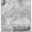
NN 7864 1499 to NN 7999 1252 An old road from Comrie to Braco runs from Bishopsfauld (NN 778 191) to Langside (NN 792 137). It leaves a boundary fence at NN 787 147 (see NN71NE 17) and descends straight for 600 yards by an easy gradient to cross a burn at NN 787 147, 60 yards E of the modern bridge. Curving almost parallel with the road it passes through a sheepfold to cross route B827, 600 yards NW of Langside, and at NN 790 137 joins the old road which crosses the R. Knaik to rise above Glenlochorn (NN 794 126) avoiding the narrow ravine and steep north-eastern slope and descends via Dunduff to Braco Bridge. Richmond and McIntyre, discussing a probable Roman Road system in relation to Fendoch say "On that site (Dealgin Ross) today there are clear signs of a great road leading south-eastwards, either down Strathearn, or back over the natural pass to Ardoch". (Visible on RAF air photographs 541/A/396 3202-3, 19 May 1948.)
Dr E A Cormack 1965. I A Richmond and J McIntyre 1936.
The whole road from the Triangularwood (NN78 16) (see also NN71NE 17) to Langside (NN 790 137) can be clearly seen in RAF vertical aerial photographs (541/A/396 frame nos. 4103 and 3203, 19 May 1948).
Information from OS, 28 October 1966.
The alleged Roman road heads in a slight SE direction, and possibly crosses the River Knaik at NN 7919 1343 and the Arrevore Burn at NN 7921 1303. E of a sheepfold near Glenlichorn (NN 7941 1256), the alleged road heads E.
Information from RCAHMS (no date).

